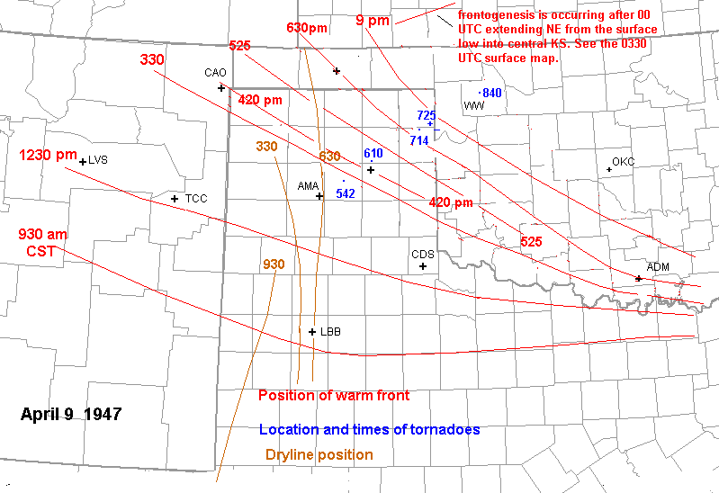
In this page, I will attempt to show where the
Woodward storm developed
and moved relative to the frontal boundaries and
dryline. The changing positions of the surface warm
front and surface dryline
on April 9, 1947 are shown here.
Tornado locations
and times are presented in blue. This figure clearly
illustrates that the
Woodward storm initiated near the dryline around Amarillo
or just south of Amarillo. In fact, the surface
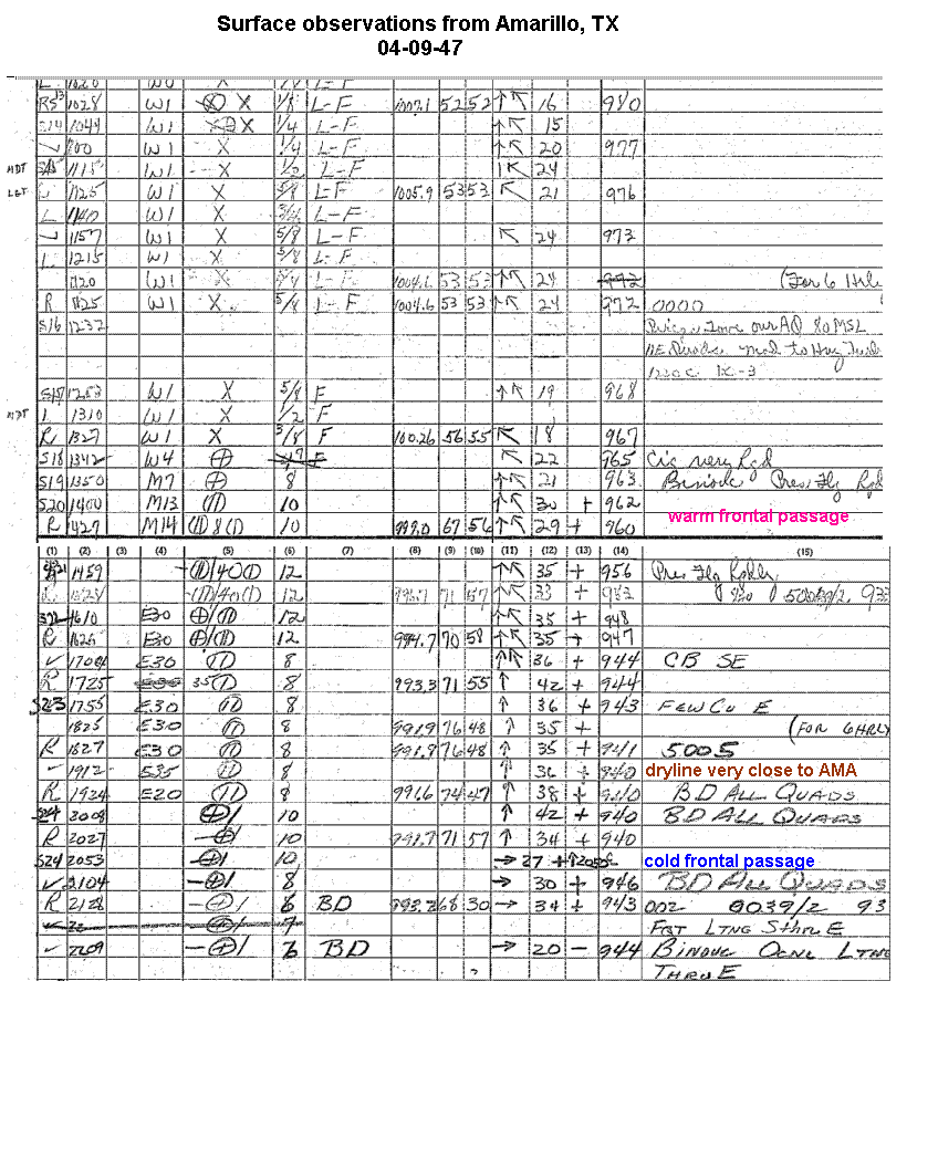
observation sheet from
Amarillo
shows CB SE in the comments section at 504 pm.
These observations from Amarillo clearly show a warm
frontal passage around
150 pm, a brief dryline passage after 6 pm,
retreating dryline after 7 pm, and a cold frontal
passage after 8 pm. The
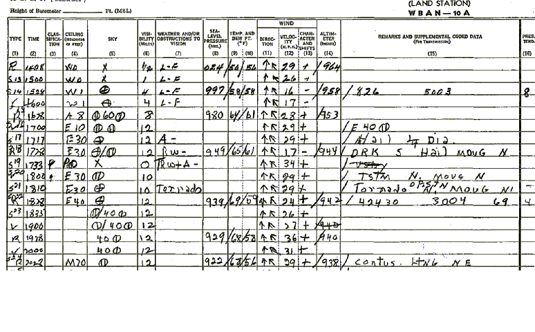
observations from Pampa
indicate a warm frontal
passage around 410 pm. The remark "CB SE" at 504 pm
in the Amarillo observations
is 40 minutes before the storm produced
a tornado wsw of White Deer. The dryline retreated
back to the west during
the evening before being overtaken by the pacific
cold front. It is possible that the storm approached
and eventually crossed
the warm front in the northeast Texas panhandle near
Glazier during the early evening. However, it
appears that this front was
undergoing frontolysis during the late evening hours.
On the cool side of the front, surface dewpoints
were actually higher and
temperatures were a little cooler. But theta-e was about
the same south of the front as immediately north of
the front. Also, the
suface winds were more backed (southeasterly) on the
cool side of the boundary. Therefore, cloud bases
were even lower and low-level
shear was higher immediately on the cool side
of the boundary. Once the storm reached northeast of
Woodward, it was far
enough into the "cool air" to encounter a slightly more
stable boundary layer--hence a gradual weakening
trend commenced. Keep
in mind that the low-level jet tends to strengthen
dramatically in the evening hours, and this may
account for the violence
of the tornadoes after dark as well. This is true of many
warm front storms in my experience. For example, on
the evening of the
Hoisington tornado in April 2001, the low level jet increased
from 30 to 55 kts between 6 pm and 9 pm. Only weak
tornadoes occurred before
dark, and then an F4 tornado occurred with the
same storm after dark.