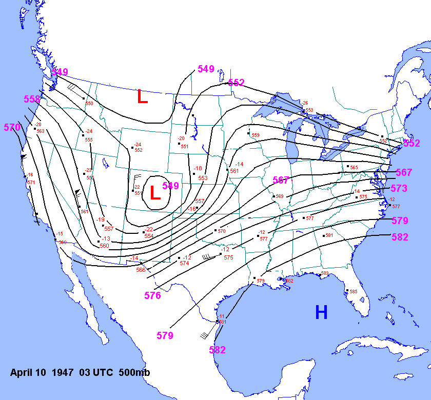
Instability Approximation for Woodward Tornado
The raob network was in its infancy in the late
1940's. Upper air data
were fairly sparse and undependable. Unfortunately, NCDC
has lost these data. I did manage to obtain some UA
maps for 03 UTC for
the late 1940s from Bobby Prentice. These maps are
fairly hard to read, but I still managed
to reconstruct the
500mb chart for 03
UTC April 10, 1947.
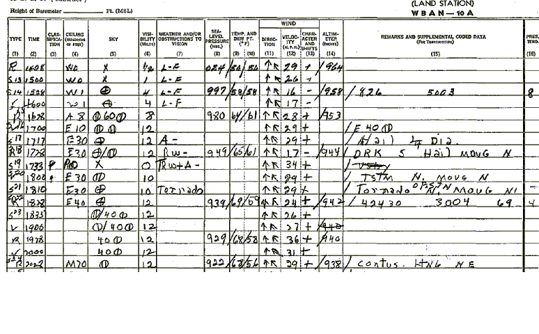
A tornado developed WSW of Pampa at 541 pm and
passed north of Pampa by
610 pm. The surface
observations around this
time showed fairly high surface dewpoints in the
upper 50s and lower 60s
with surface temperaures on the rise south of the warm
front. At 530 pm and 630 pm the T/TD were 64F/61F
and 69F/59F respectively.
The elevation of Pampa is about 3250ft. The
station pressure was 886mb. Using a skew-T log-P
diagram, one can easily
find the lifted index at Pampa assuming 500mb temp.
around -15C. This 500mb temp was estimated based on the 03 UTC 500mb temps at FTW, BSP, OMA, LBF and DDC.
Lifting 64F/61F up the dry
adiabat
and then up the moist adiabat to 500mb yields -7C. So the lifted
index was around
-8
at Pampa when the storm was to the WSW. After the storm moved north the
T/TD were 69F/59F, which has nearly the same
theta-e as before.
Further
east at Gage(elevation 2200ft or 920mb),
the T/TD were 67F/63F at 730 pm. The theta-e was
almost identical
at Gage(340K).
Even though surface potential temperature was slightly lower at
Gage than Pampa,
the mixing ratio was
slightly higher.