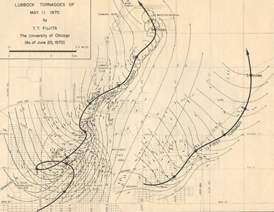
Lubbock F5 Tornado
May 11, 1970
Jonathan D.
Finch
Back to Lubbock Area Tornadoes Webpage
Back to Amarillo Area Tornadoes WebpageDetailed Tornado Cases for Amarillo and Lubbock
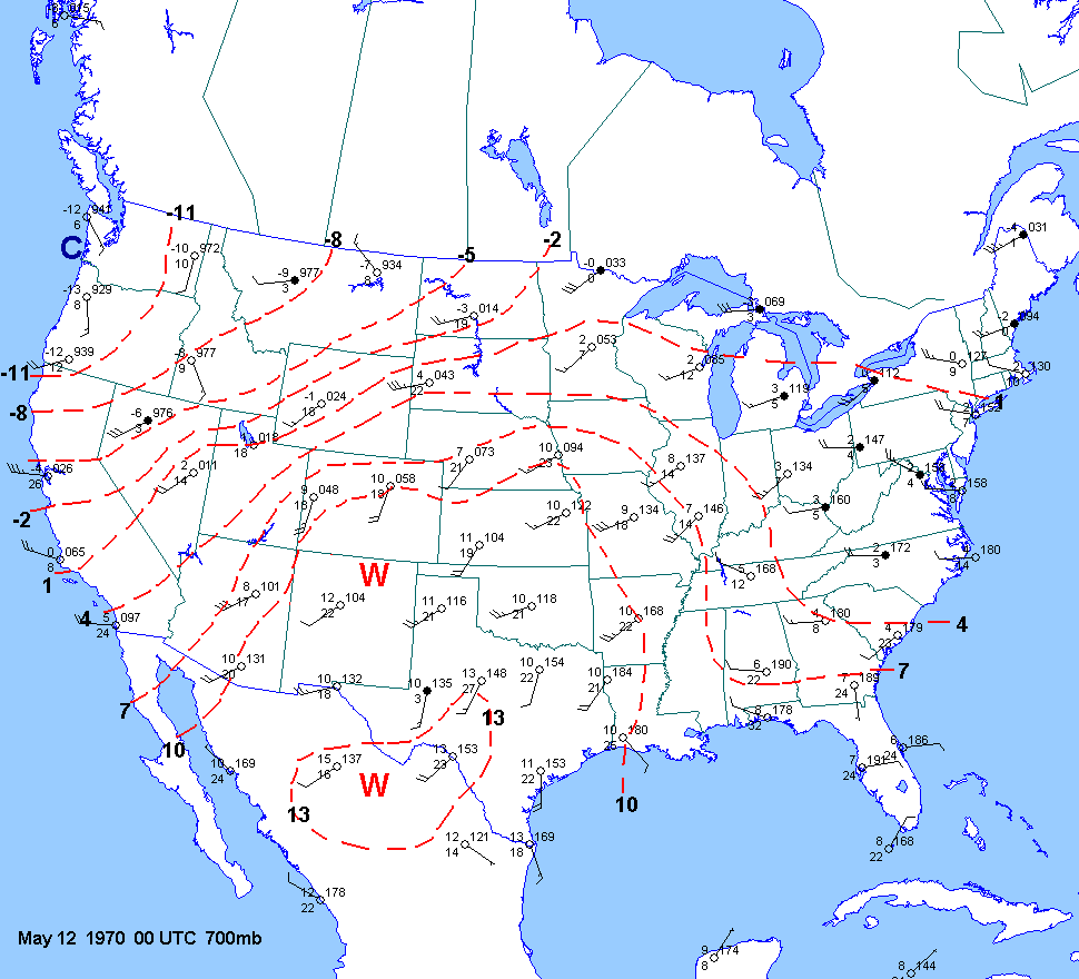
The famous F5 Lubbock
tornado occurred in a synoptically quiescient weather pattern. The flow at
mid and upper levels was
fairly light. This tornado occurred on the extreme
SE edge of the westerlies--well out ahead of any mid level cooling or
forcing
associated with the polar
jet. A weak subtropical jet was noted across northern Mexico into the Gulf
of Mexico. A strong
shortwave trough was exiting the central Rockies
into the northern Rockies and northern plains during the day. A
nearly
stationary front was draped from Iowa into central
Kansas and then into Colorado. There was no significant shortwave
trough approaching west Texas.
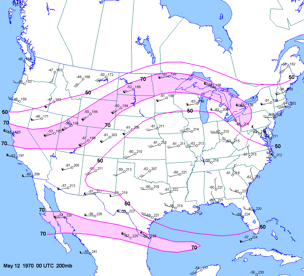
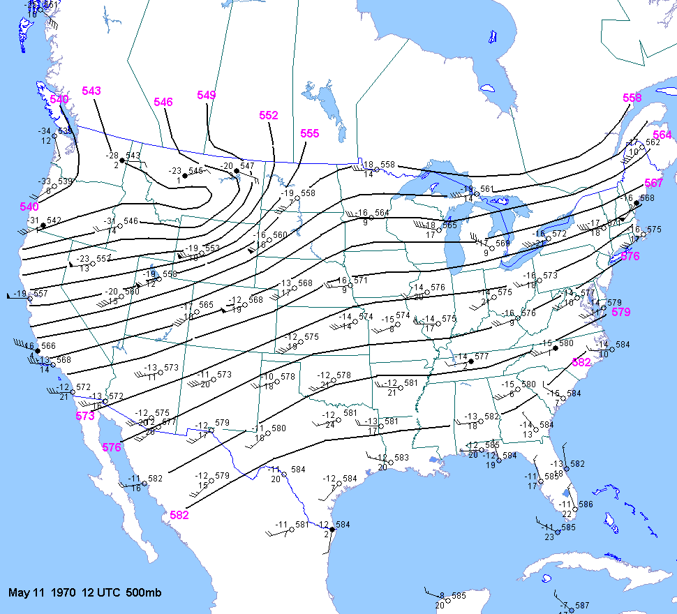
500mb heights were on the rise througout the region from 12
UTC May 11 to 00 UTC May
12.
This was partly due to the
exiting shortwave trough as well as to afternoon elevated heating.
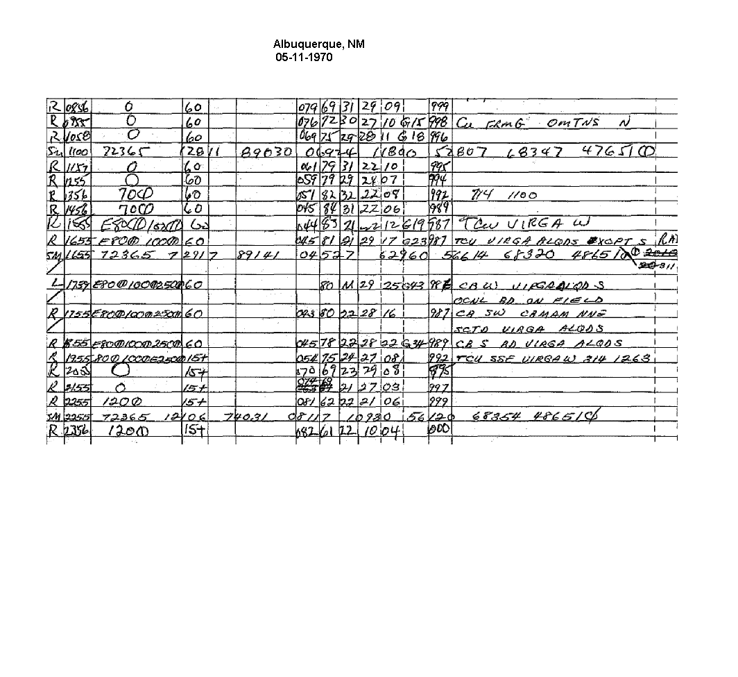
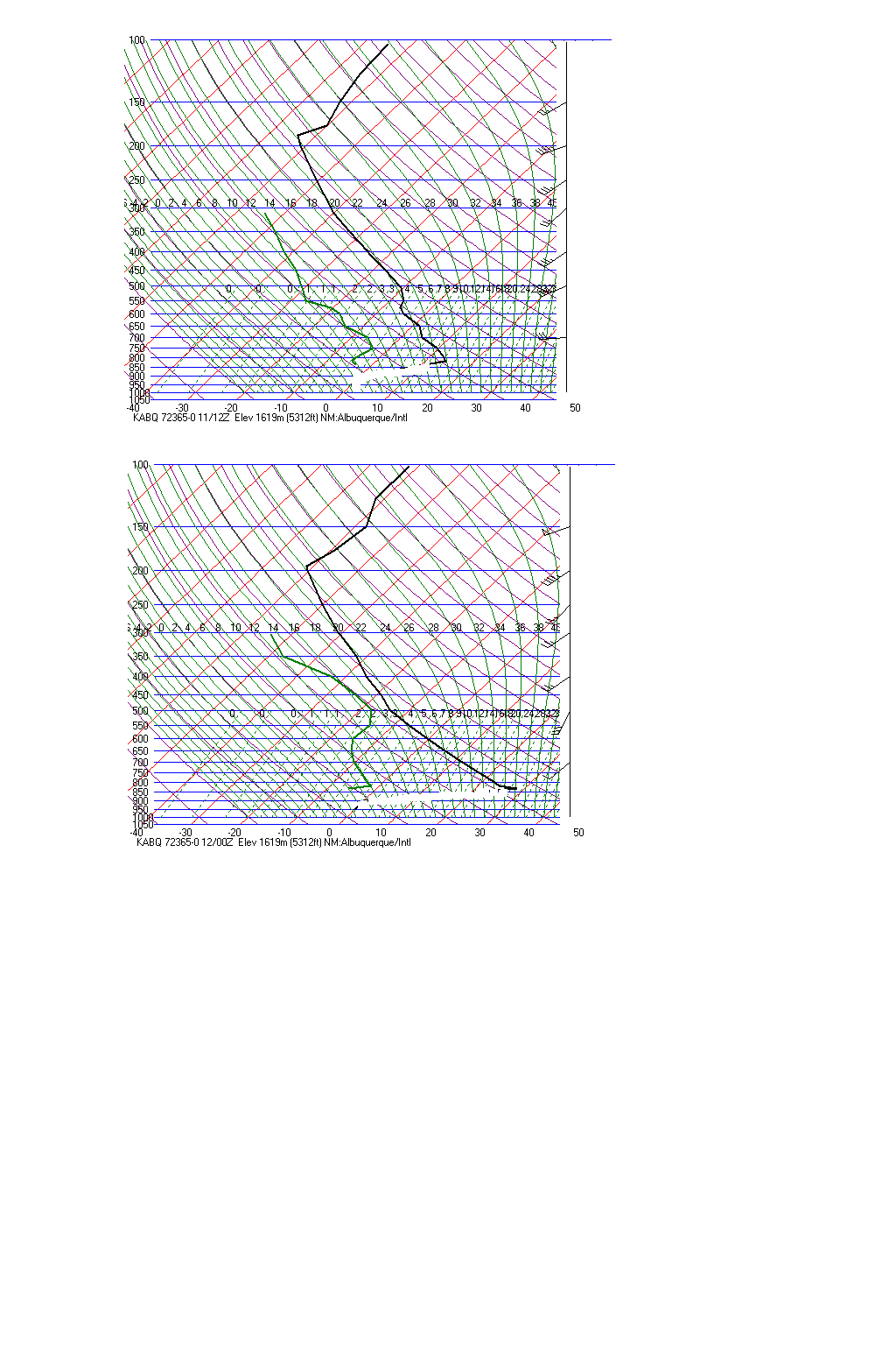
The 500mb winds at ELP and
ABQ at 00z might lead one to
believe that a shortwave trough was approaching. But inspection of the actual upper air data
shows that the winds at 500mb at
El Paso were only veered at 500mb and not immediately below and above 500mb.
So it is not clear if the due
west 500mb wind at ELP is indicative of a shortwave trough of some kind
of measurement error.
Also, thunderstorms were occurring around ABQ near the time of the upper air release and this likely affected the winds.
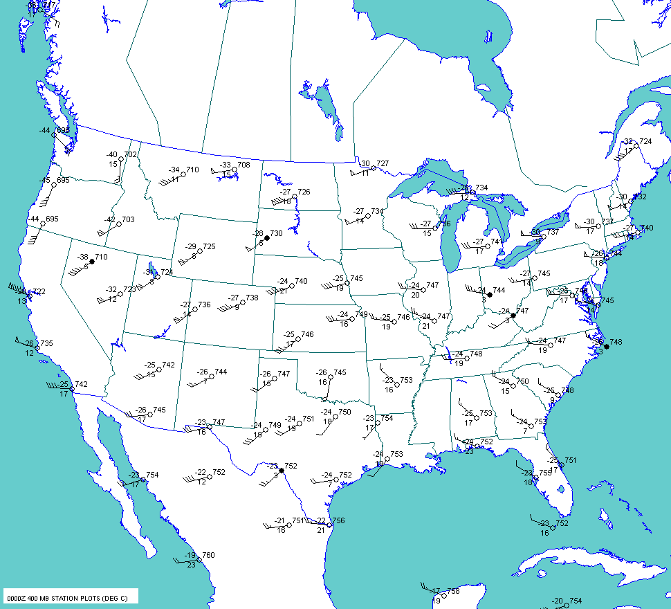
In fact,
the 00 UTC
400mb chart does not show any well defined
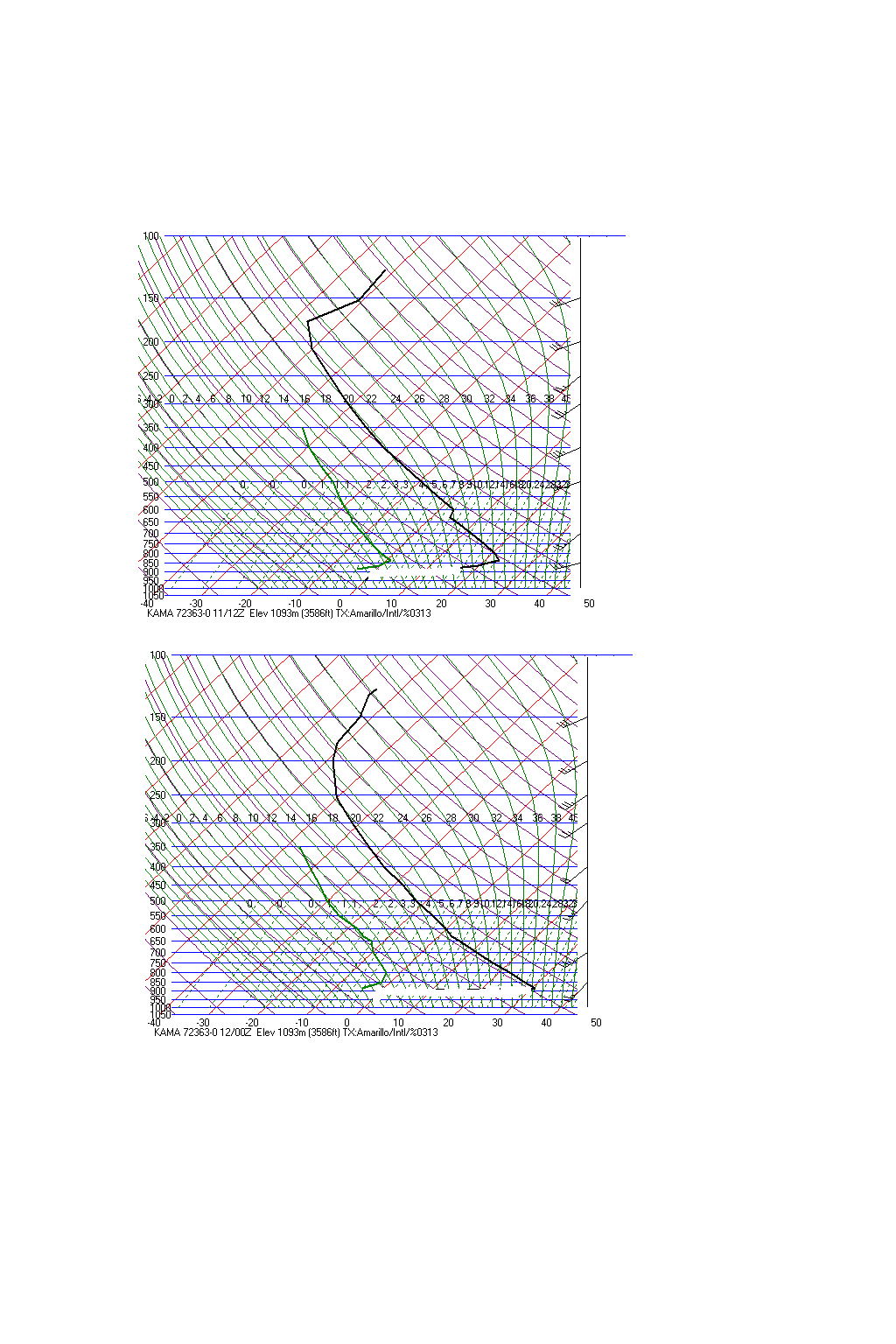
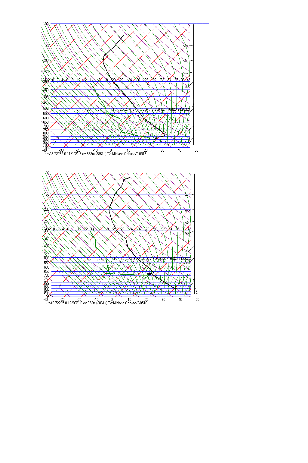
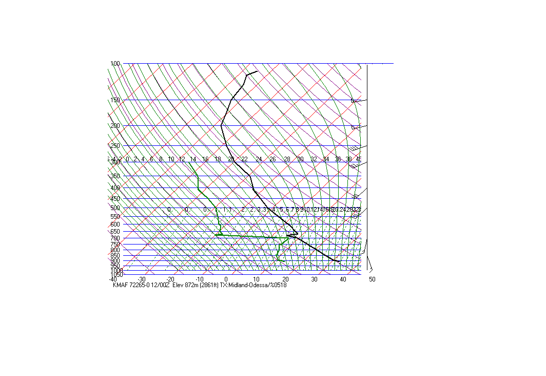
shortwave trough. The AMA and MAF soundings
at 12
UTC and 00 UTC show
steepening low level lapse rates due
to diurnal heating. The west Texas region was located near
the
middle of large 700mb warm
plume. Of course this is to be
expected since we are dealing with a dryline, with no surface
fronts.
The cooler temperature at 700mb
at Midland at 00z was due to intense surface heating, vertical mixing
and low level convergence
immediately ahead of the dryline. This was despite general 700mb warming across the region. So the 700mb temp. at Midland
held steady in spite of the 700mb
warming that was occurring at ABQ, AMA, ELP and DYS. Note that the
moist layer on
the MAF sounding extended up to around 700mb. Modern day numerical models often show
700-500mb cooling/moistening in
the vicinity of the dryline
during
model convective initiation. In fact, sometimes the models
don't develop precip but show a narrow
axis of cooling/moistening
around 700mb. That superadiabatic layer just above 700mb is
the result of the wet bulbing effect and the
data in this layer is in
error.
The bottom line
is that if there was an approaching
shortwave trough then it was fairly weak. This dryline
retreated after
4 pm which
is rather early in the
afternoon and
possibly indicative of an approaching shortwave trough. But
the strong shortwave troughs
traversing the northern plains
may have resulted in a further east position of the dryline in
Kansas and northern Oklahoma compared to
Texas. This could be why the
southern end of the dryline started to retreat before the northern end
did. Typical
dryline retreats
occur after 5 or 6 pm. I am
sure that one could claim
the existence of a shortwave trough in the southern Rockie/Plains.
Sometimes
it seems that every
thunderstorm that pops up is blamed on a
shortwave trough. This is of course absurd as mesoscale forcing is
orders of magnitude
larger than
synoptic scale forcing. Mesoscale and smaller dryline features
and terrain features are often
key in west Texas storm
initiation in the absence of strong or even weak synoptic scale
forcing.
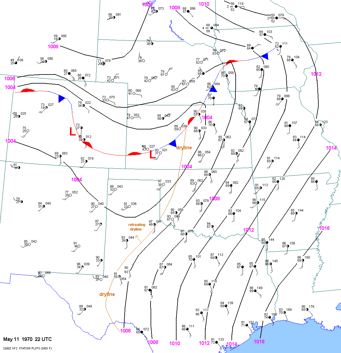
At 22 UTC,
the southwestern end of the dryline was retreating to the northwest.
Surface dewpoints west of the dryline near
Lubbock were in the upper 30s and
lower 40sF. Surface dewpoints east of the dryline were in the upper 50s
to mid 60sF
depending on elevation. There
could have been more than 1 convergence line or dryline across west
Texas, but we will never
know since surface observations
have been traditionally tied to aviation in this country and have not
been positioned according to
meteorological need. Again,
the strong shortwave troughs traversing the northern plains may have
resulted in a further east position of the
dryline in Kansas and northern
Oklahoma compared to Texas.
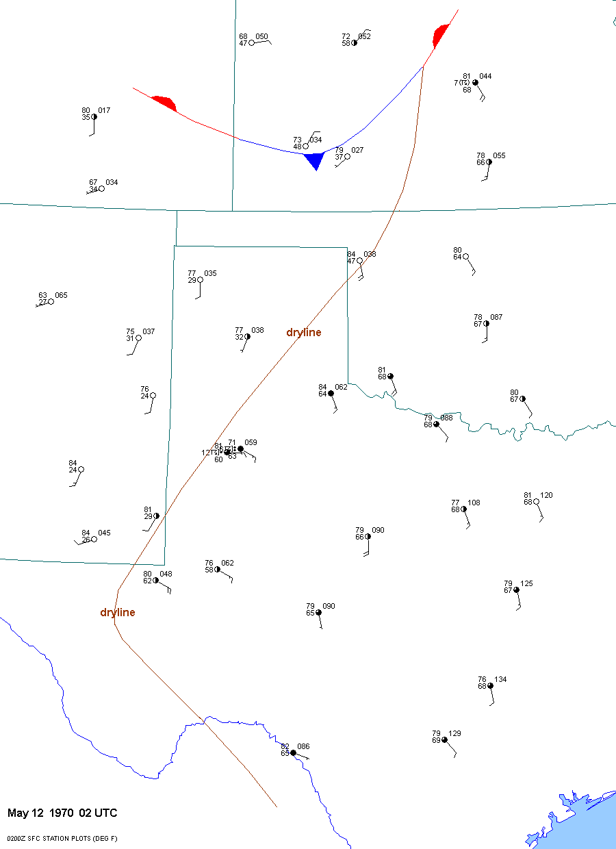
The dryline continued to retreat after 22 UTC
and was located in the vicinity of Lubbock by 00 UTC.
By 02 UTC
the dryline
extended from just east of Hobbs
to west of Reese AFB to just south of GAG. Due to the lack of surface
data and since the
low levels were altered
dramatically by ongoing convection in the Lubbock area, it is very
difficult to assess the instability and shear.
Nevertheless, the 02 UTC
observations from LBB and REE showed plenty of moisture with lower 60s
F surface dewpoints.
Instability and shear undoutbedly varied
tremendously across the Lubbock region due to small scale convective
effects. Thunderstorms
were ongoing in the Lubbock area
from 630 pm through the evening. While the storm scale and mesoscale
effects are not known,
these effects could have turned
an ordinary looking severe weather day into a violent tornado
situation. I can make a rough estimate
of surface based instability at
01 and 02 UTC based on the surface data at LBB and surrounding RAOBS.
At 01 UTC the T/TD
were 86F/56F at 897mb while at 02
UTC they were 71F/63F. Actually these observations are almost identical
in terms of
theta-e. Surface based cape
was around 3000 j/kg. Of course, some prefer to use a mean layer CAPE
value. But I am not a
huge fan of this. The reason why
I am not a fan is simple. How do we know what the vertical distribution
of moisture is like
given the wide spacing of
radiosonde stations? The answer is that we do not know. If we do
not know, then why use it?
For convection that is ingesting
low air at the lowest levels(such as supercell storms), I think that
surface based cape is a
decent proxy of instability.
Also, low level moisture tends to "pool" and be locally deeper in
convergent areas near thunderstorm
updrafts. For low top
storms, a lower level lifted index or low level CAPE would probably be
better.
A timeline of the event can be found here.