Historical Tornado Cases for Dodge City
Warning Area
| Event Details | SFC | LI SBCAPE |
850mb | 700mb | 500mb (400) | jet level | Skew T | Affected States | Pictures | Surface obs |
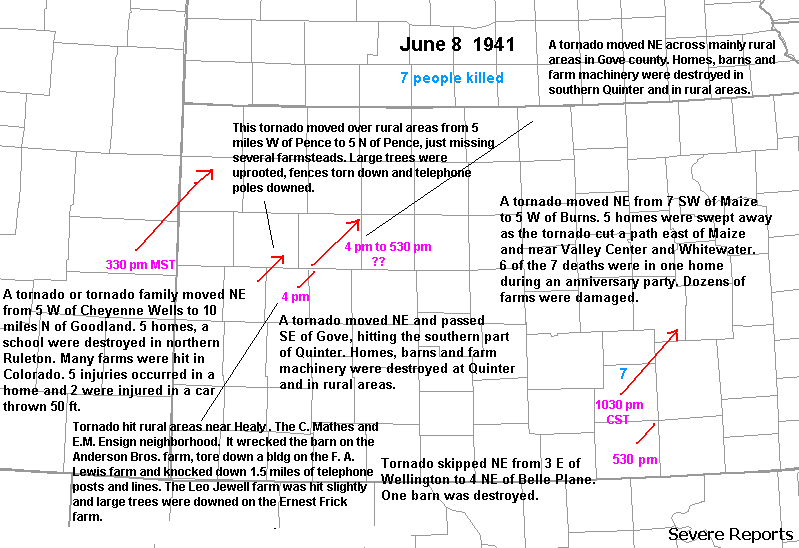
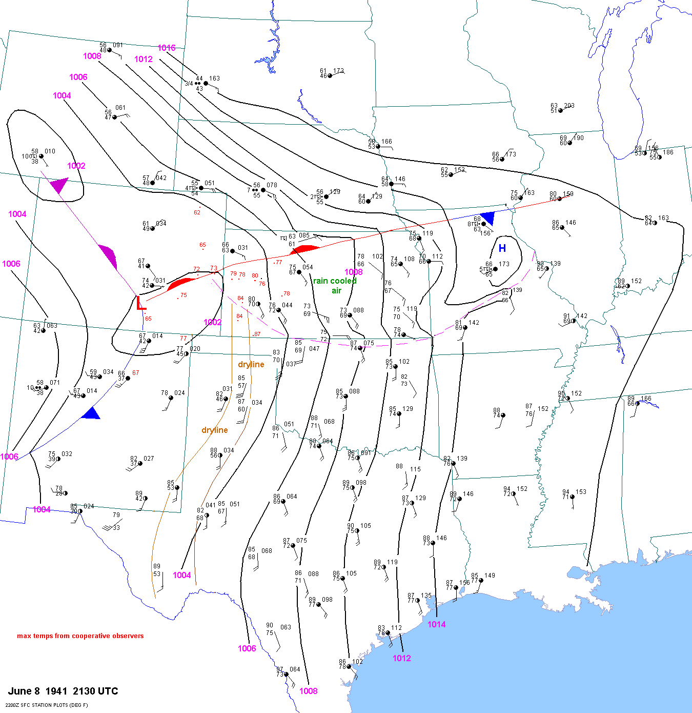
| 06-08-41 | 2130Z | X | X | X | X | XX | XX | KS CO | XX | XX |
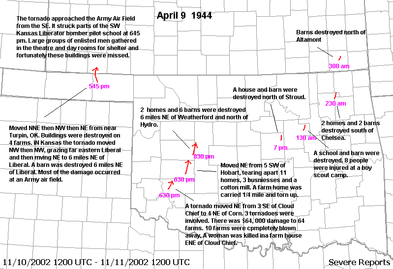
| 04-09-44 | 2130Z | X | X | X | X | XX | X | OK KS | XX | XX |
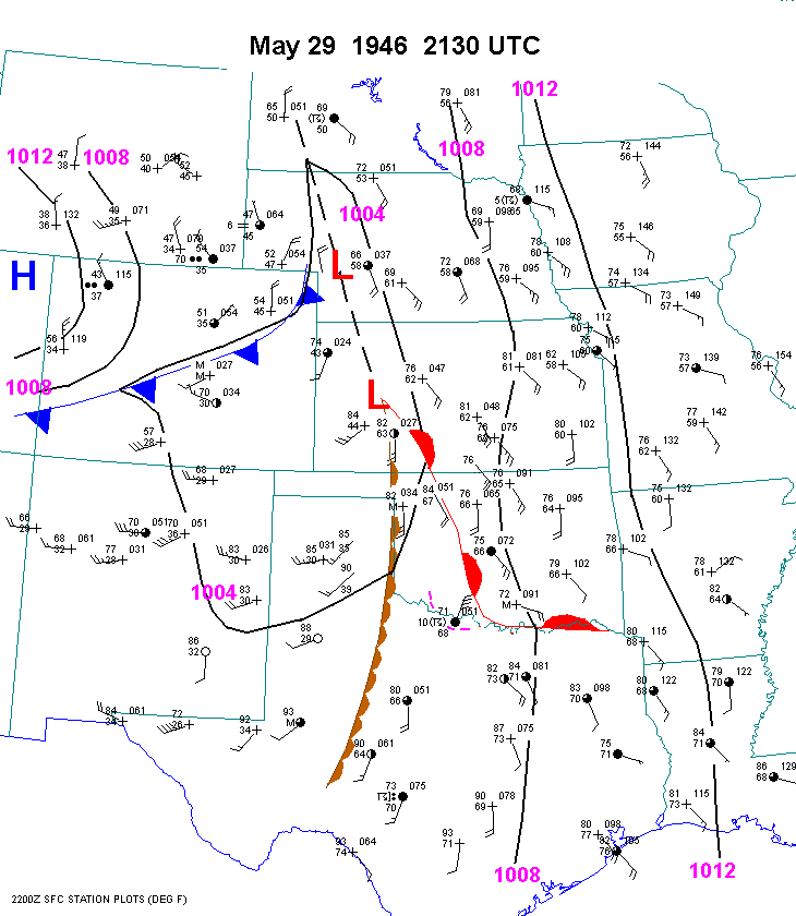
| 05-29-46 | 2130Z | X | X | X | X | XX | XX | KS | XX | XX |
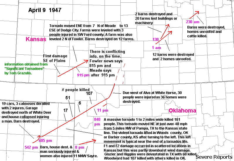
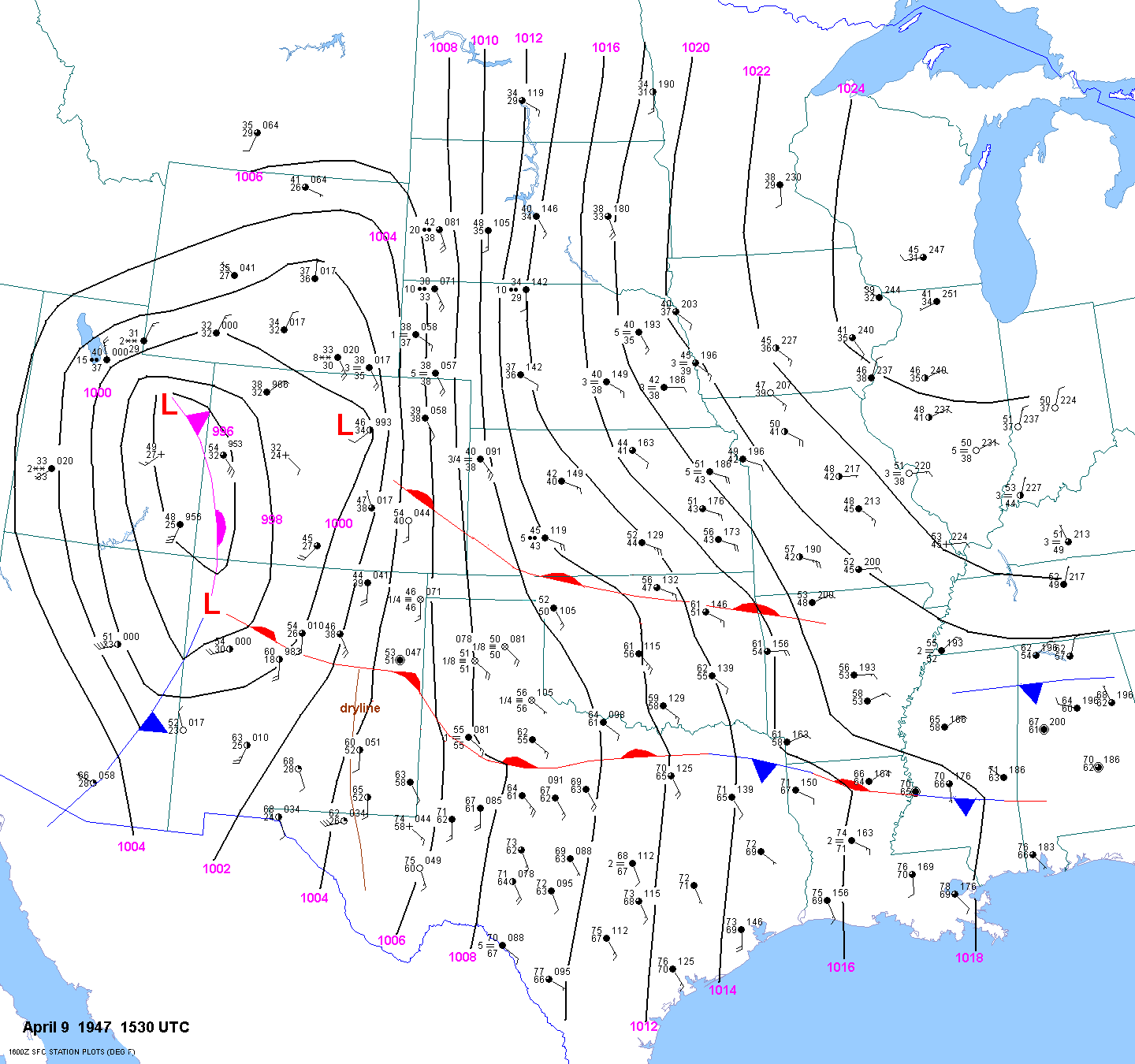
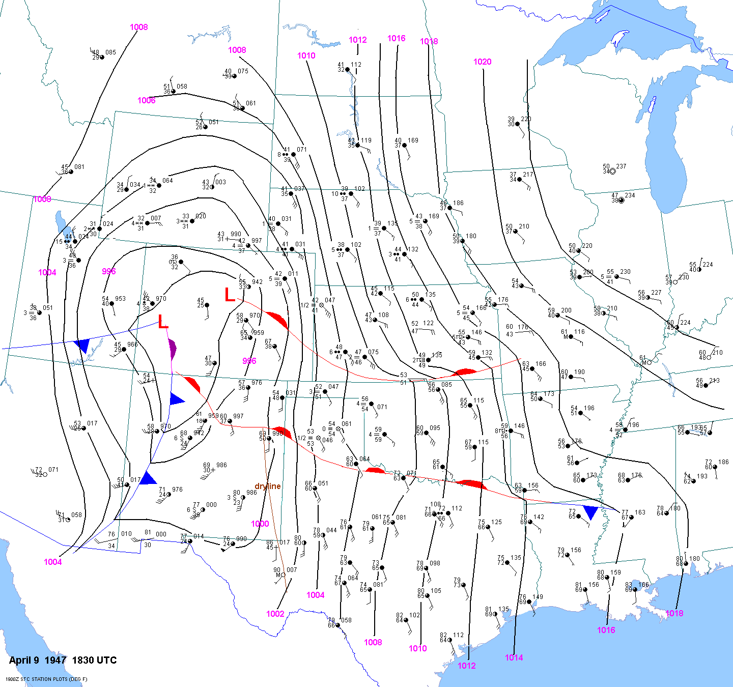
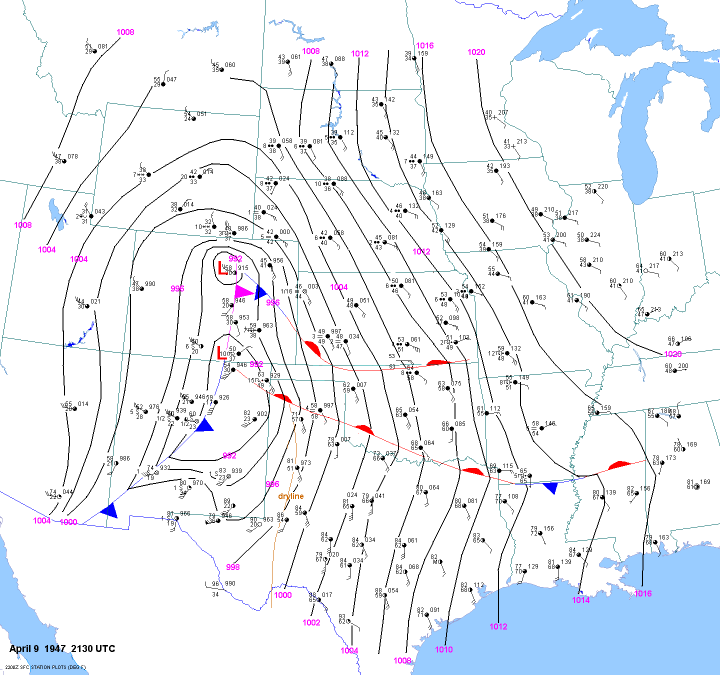
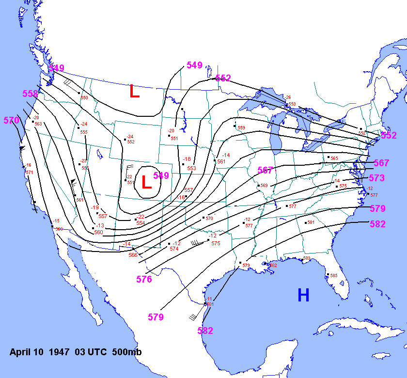
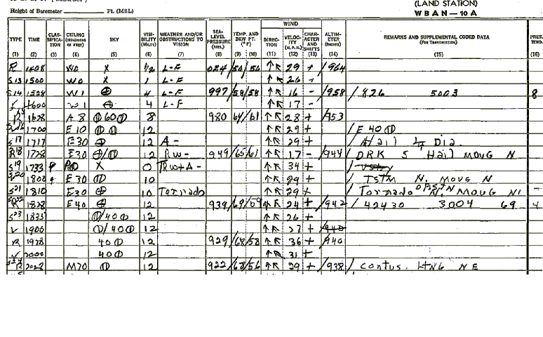
| 04-09-47 | 15Z 18Z 21Z 00Z 03Z | -8 to 11 | X | X | 03Z 10 | X | X | OK TX\ KS | X | X |
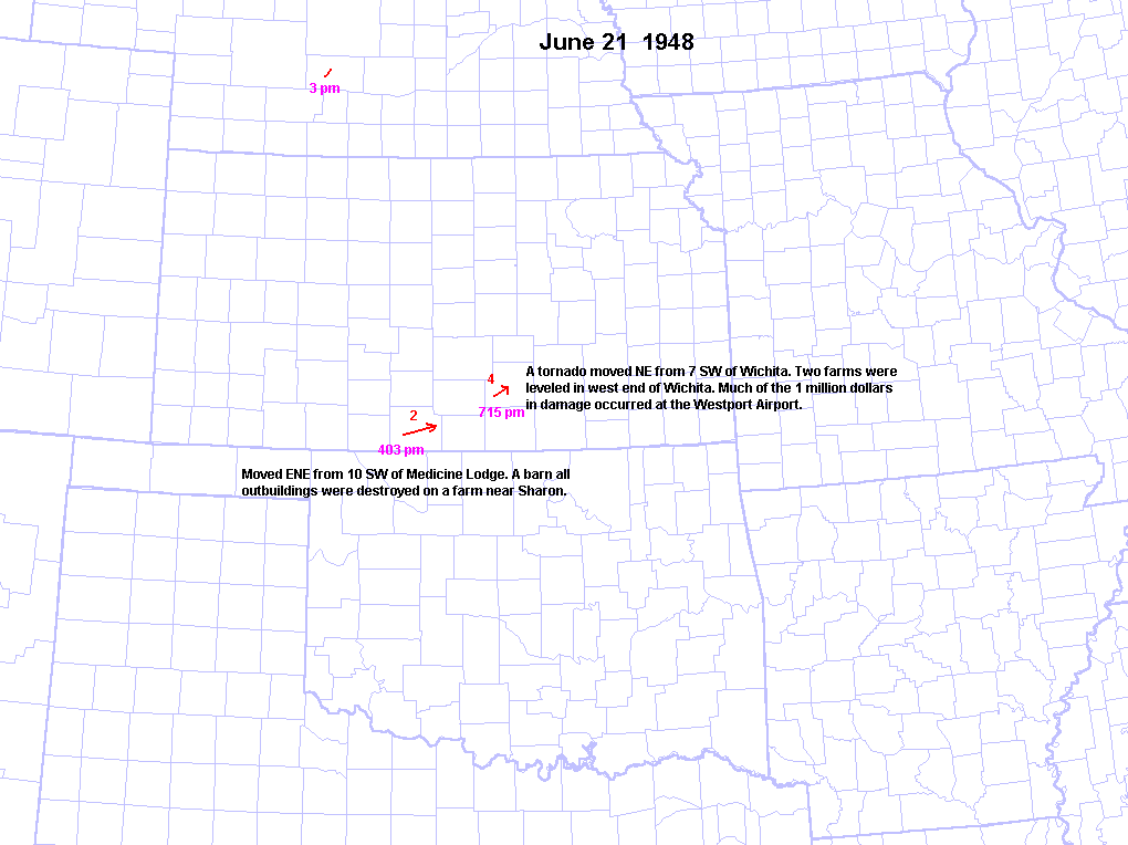
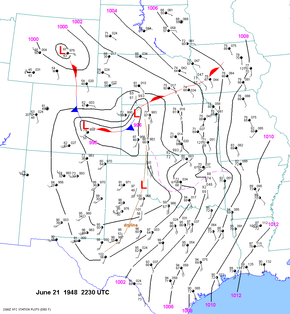
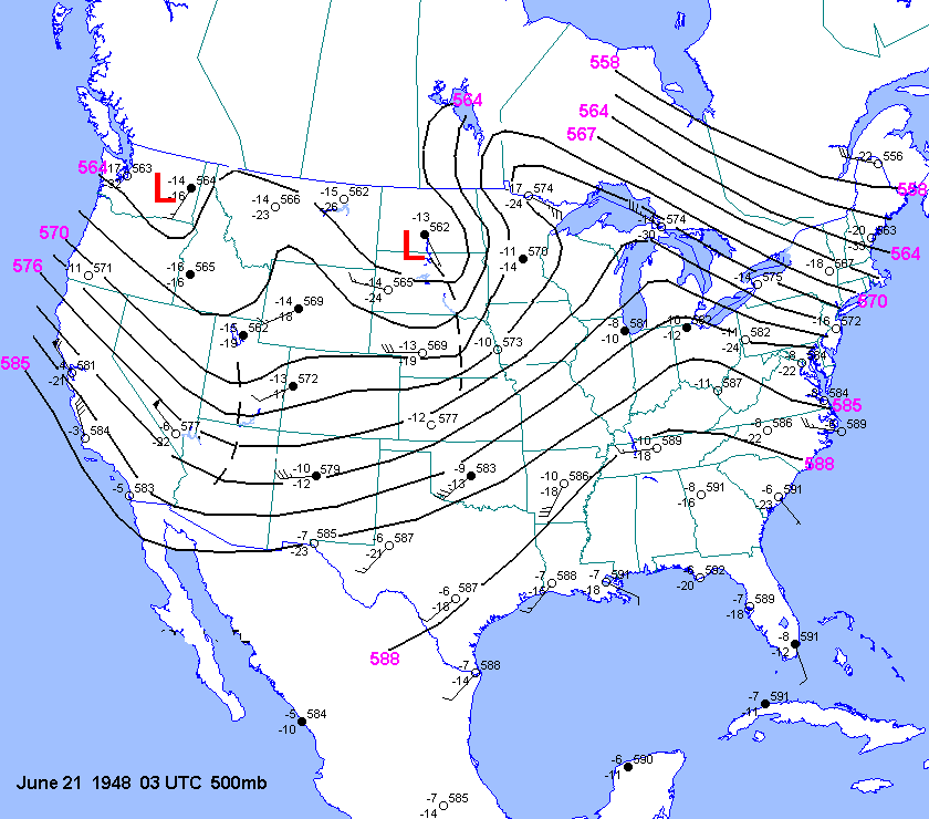
| 06-21-48 | 2230Z | 03Z 15Z 03Z 22 | OK KS | |||||||
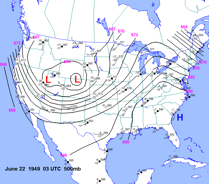
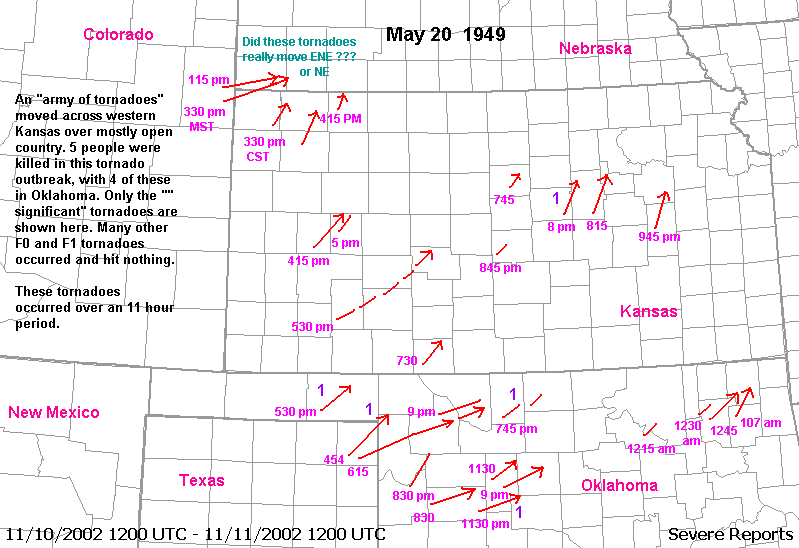
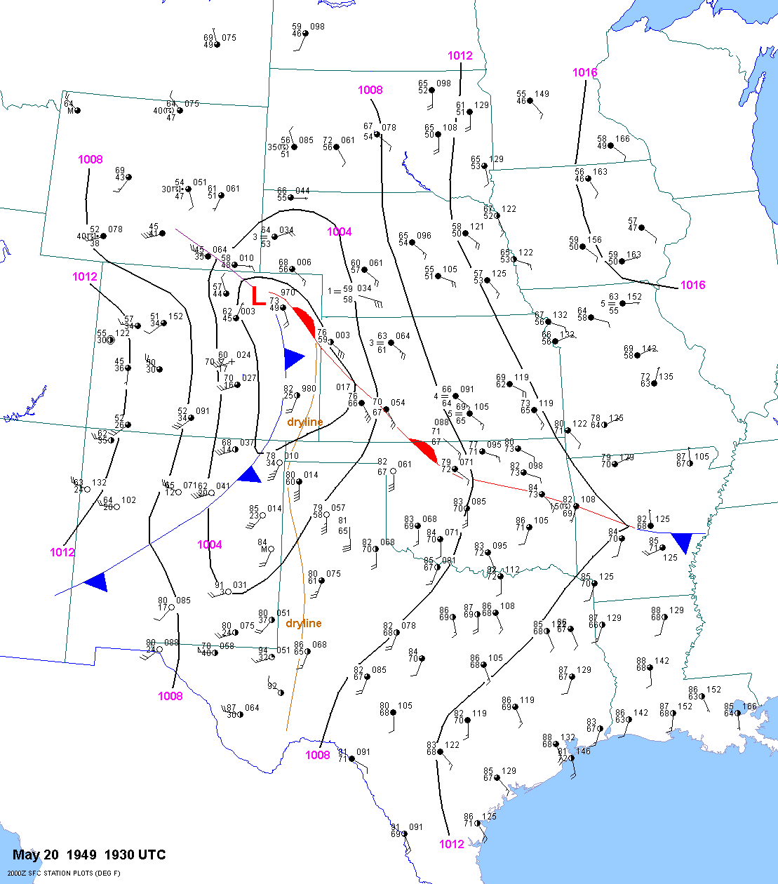
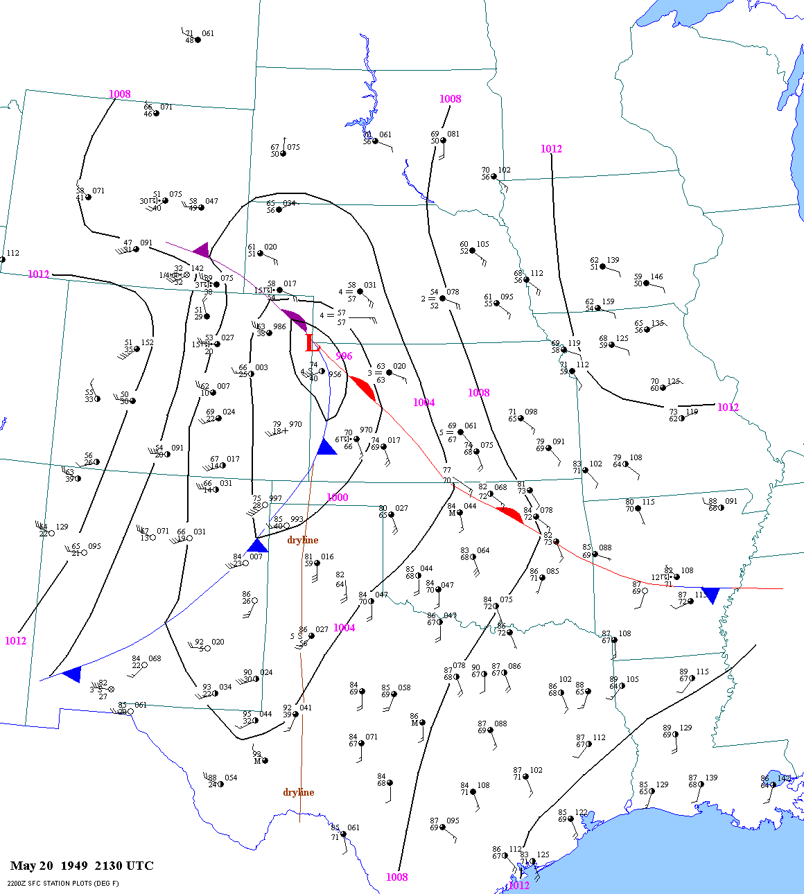
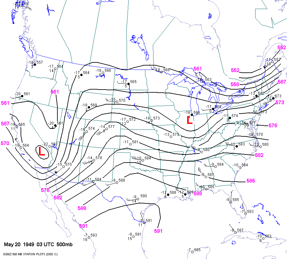
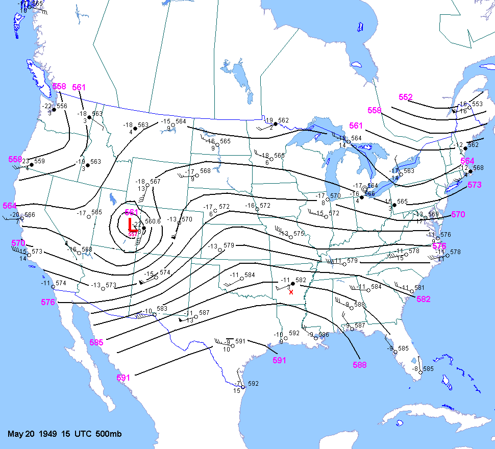
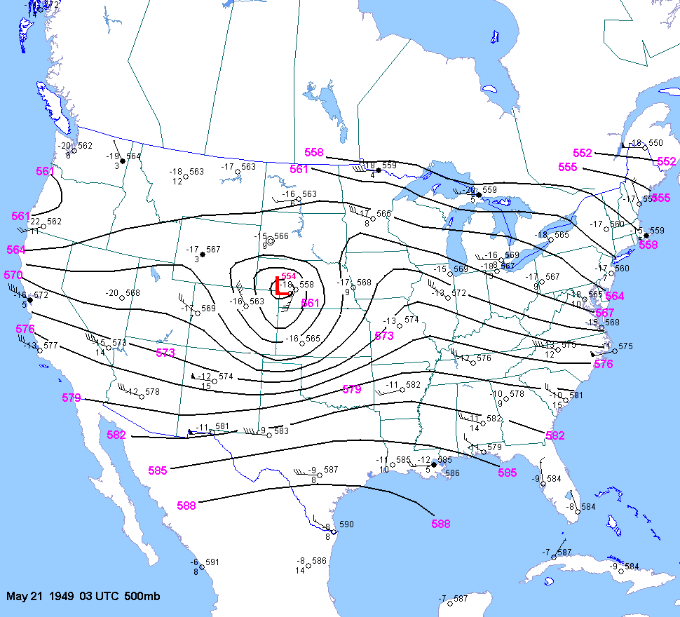
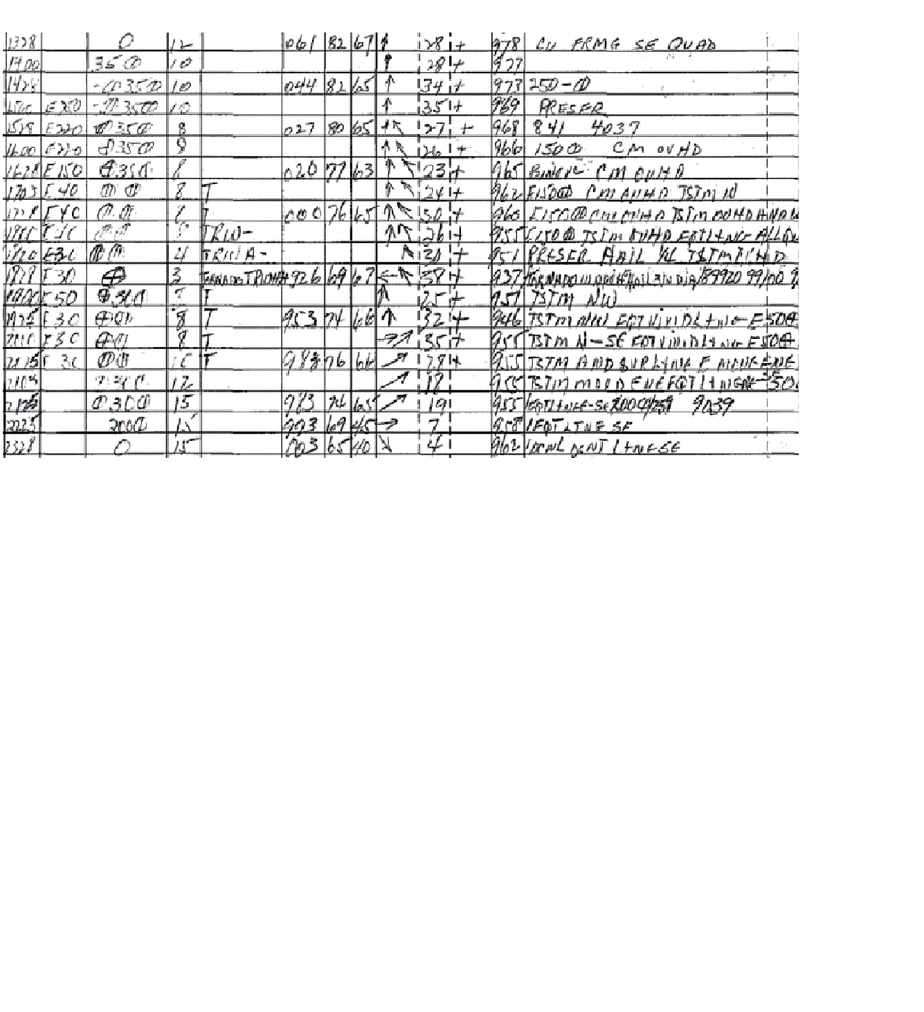
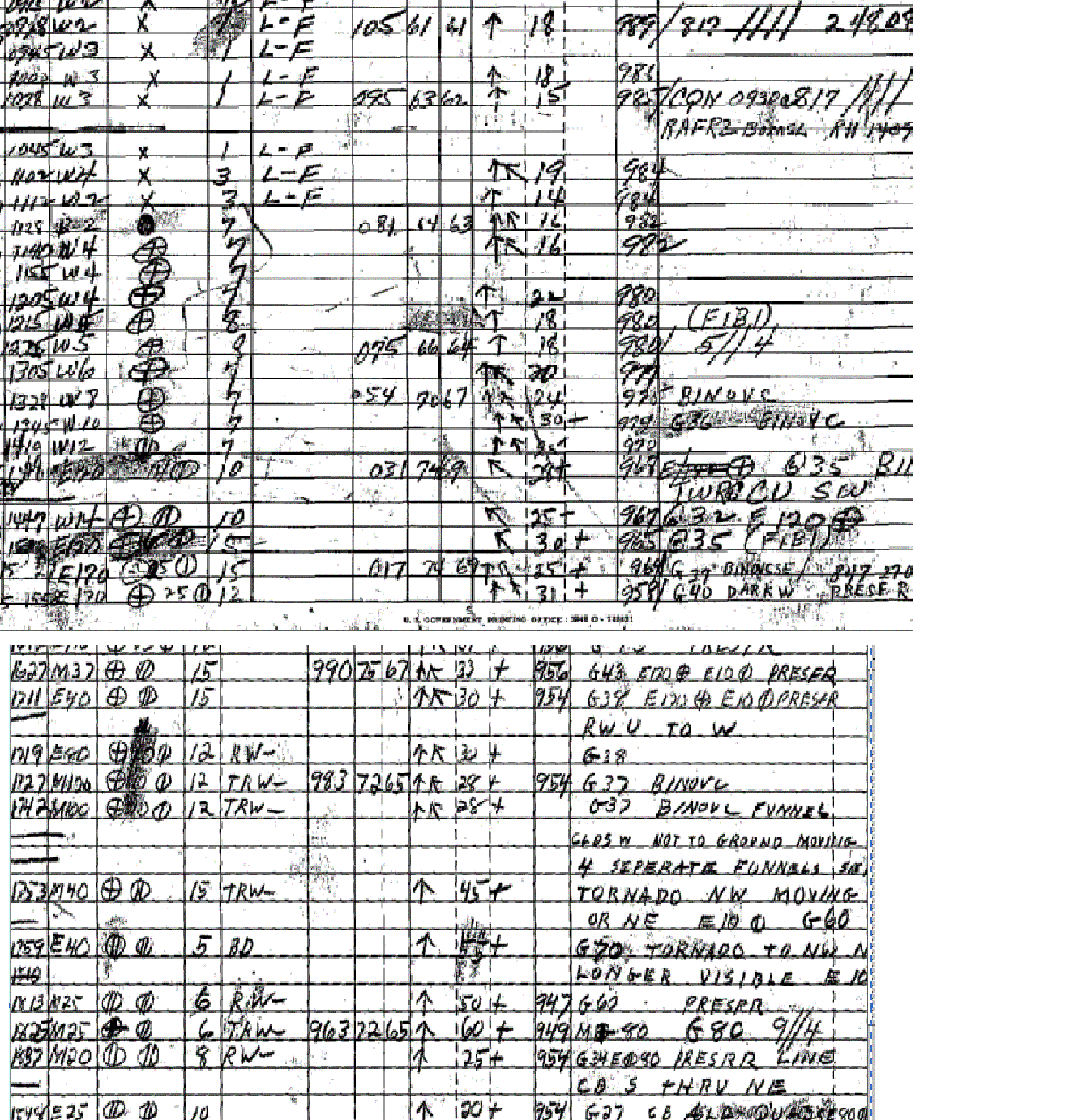
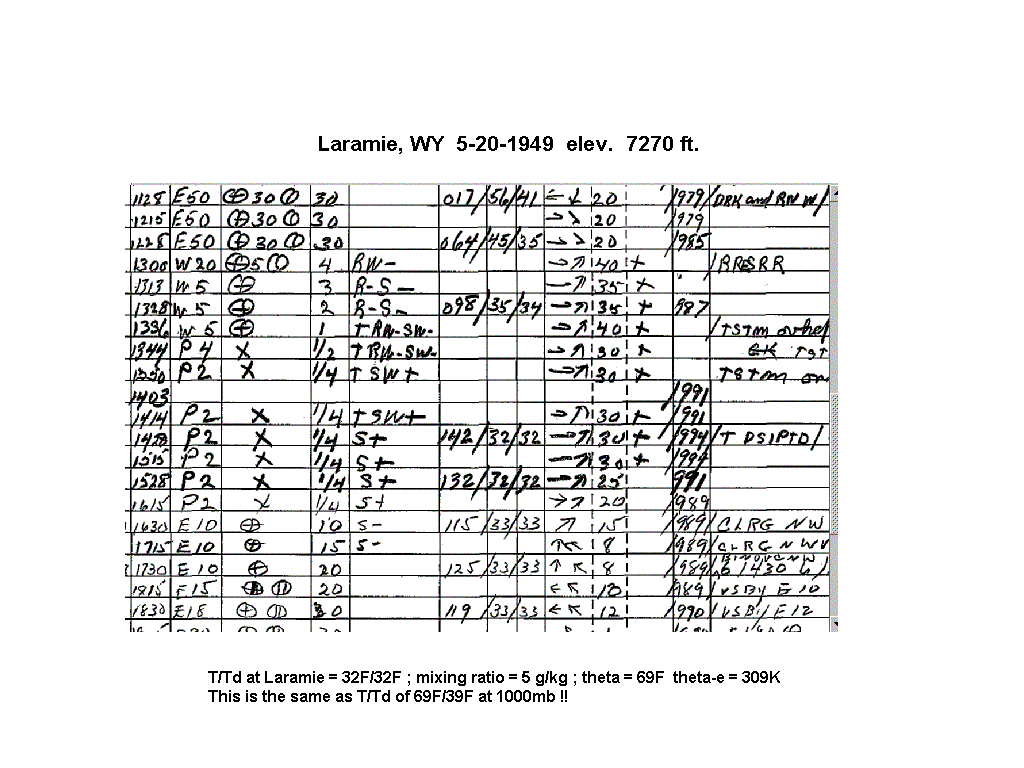
| 05-20-49 | 1930Z 2130Z | -10 to -13 | X | X | 03Z 15Z 03Z | X | X | CO OK KS NE TX | X | GAG DDC LAR |
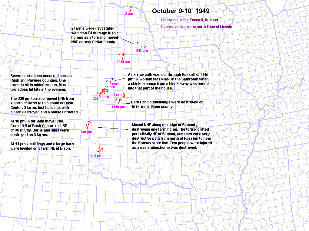
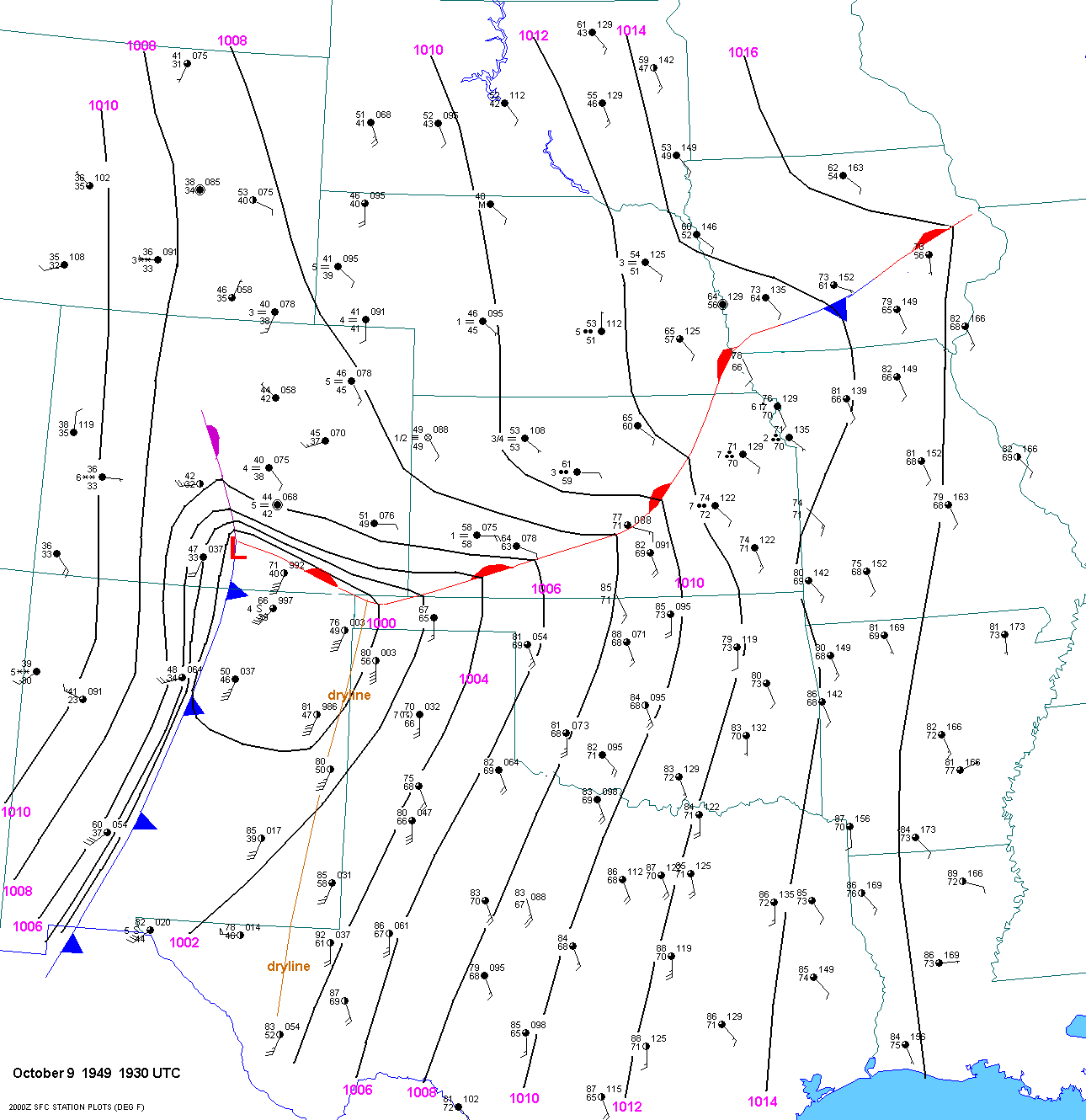
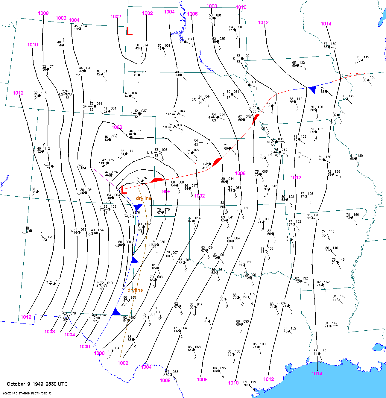
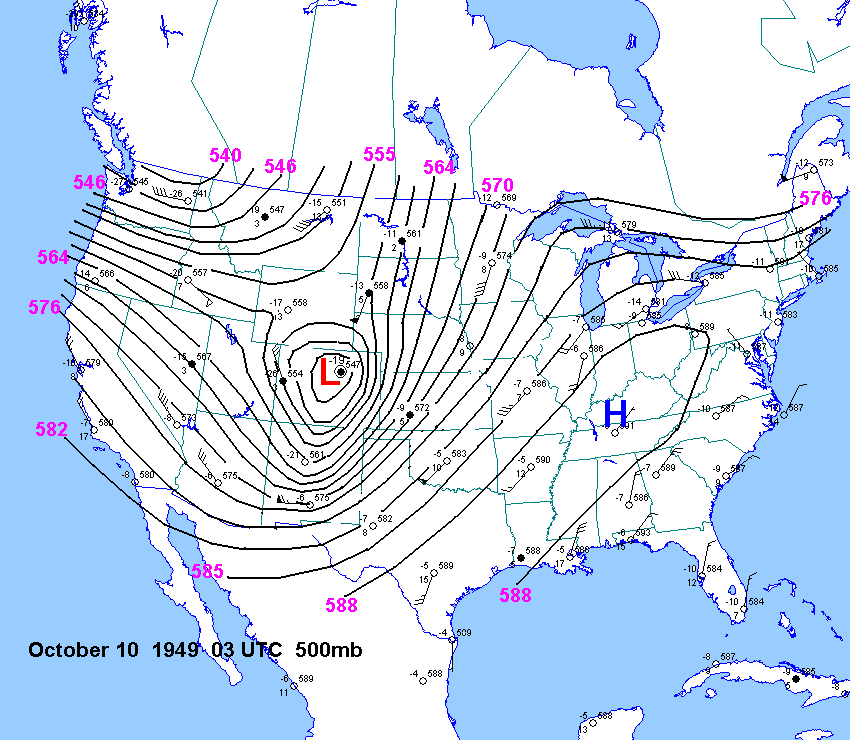
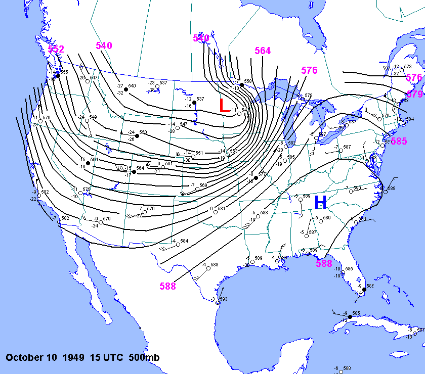
| 10-09-49 | 1930Z 00Z | -8 | X | X | 15 3Z 15Z | X | X | OK KS NE | X | X |
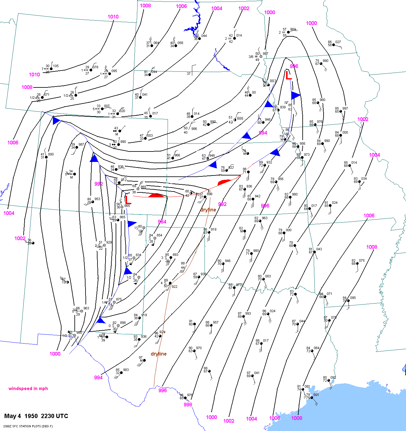
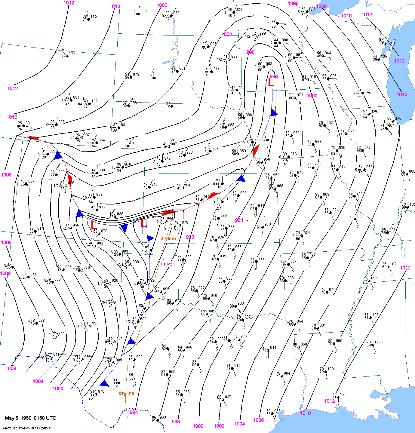
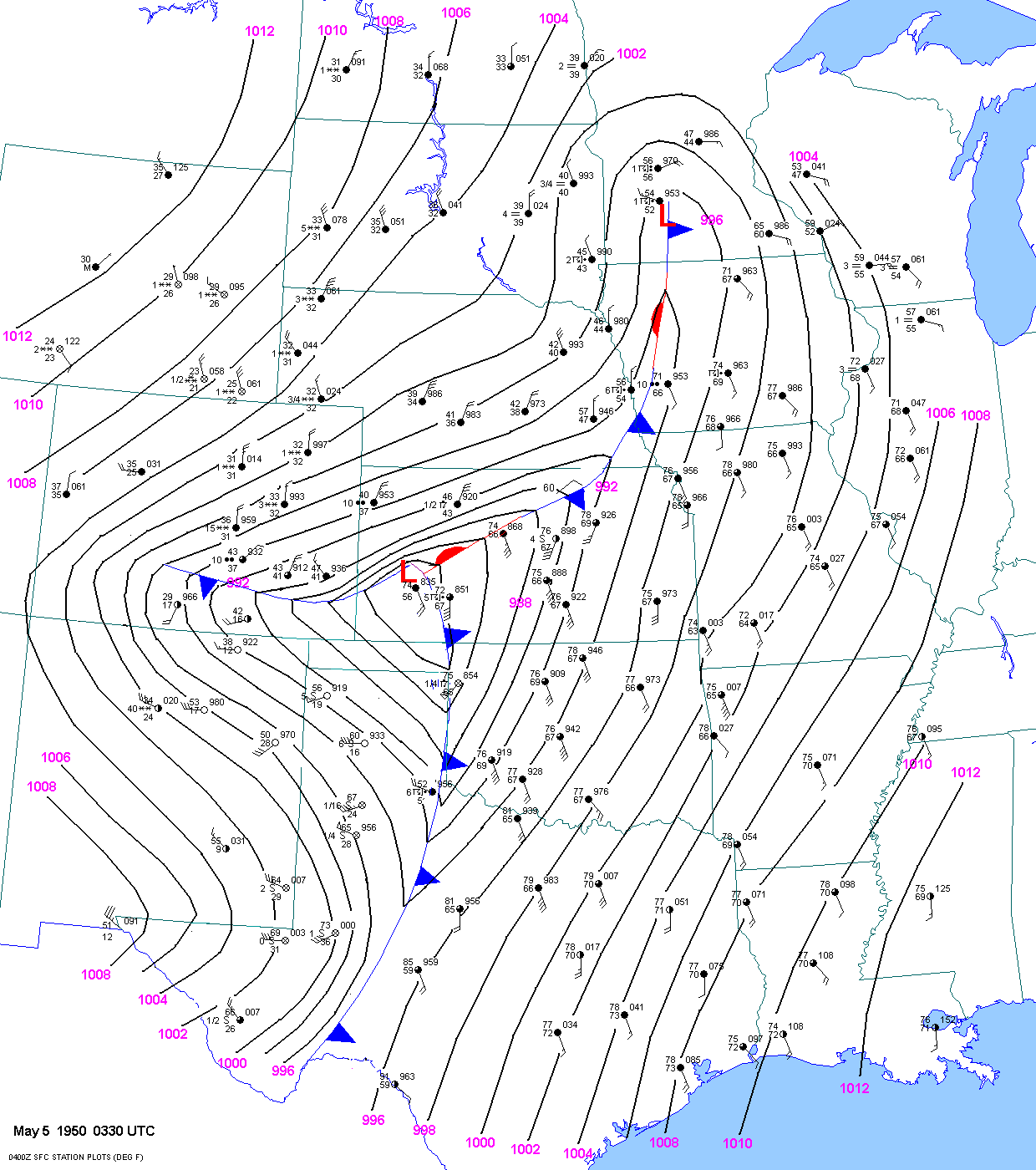
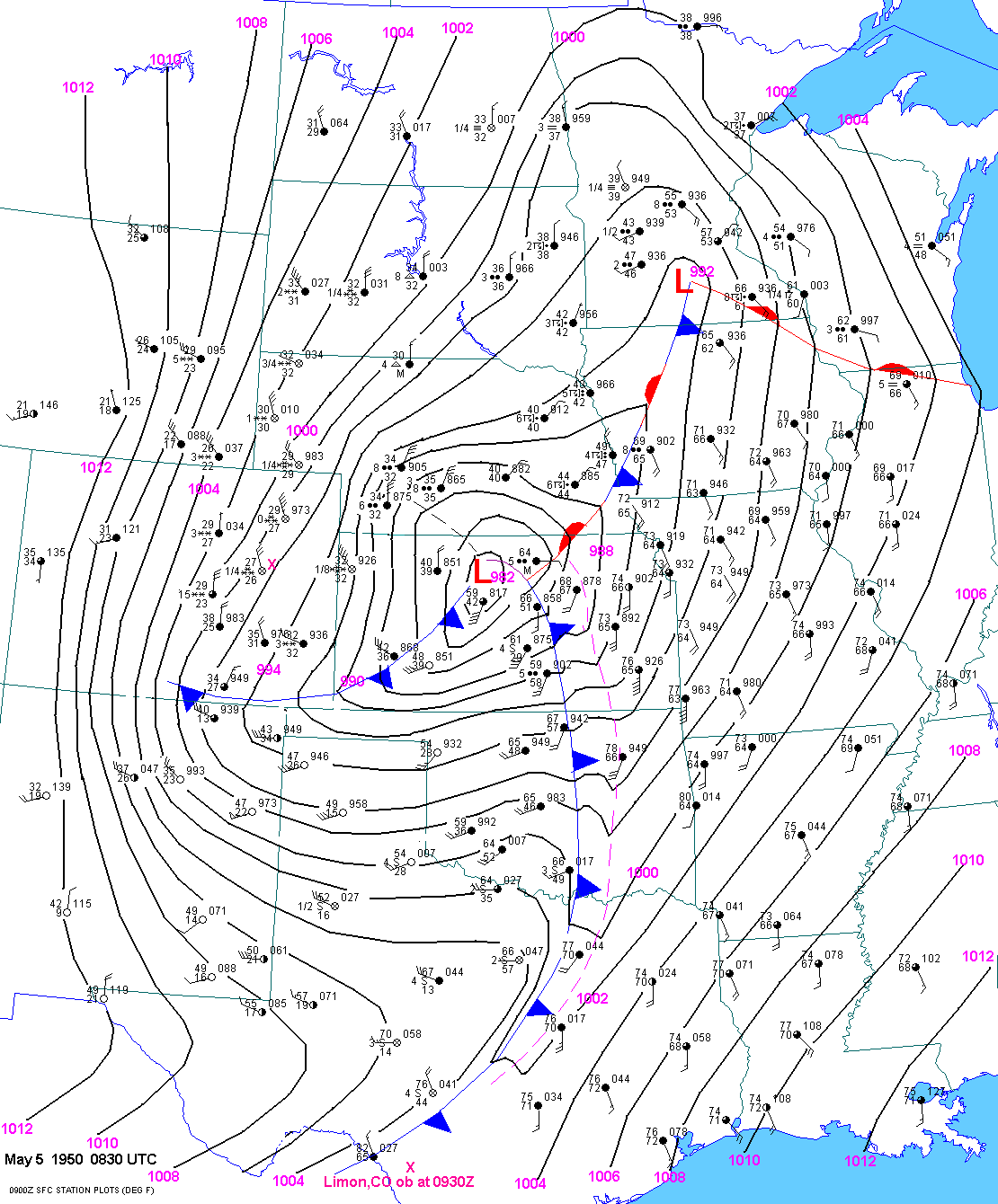
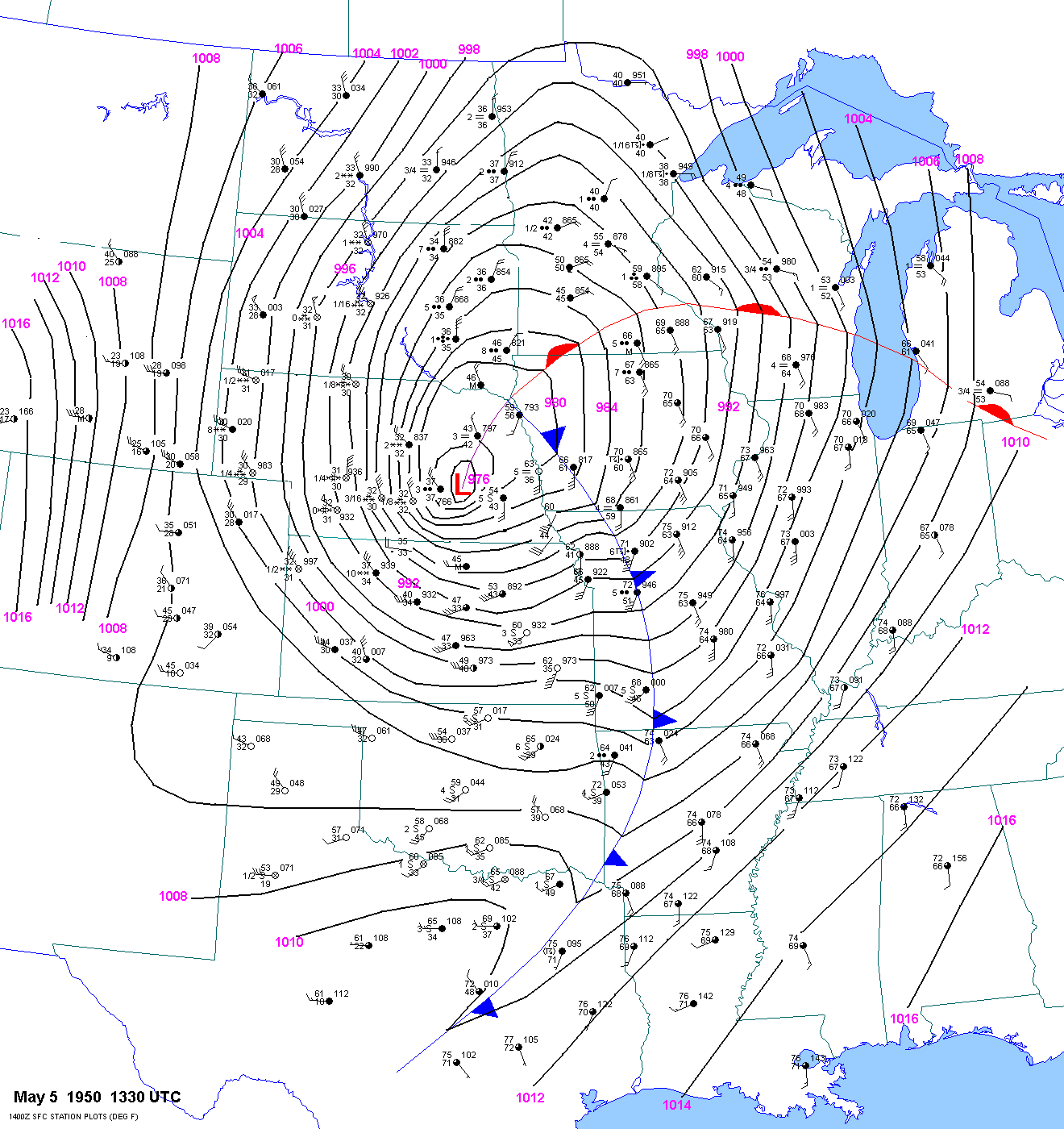
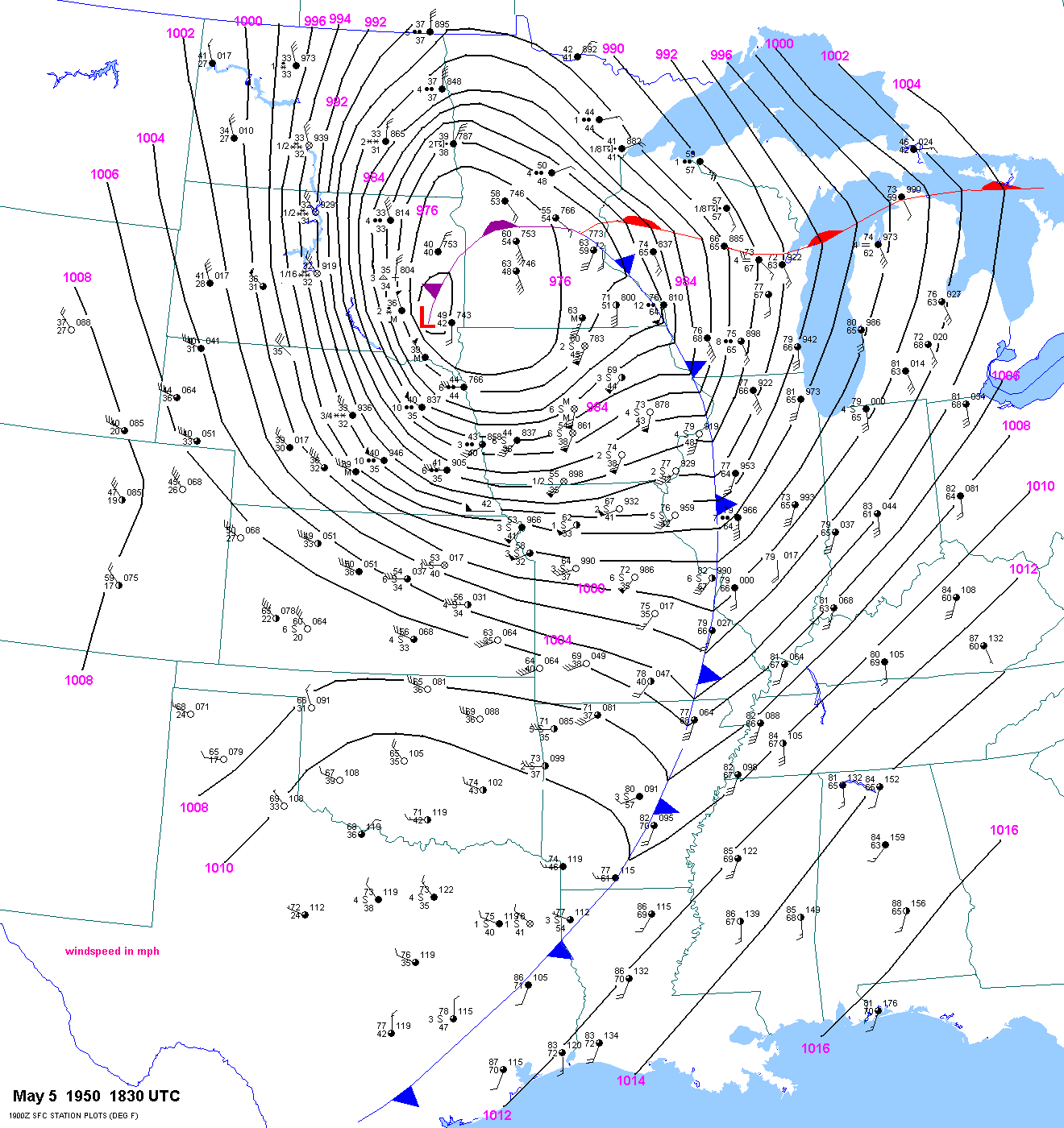
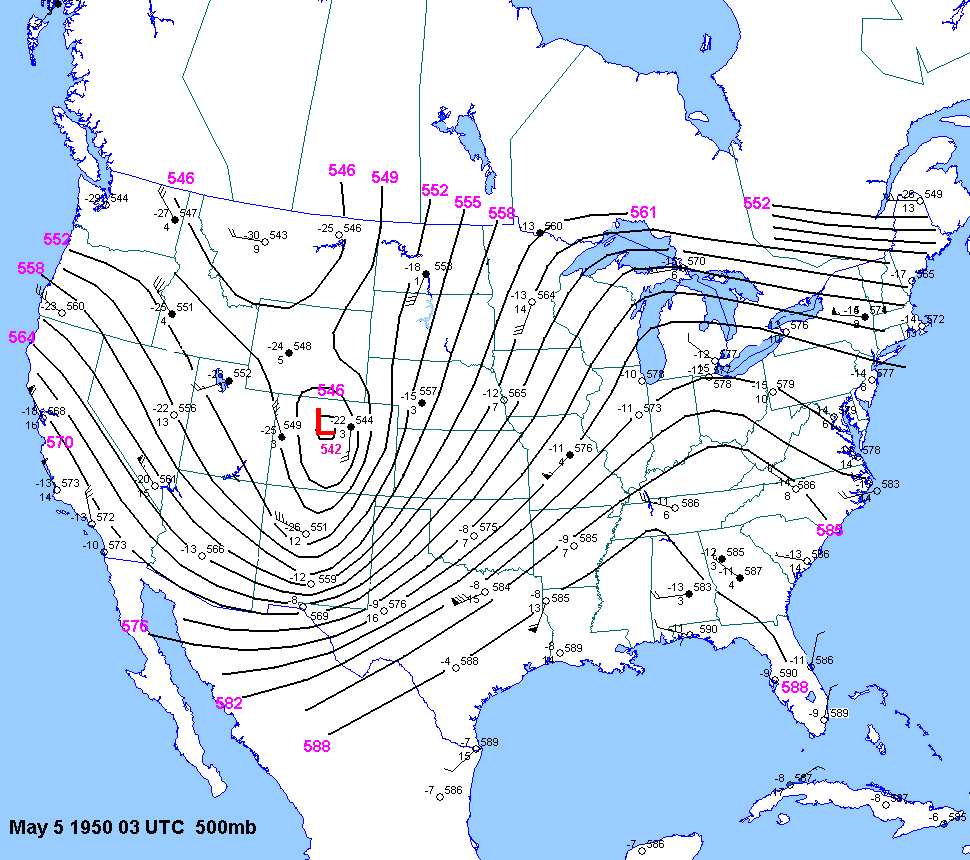
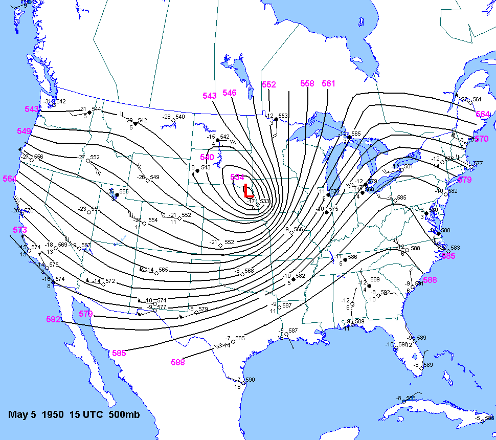
| 05-04-50 | 1930 2230 0130 330 6 9 13 19 |
-11 TX | X | X | 03Z 15Z | X | X | TX OK KS | X | X |
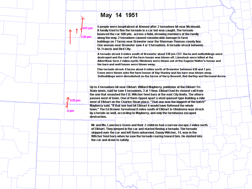
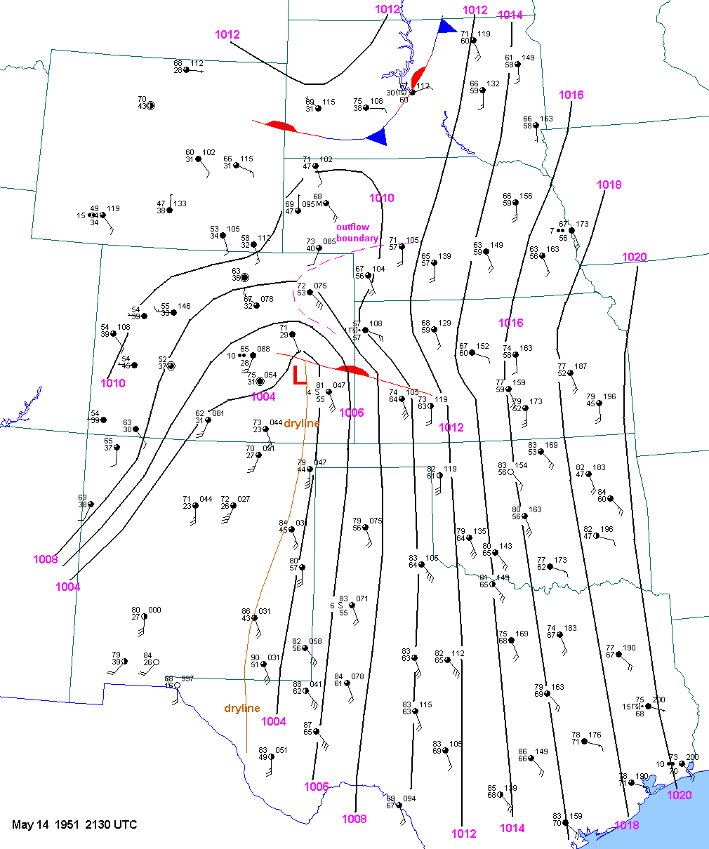
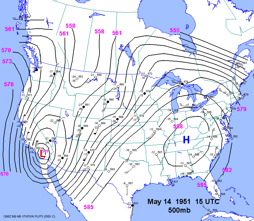
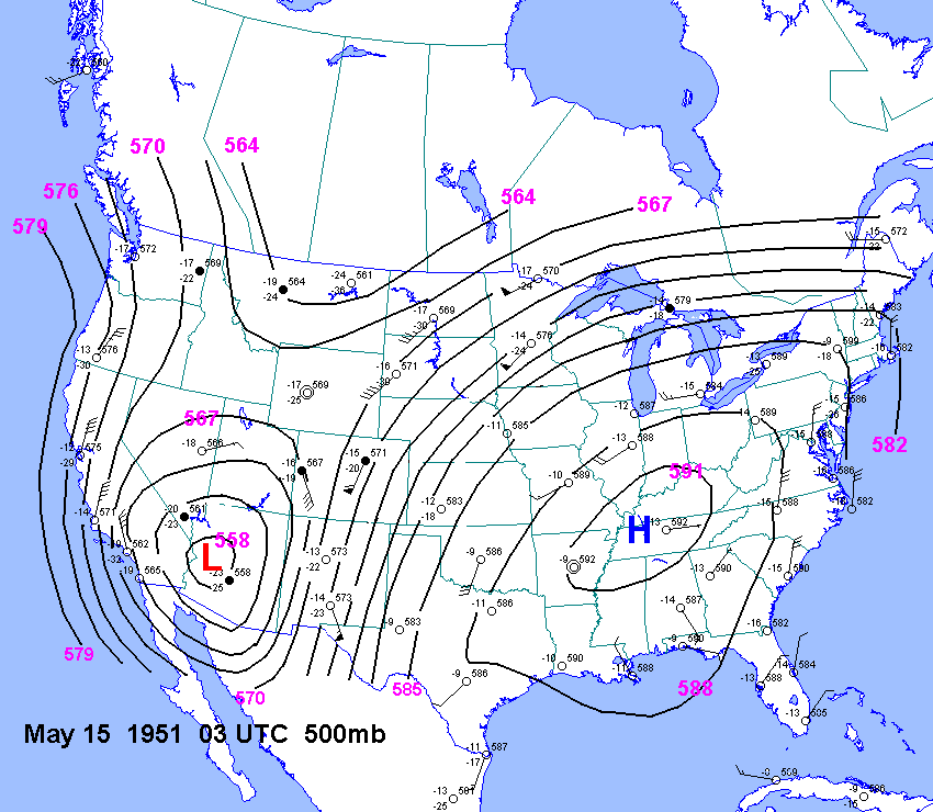
| 05-14-51 | 2130Z | -7 | X | X | 15Z 03Z | X | XX | KS | X | X |
| 05-20-51 | ||||||||||
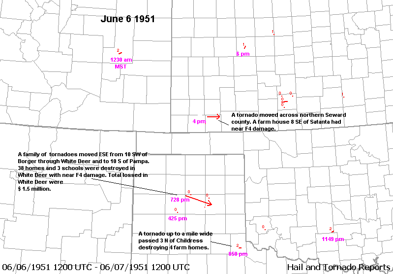
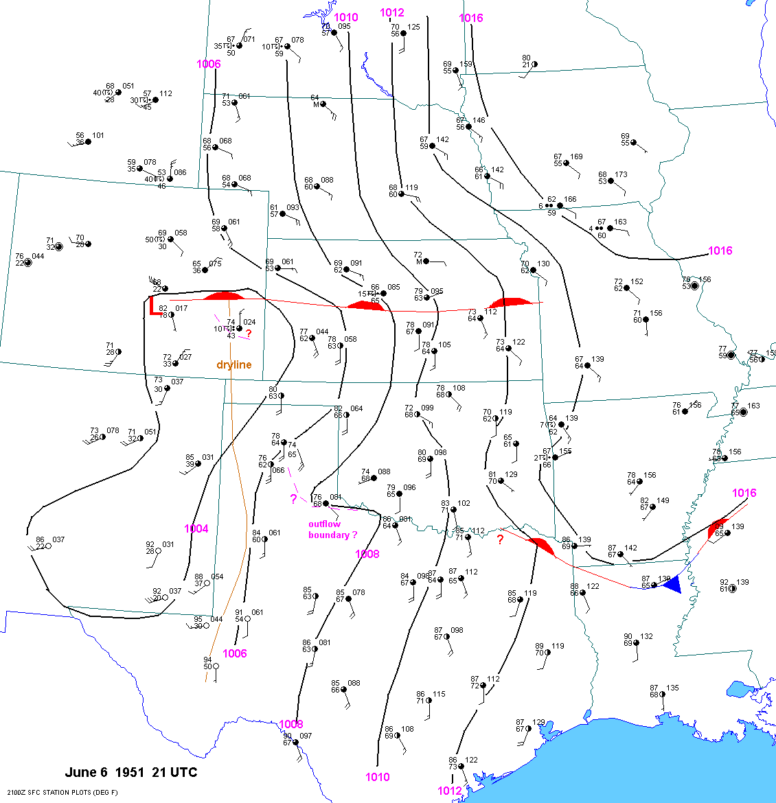
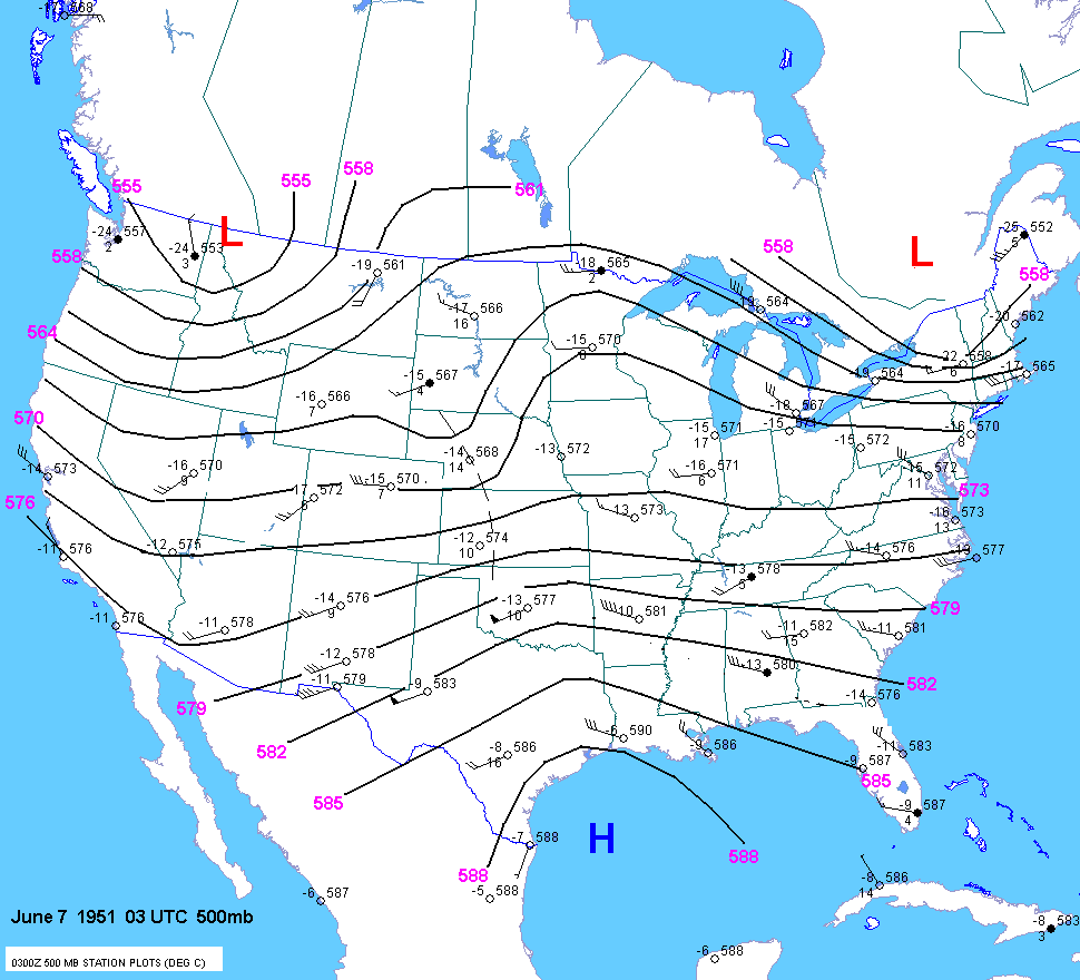
| 06-06-51 | 21Z | -12 4200 |
X | X | 15Z 03Z | X | XX | TX OK KS | X | X |
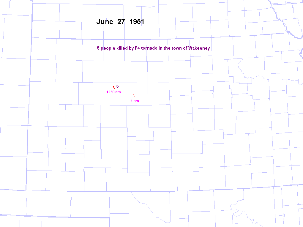
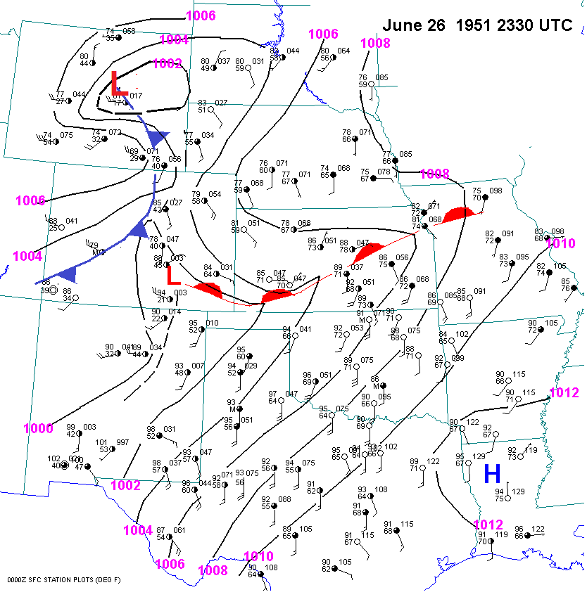
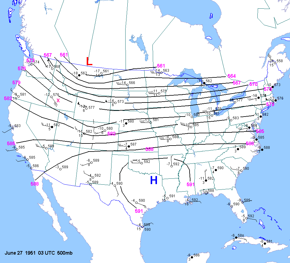
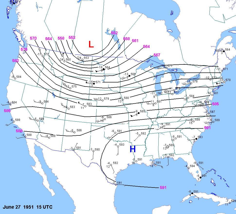
| 06-27-51 | 2330Z | -9 | X | 03Z 15Z | X | KS | X | X | ||
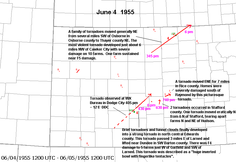
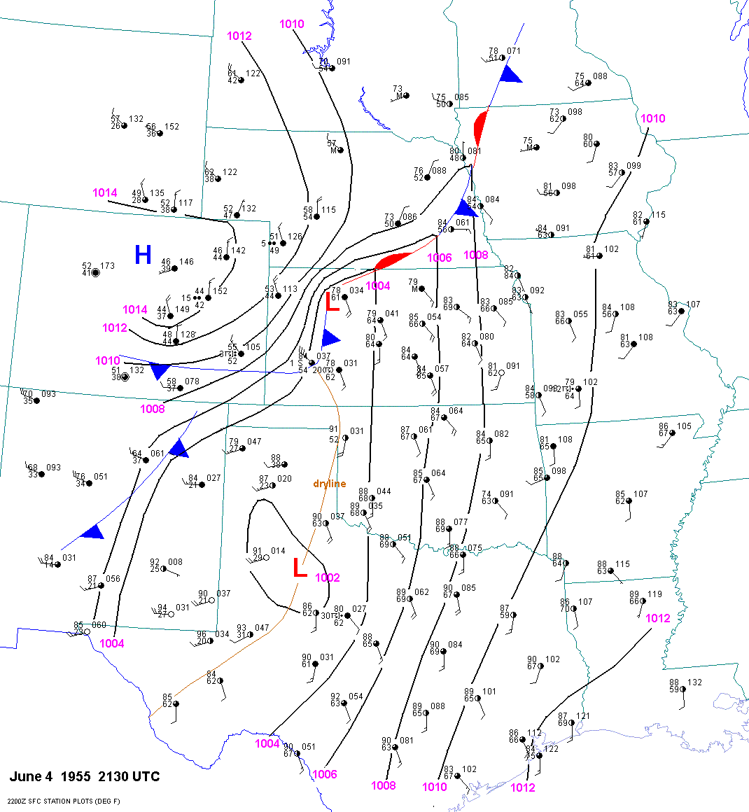
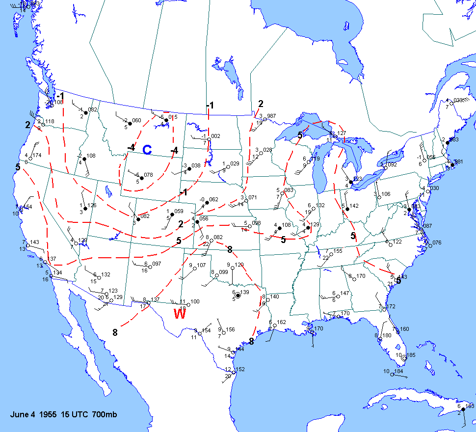
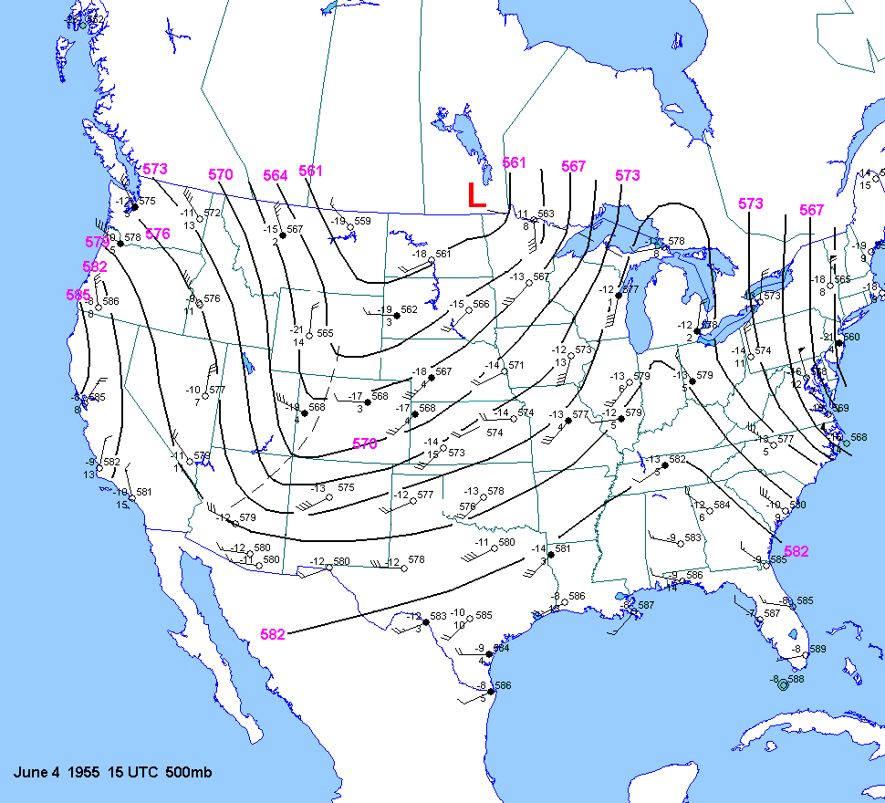
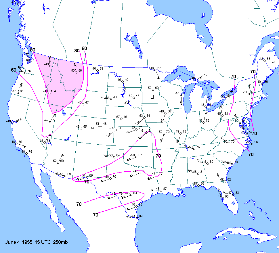
| 06-04-55 | 2130Z | -10 to-11 | X | 15Z | 15Z 03Z | 15Z | X | KS NE | X | X |
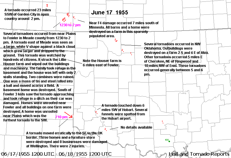
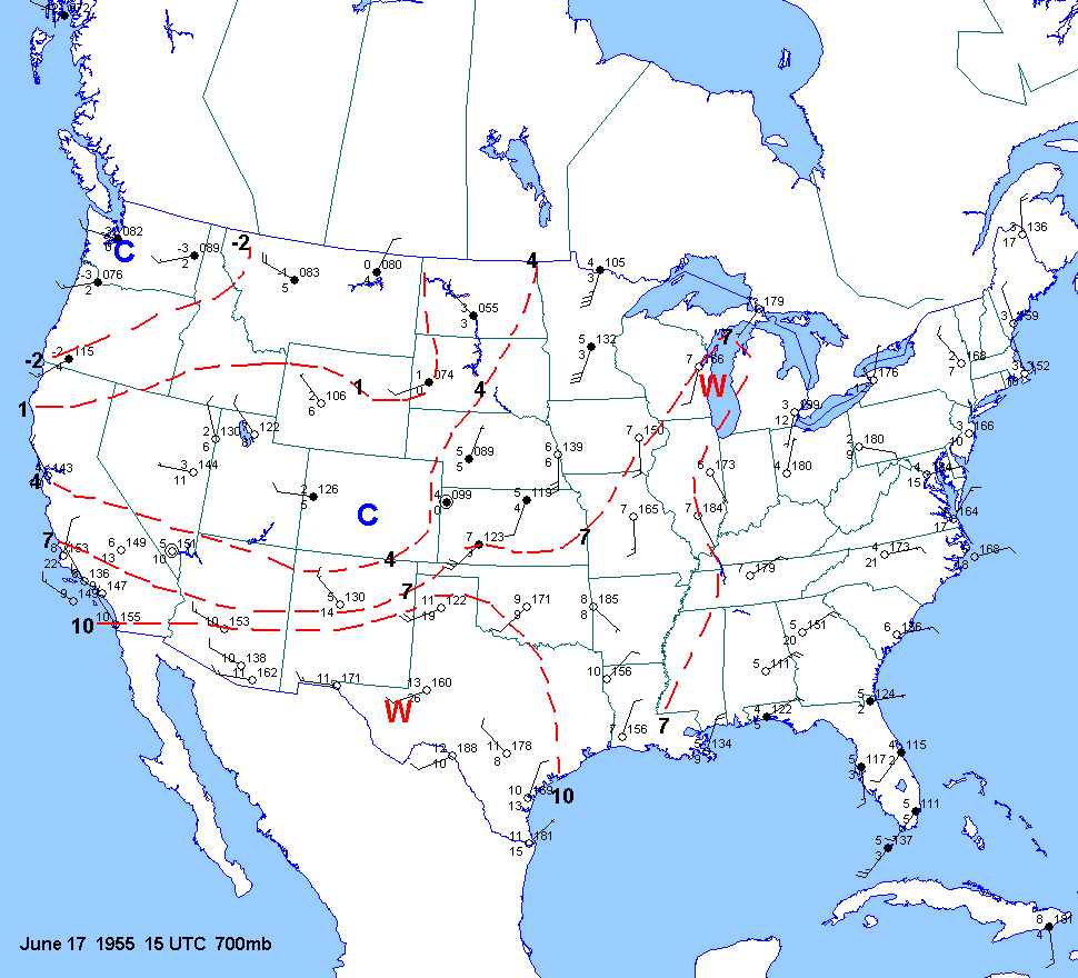
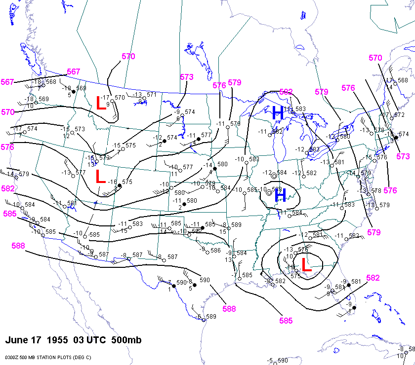
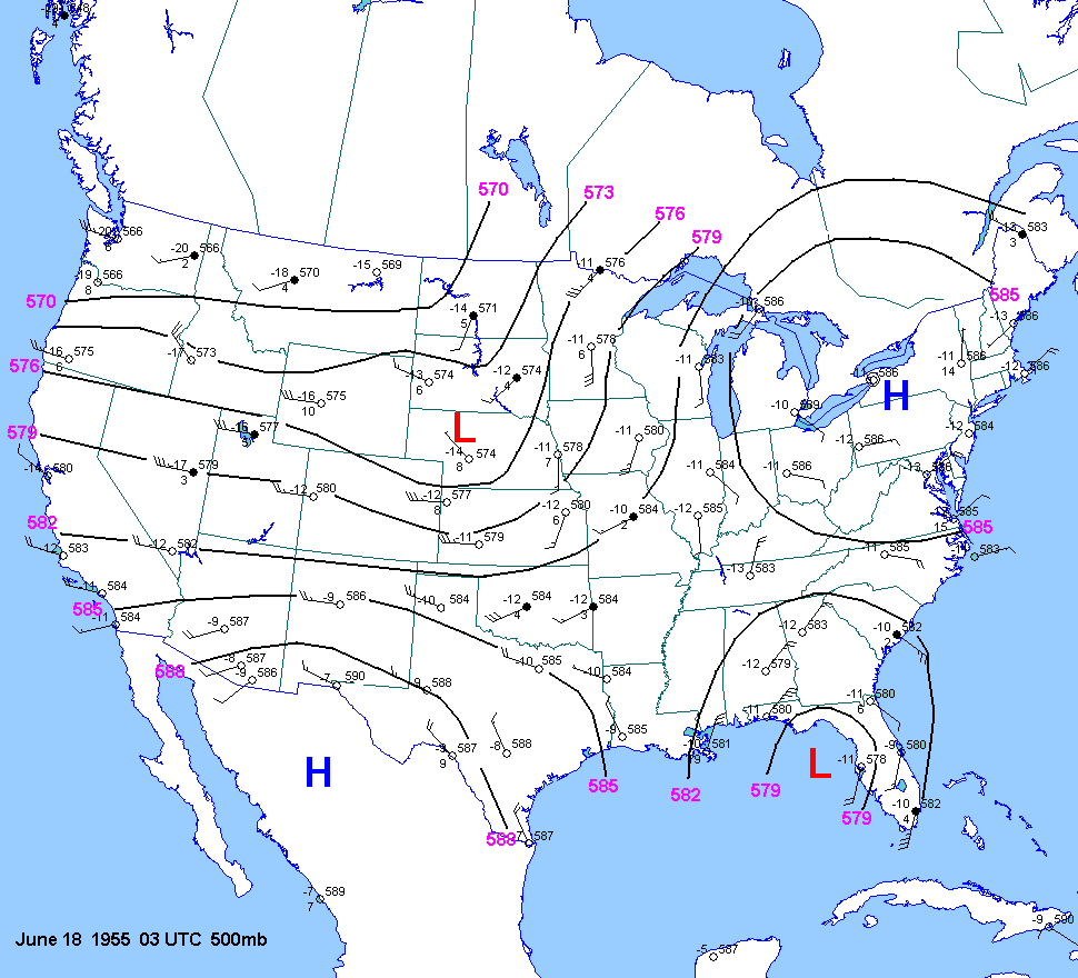
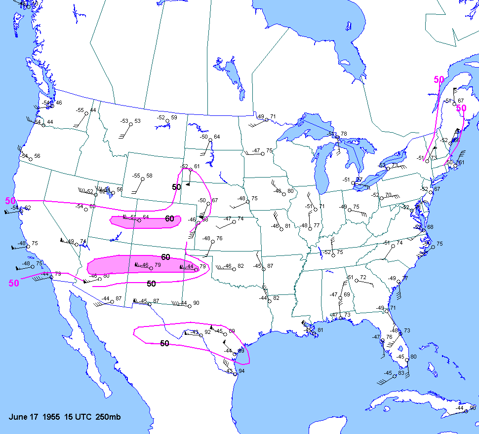
| 06-17-55 | 1730Z | -10 | X | 15Z | 03Z 15Z 03Z | 15Z | X | TX OK KS | X | X |
| 04-02-56 | ||||||||||
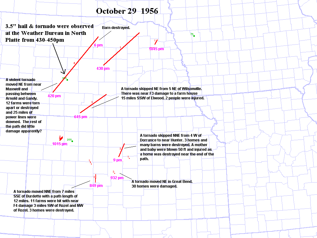
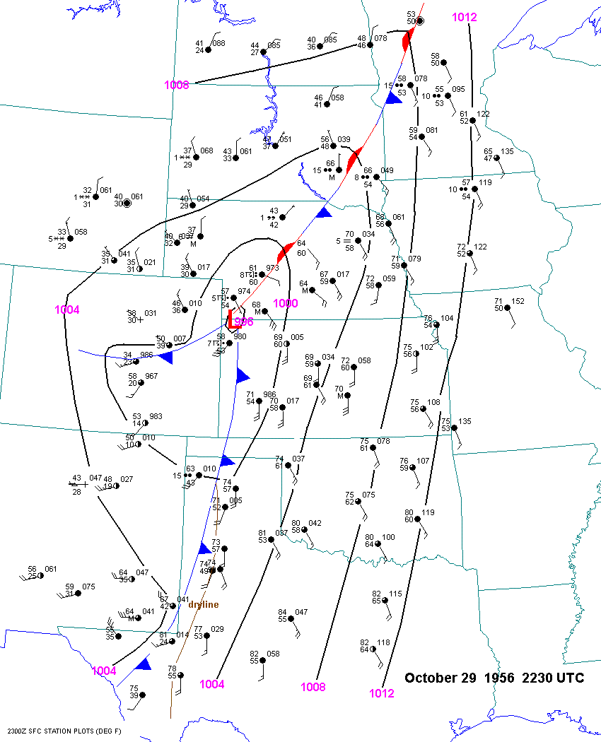
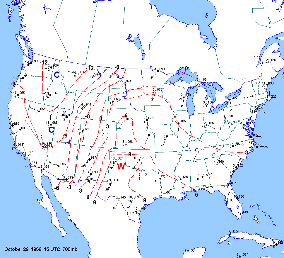
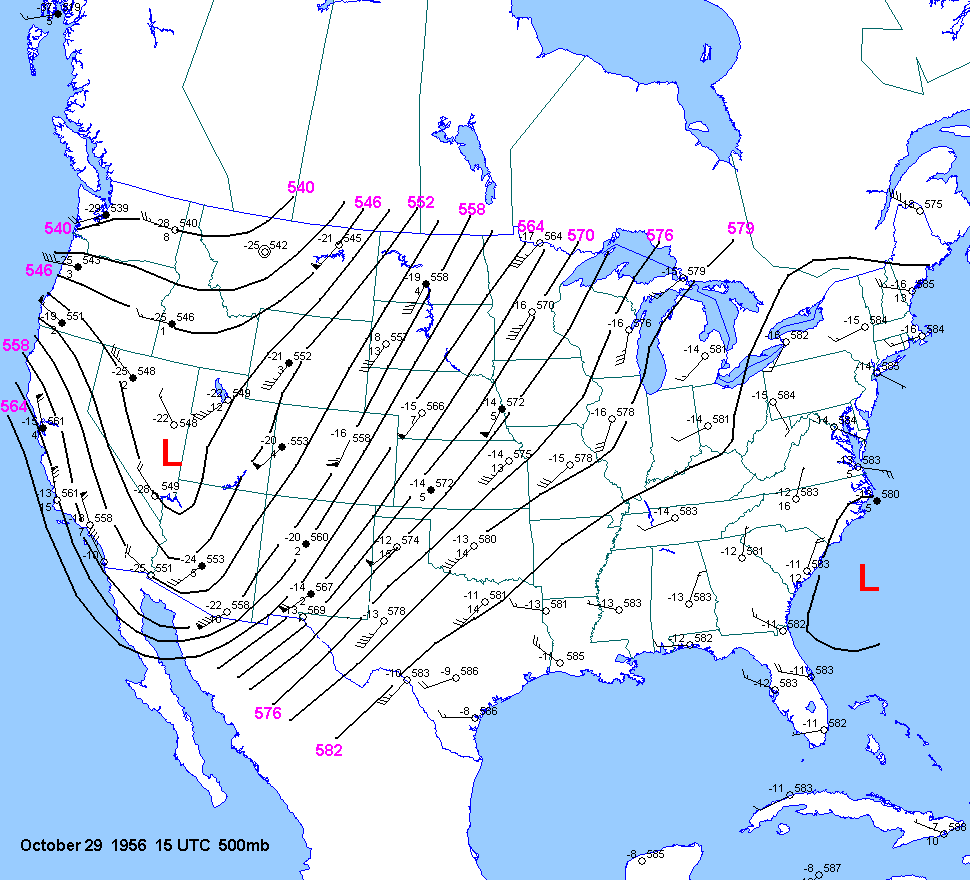
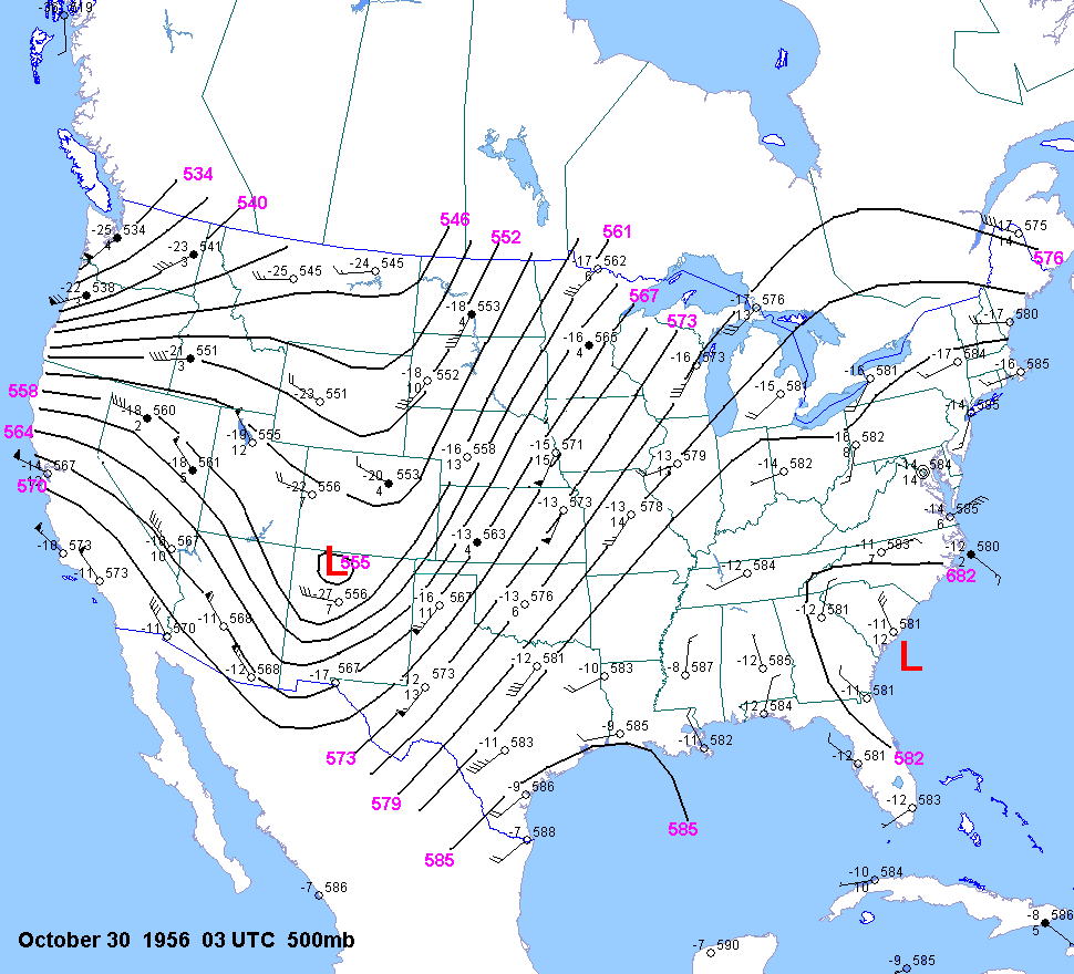
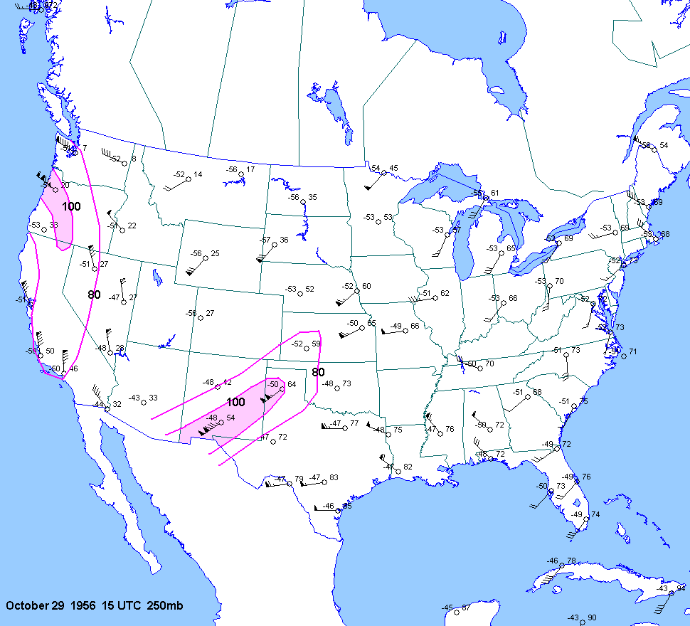
| 10-29-56 | 22Z | -7 to -8 | X | 15Z | 15Z 03Z | 15Z | X | NE KS | X | X |
| 06-12-58 | ||||||||||
| 07-13-58 | ||||||||||
| 05-28-59 | ||||||||||
| 05-29-59 | ||||||||||
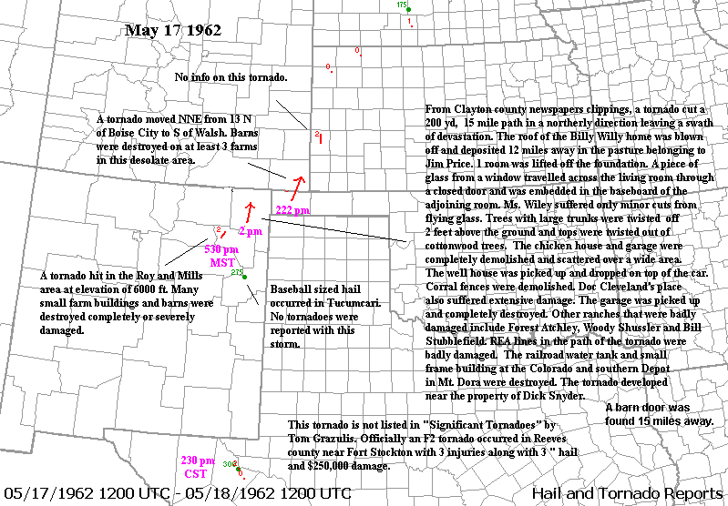
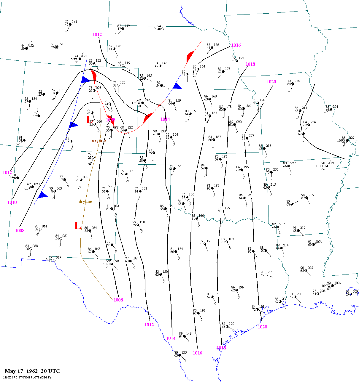
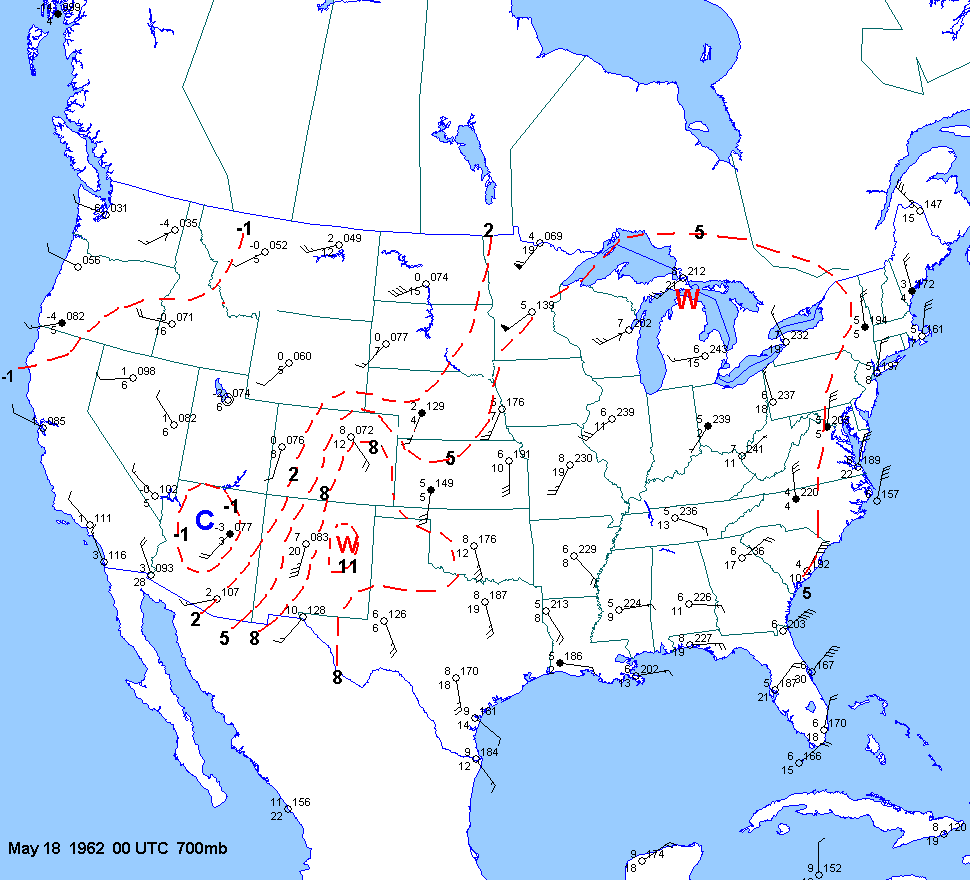
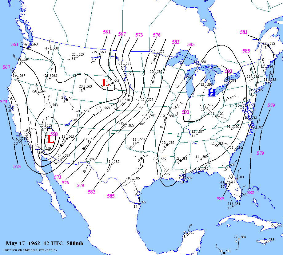
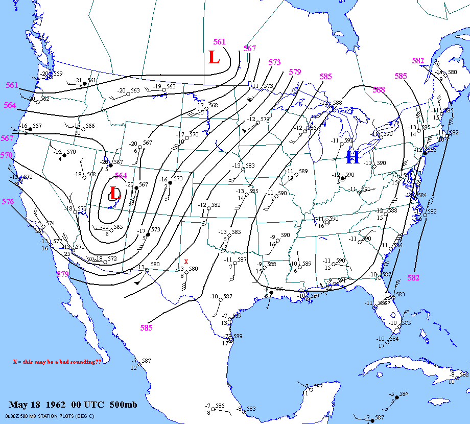
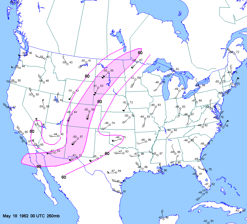
| 05-17-62 | 21Z | -7 to -8 | X | 00Z | 12Z 00Z | 00Z | X | NM OK KS CO | X | X |
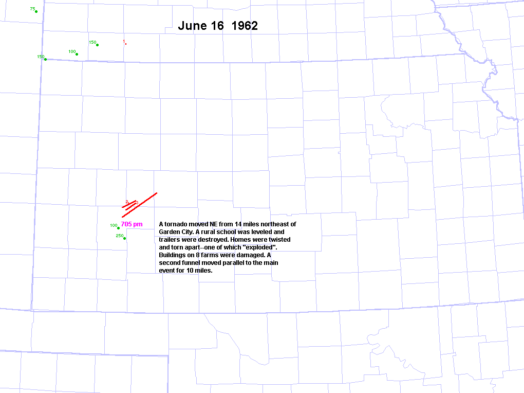
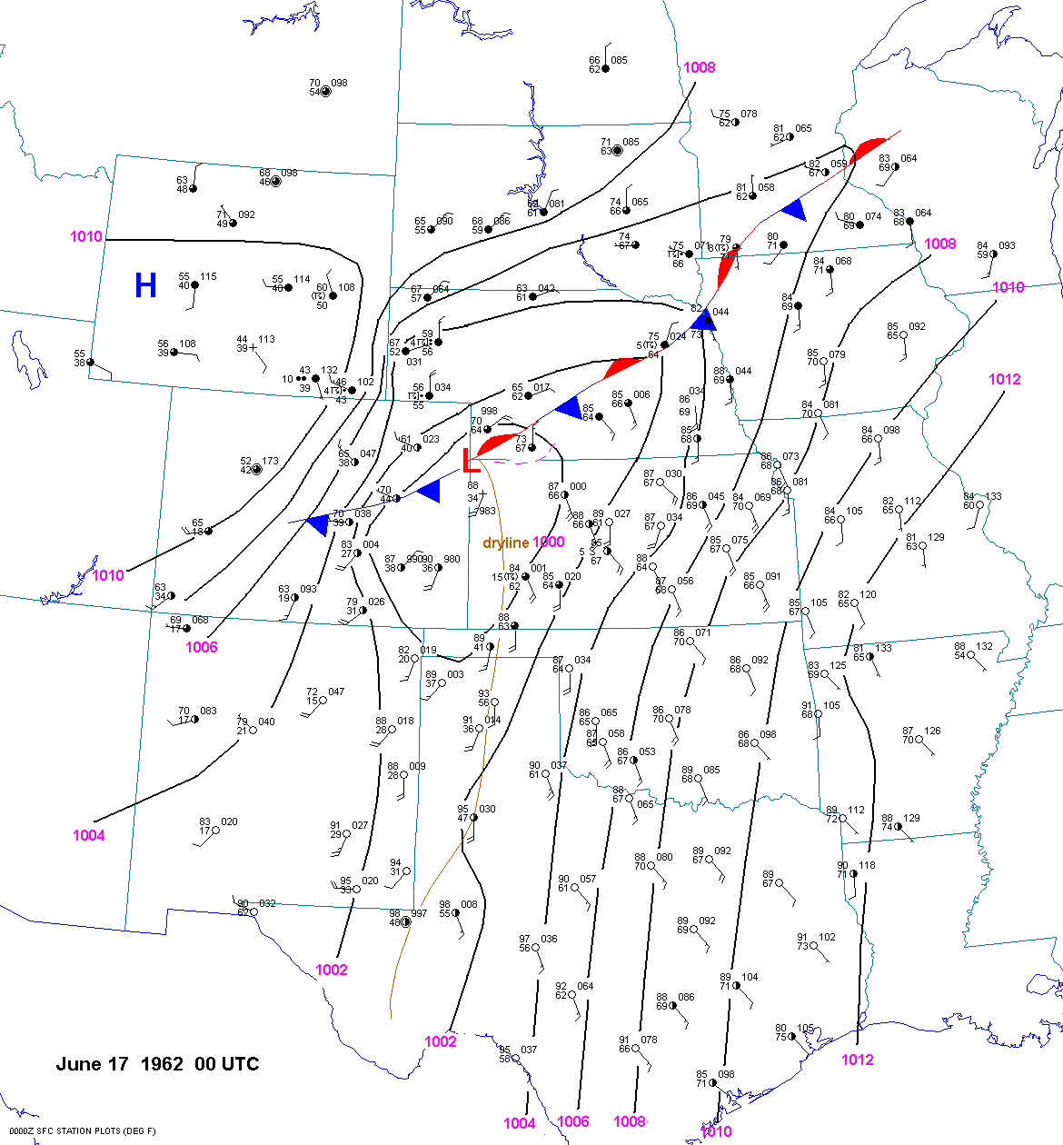
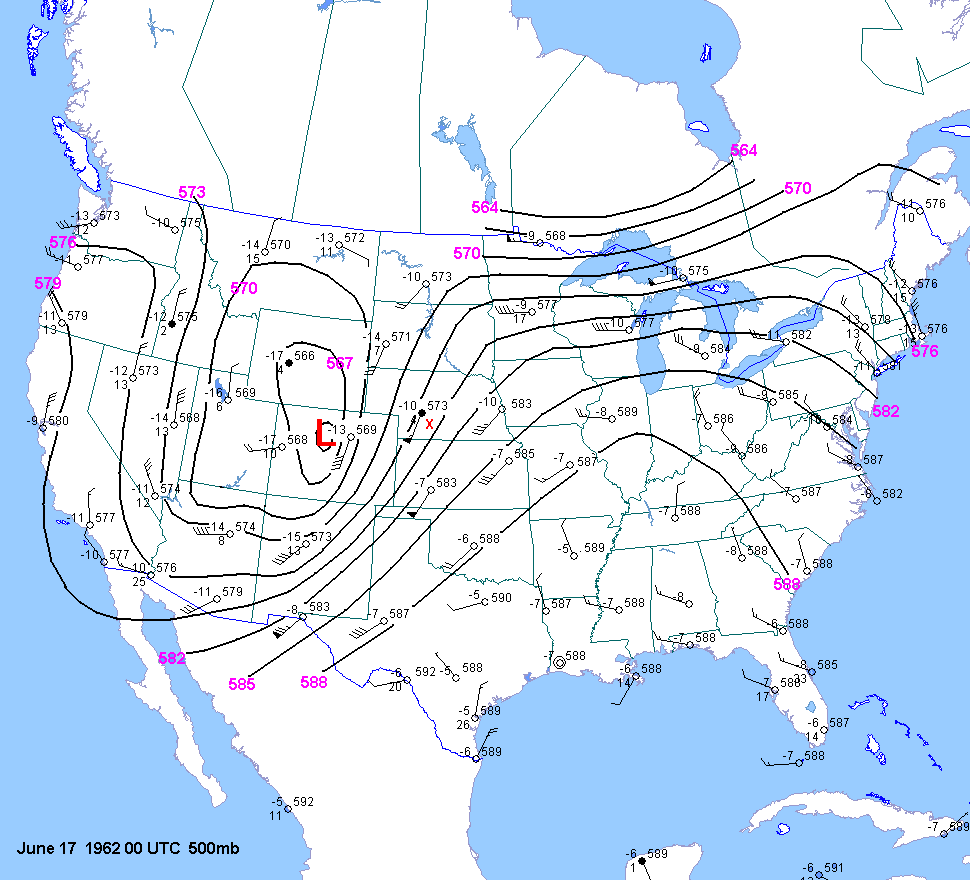
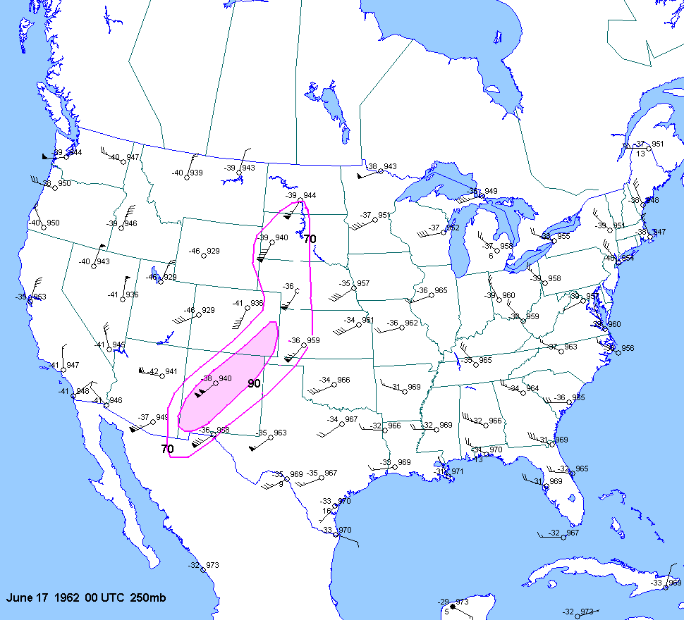
| 06-16-62 | 00Z | -7 | X | 00Z | 12Z 16 00Z 17 | 00Z | X | KS | X | X |
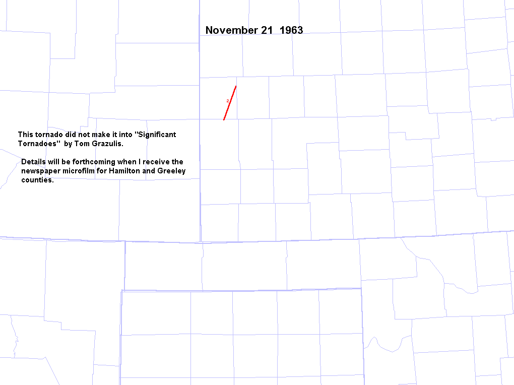
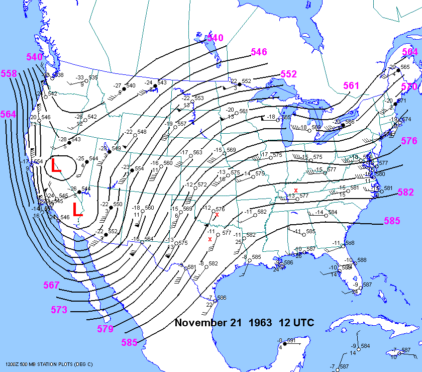
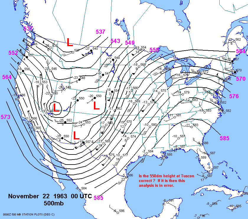
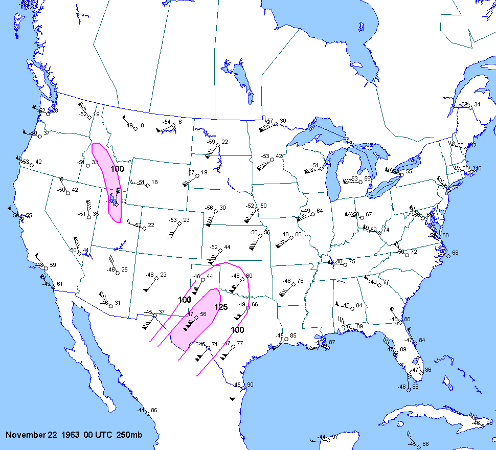
| 11-21-63 | 23Z | -6 | X | 12Z 00Z 12Z | 00Z | X | KS | X | X | |
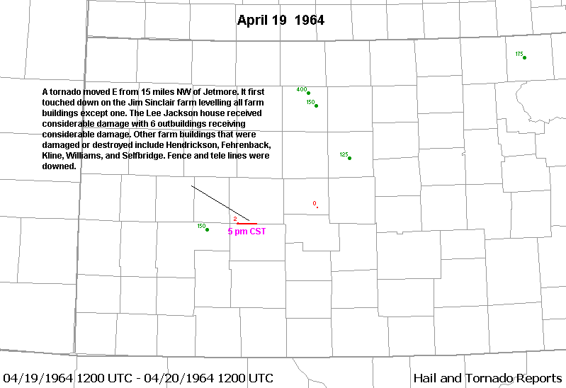
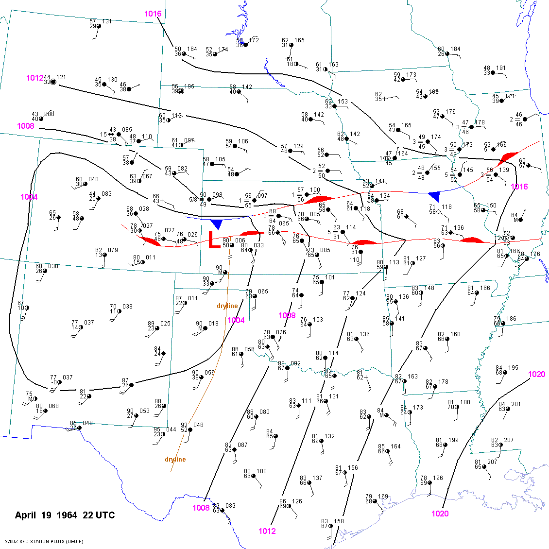
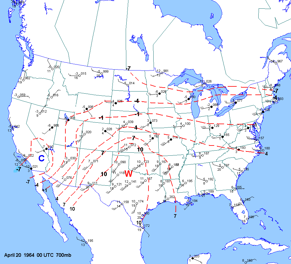
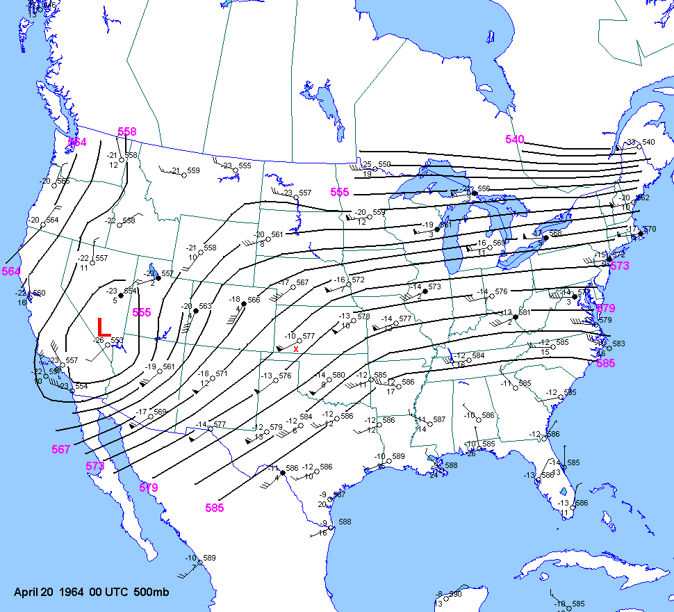
| 04-19-64 | 22Z | -10 to-11 | X | 00Z | 12Z 00Z | 00Z | X | KS | X | X |
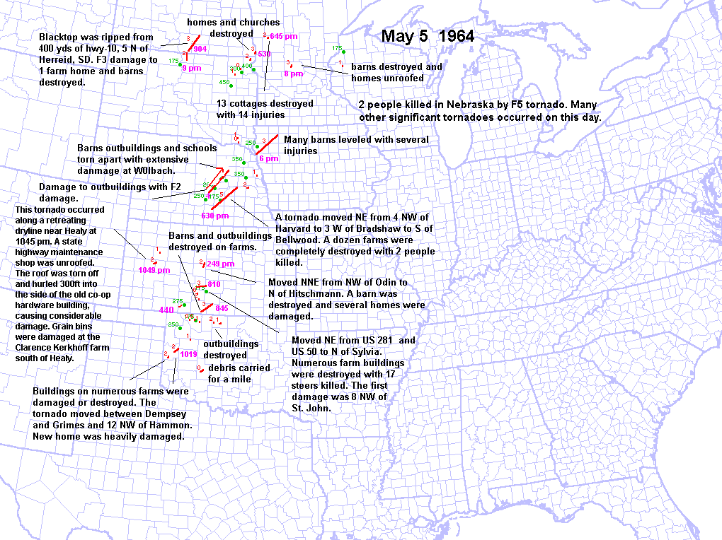
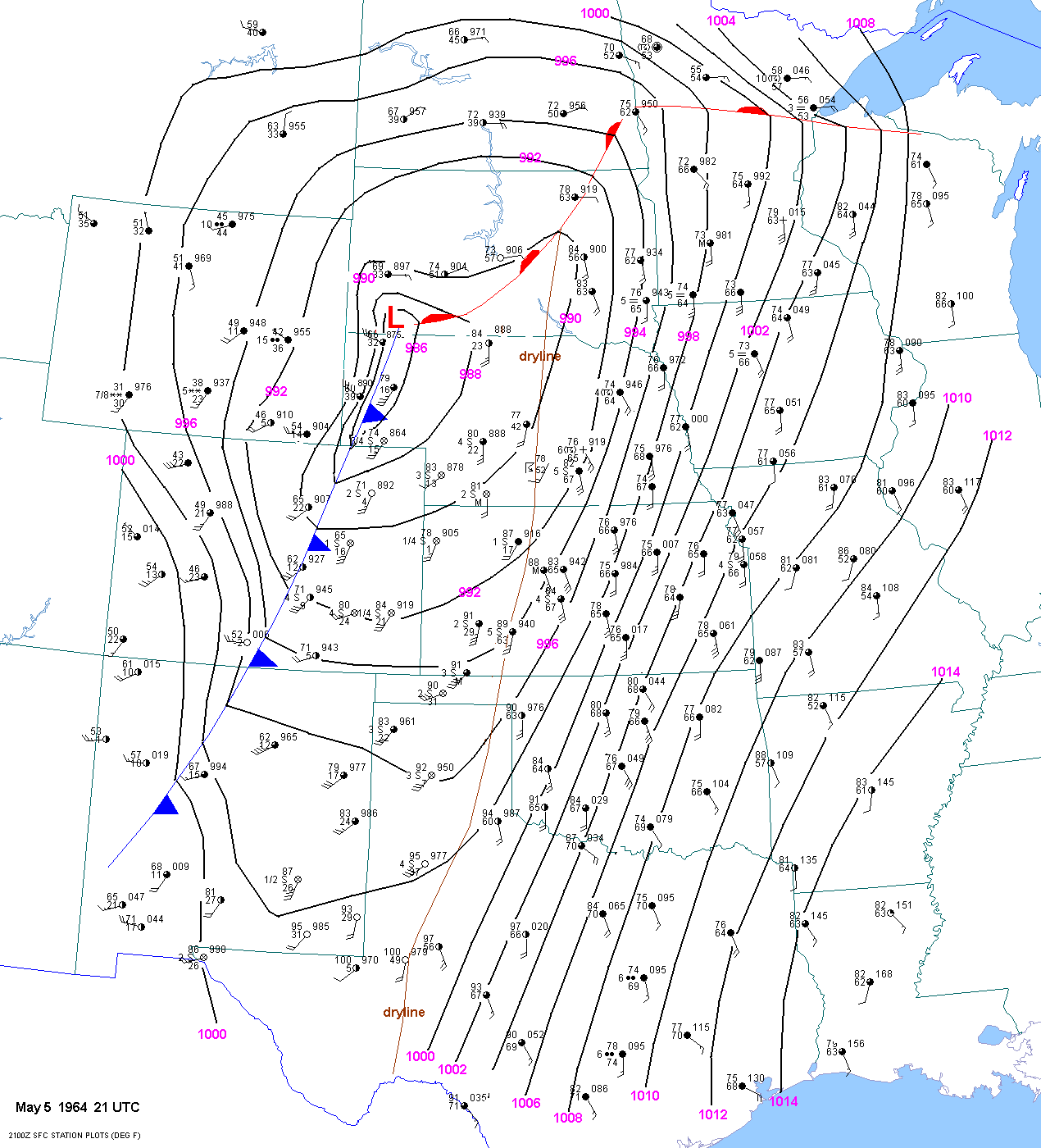
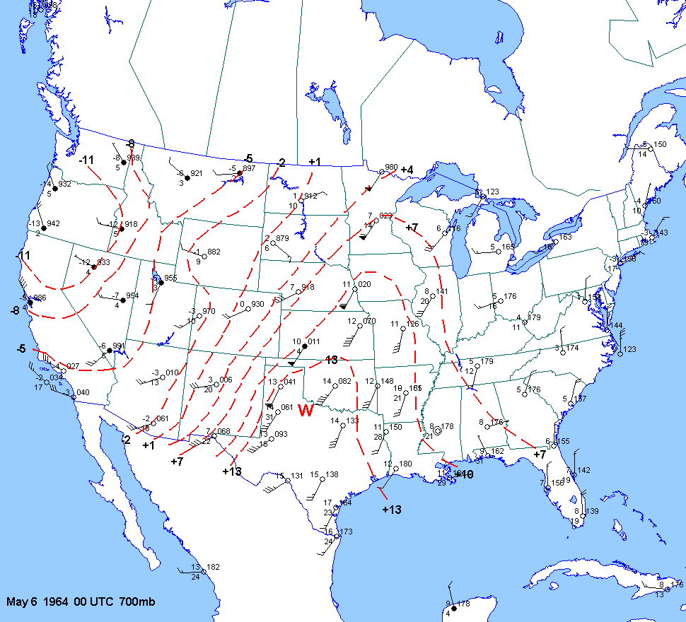
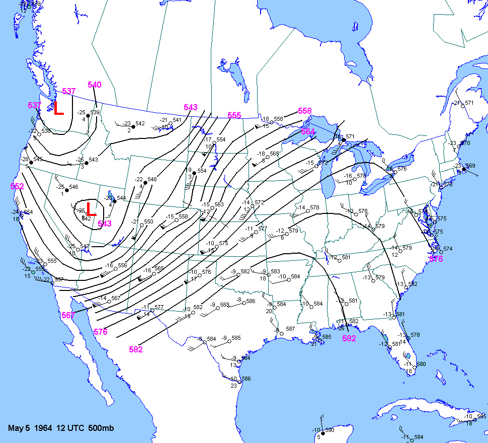
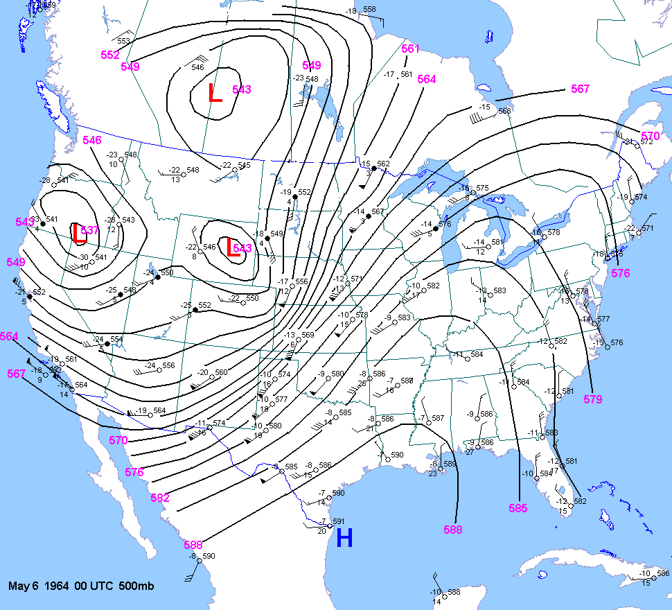
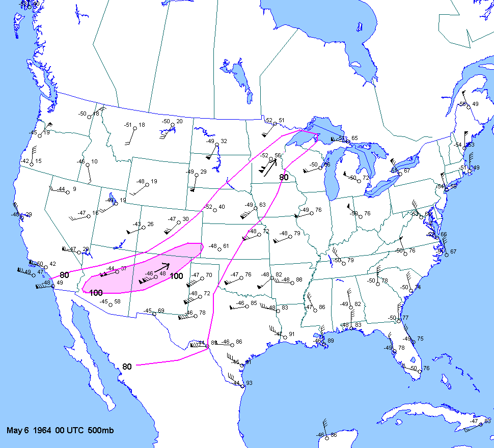
| 05-05-64 | 21Z | -11 | X | 00Z | 12Z 05 00Z 06 | 00Z | X | MN to OK | X | X |
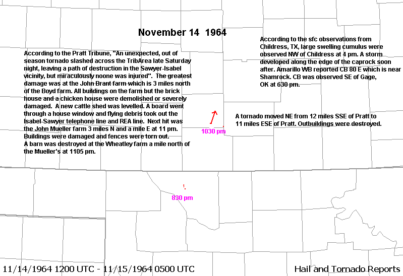
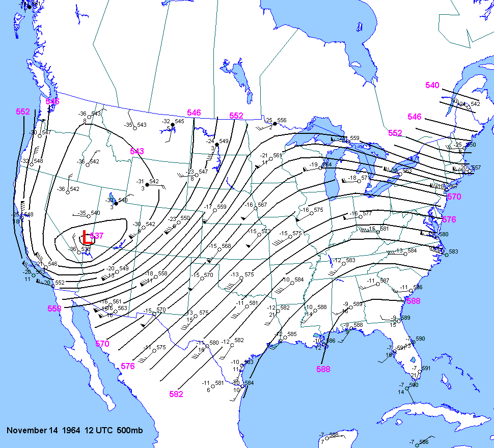
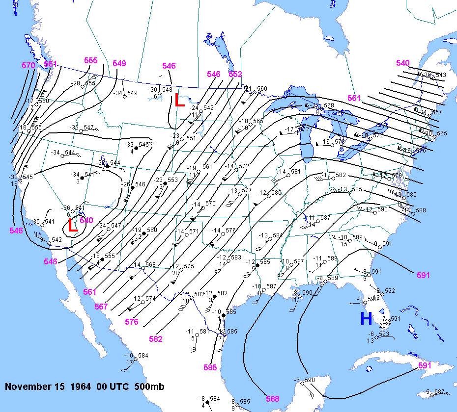
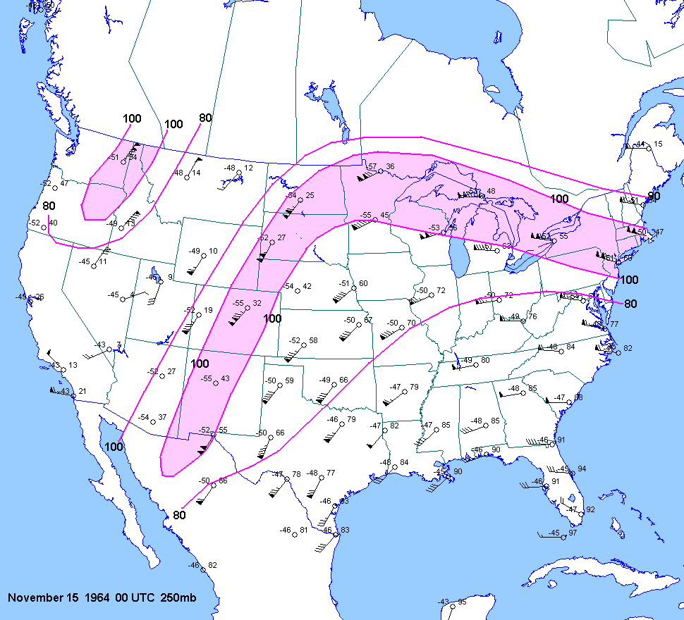
| 11-14-64 | 22Z | -6 to -7 | X | 00Z | 12Z 15 00Z 15 | 00Z | X | KS OK | X | X |
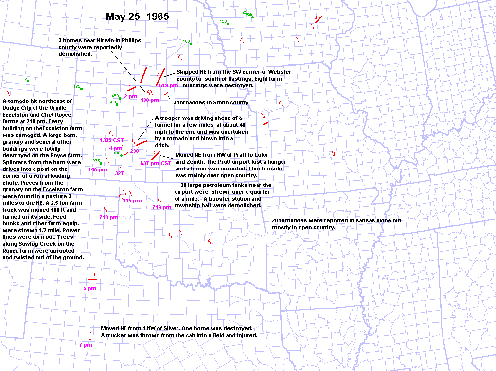
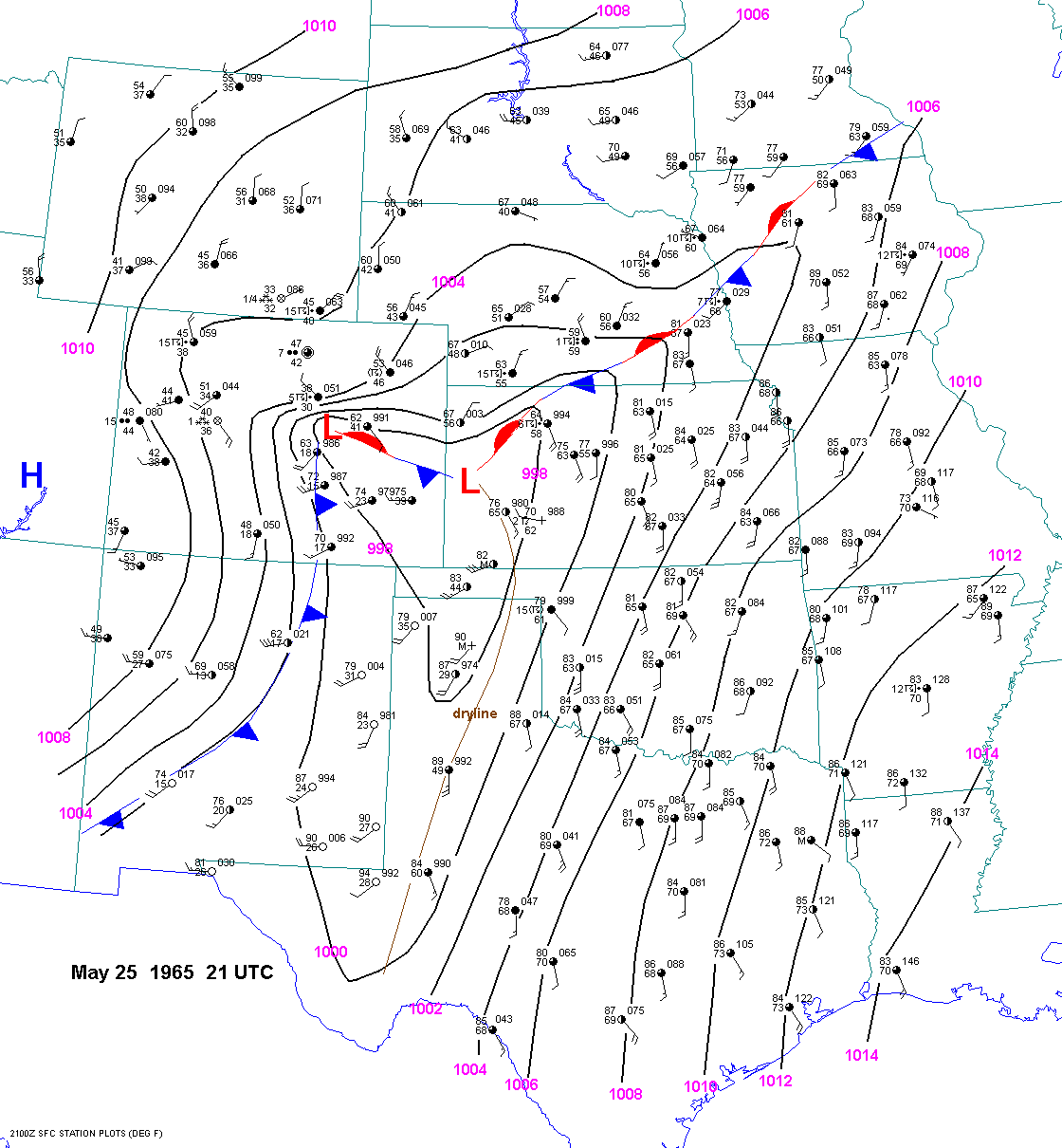
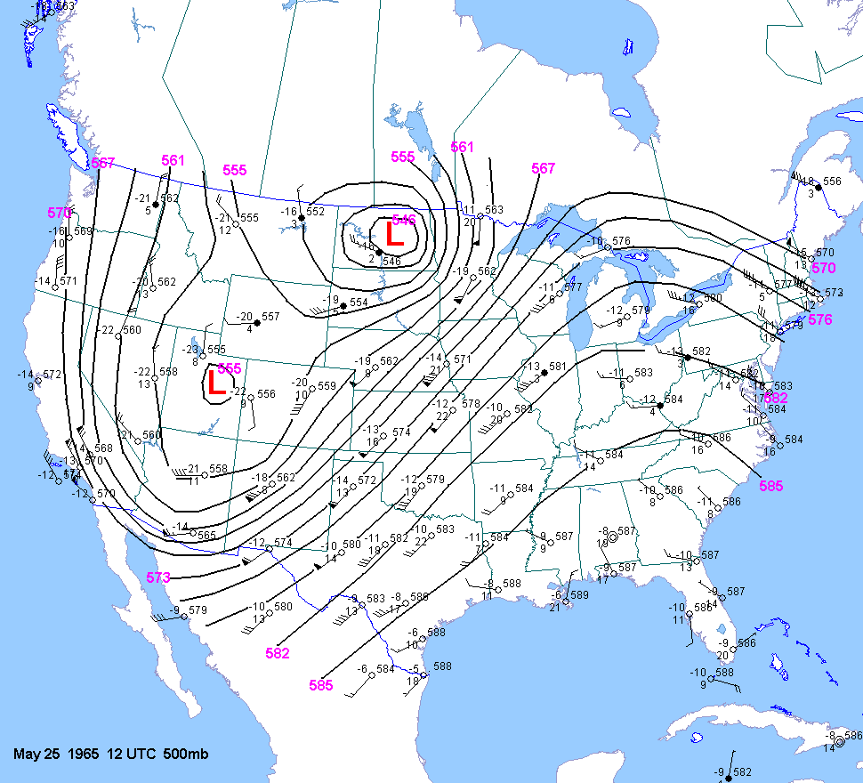
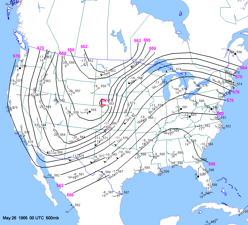
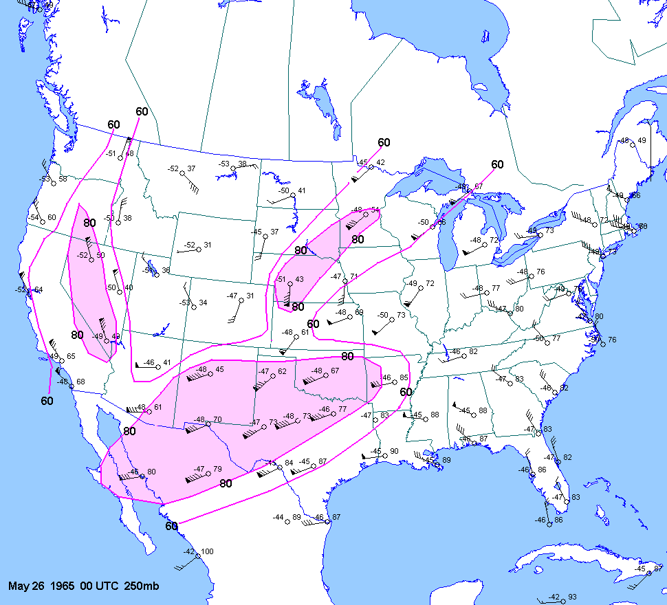
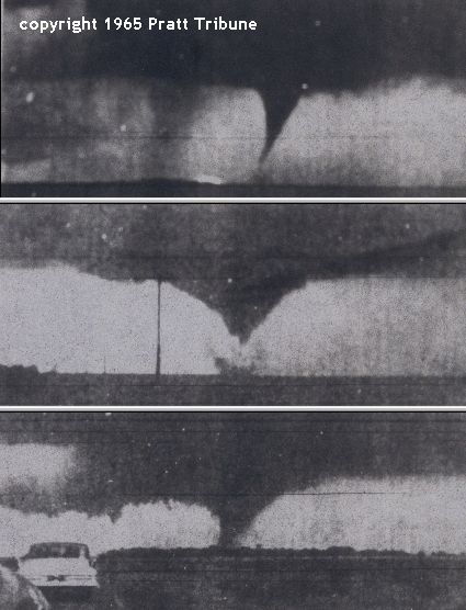
| 05-25-65 | 21Z | -7 to -8 | X | 00Z | 12Z 00Z | 00Z | X | OK TX NE KS | PrattTOR | X |
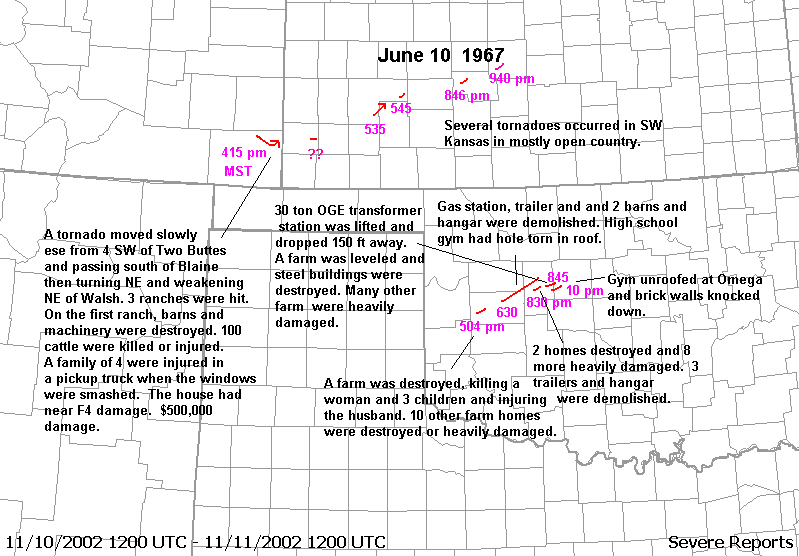
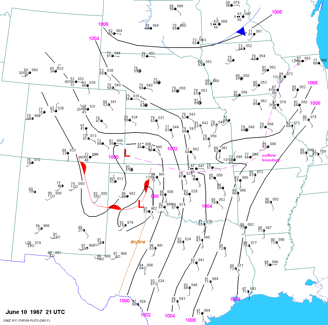
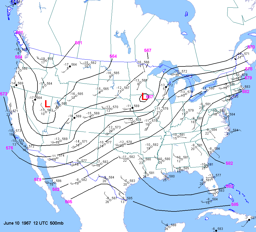
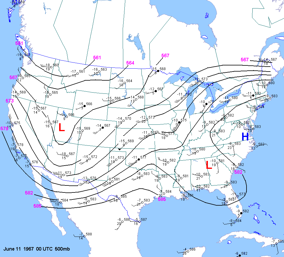
| 06-10-67 | 21Z | X | 00Z | 12Z 00Z | 00Z | X | OK CO KS | X | X | |
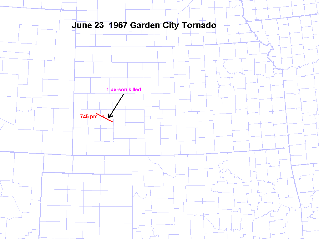
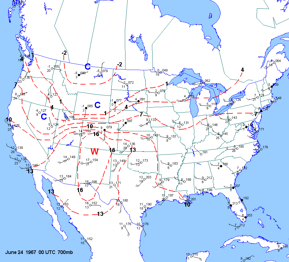
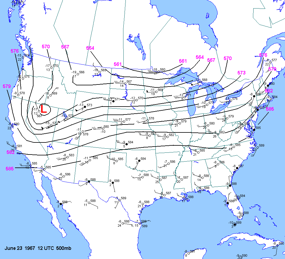
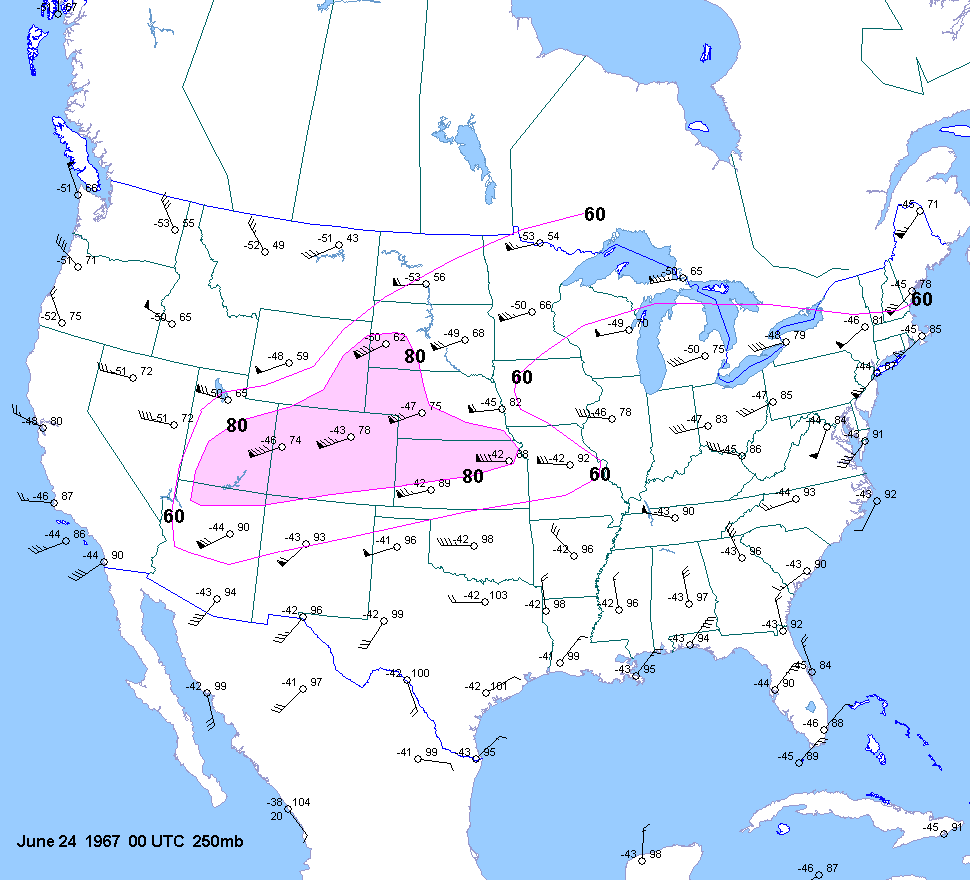
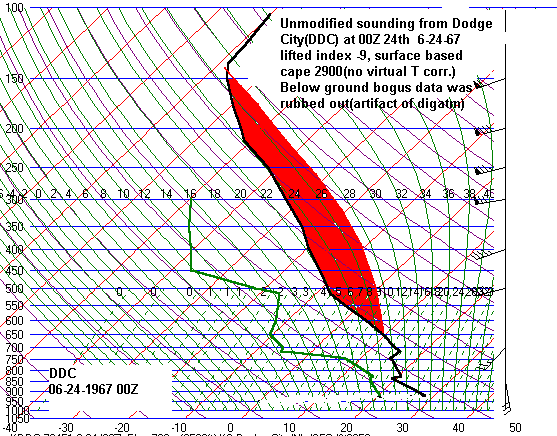
| 06-23-67 | 22Z | -8 to -11 | X | 00Z | 12Z 23 00Z 24 |
00Z | 00Z | KS | X | X |
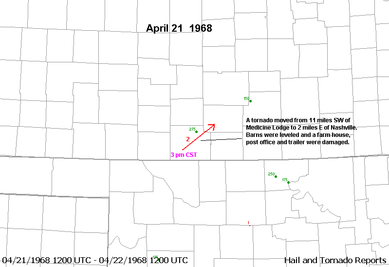
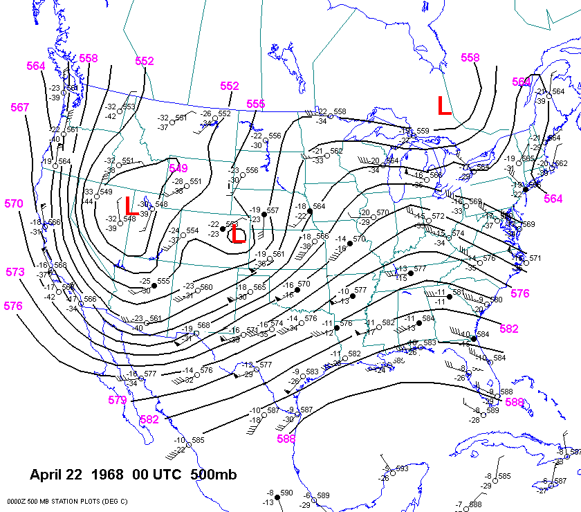
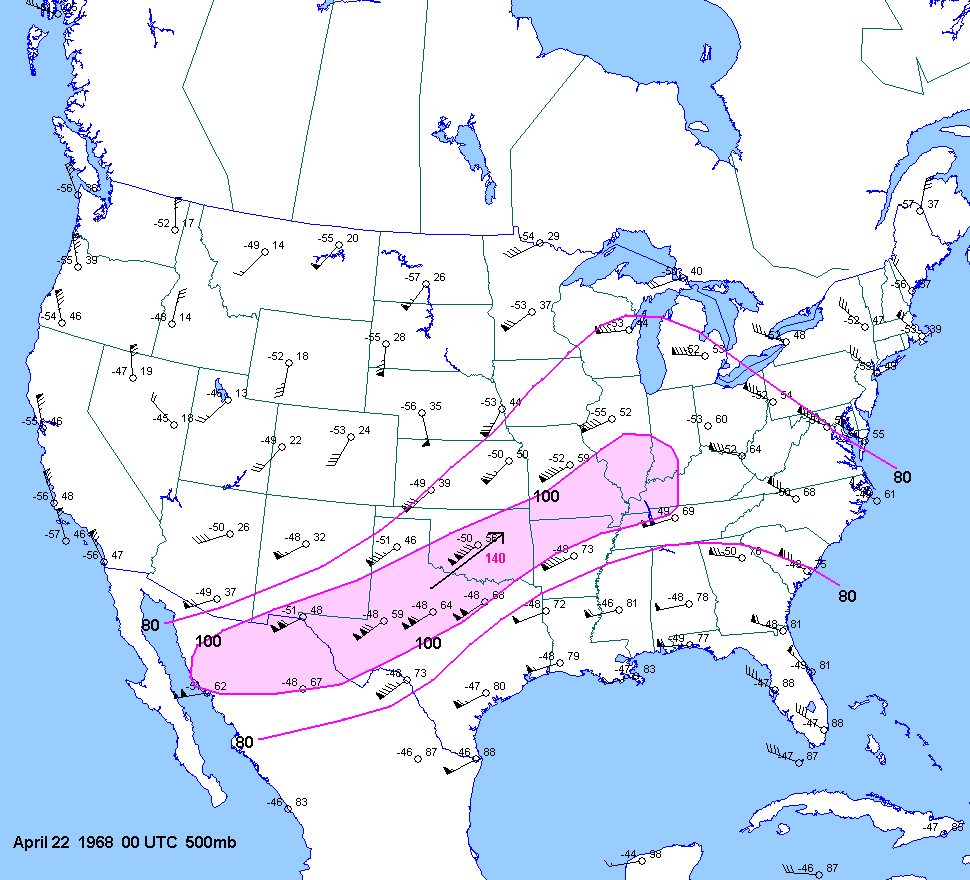
| 04-21-68 | 20Z | -7 | X | 00Z | 12Z 00Z | 00Z | X | KS OK | X | X |
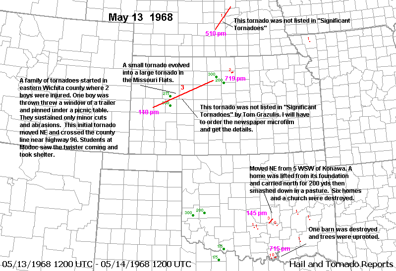
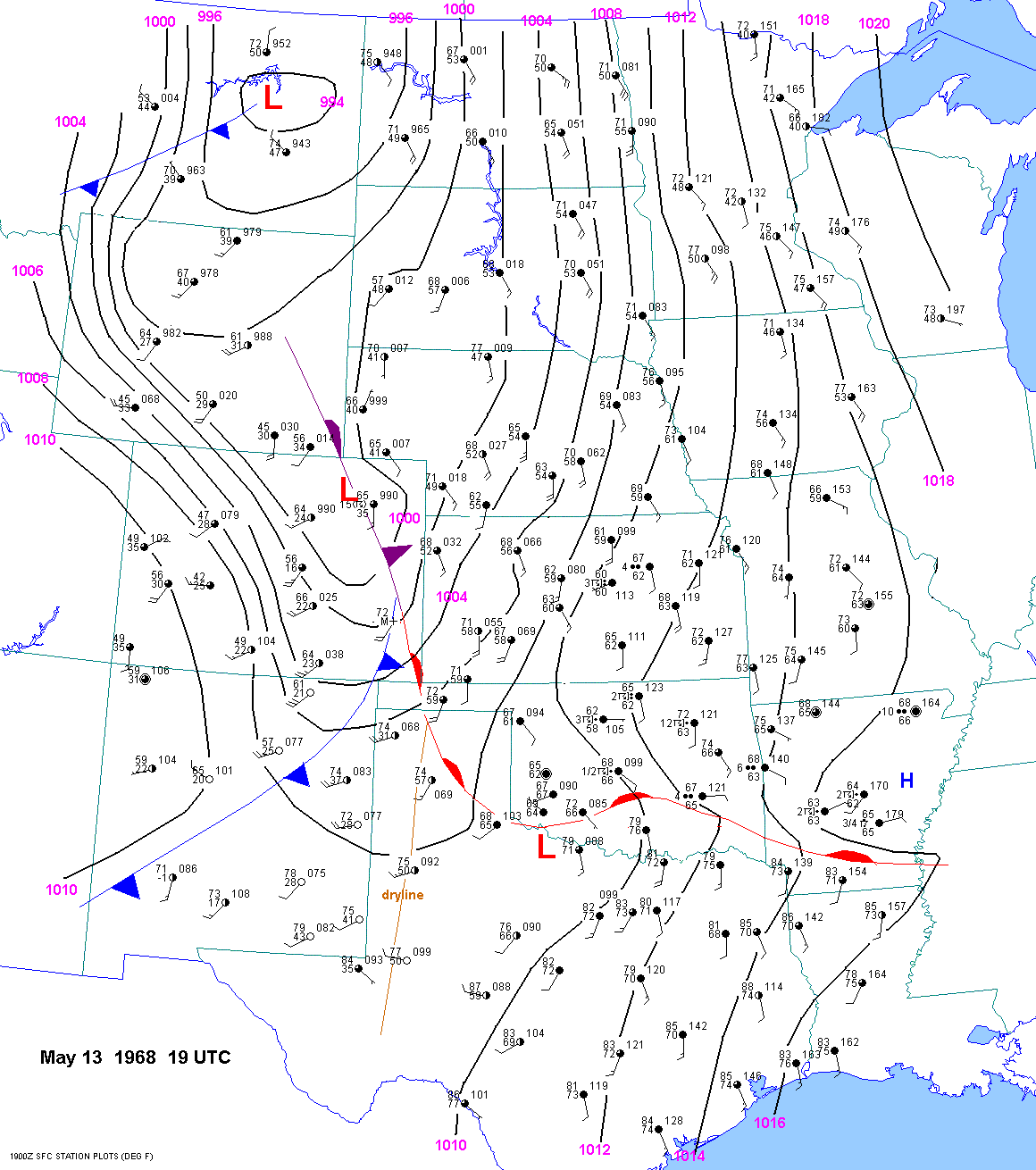
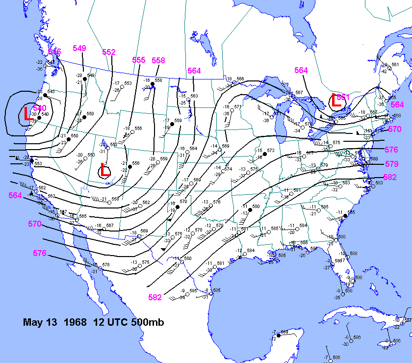
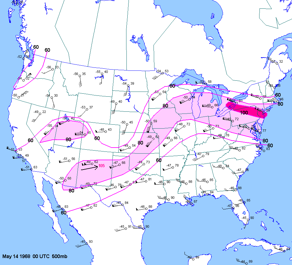
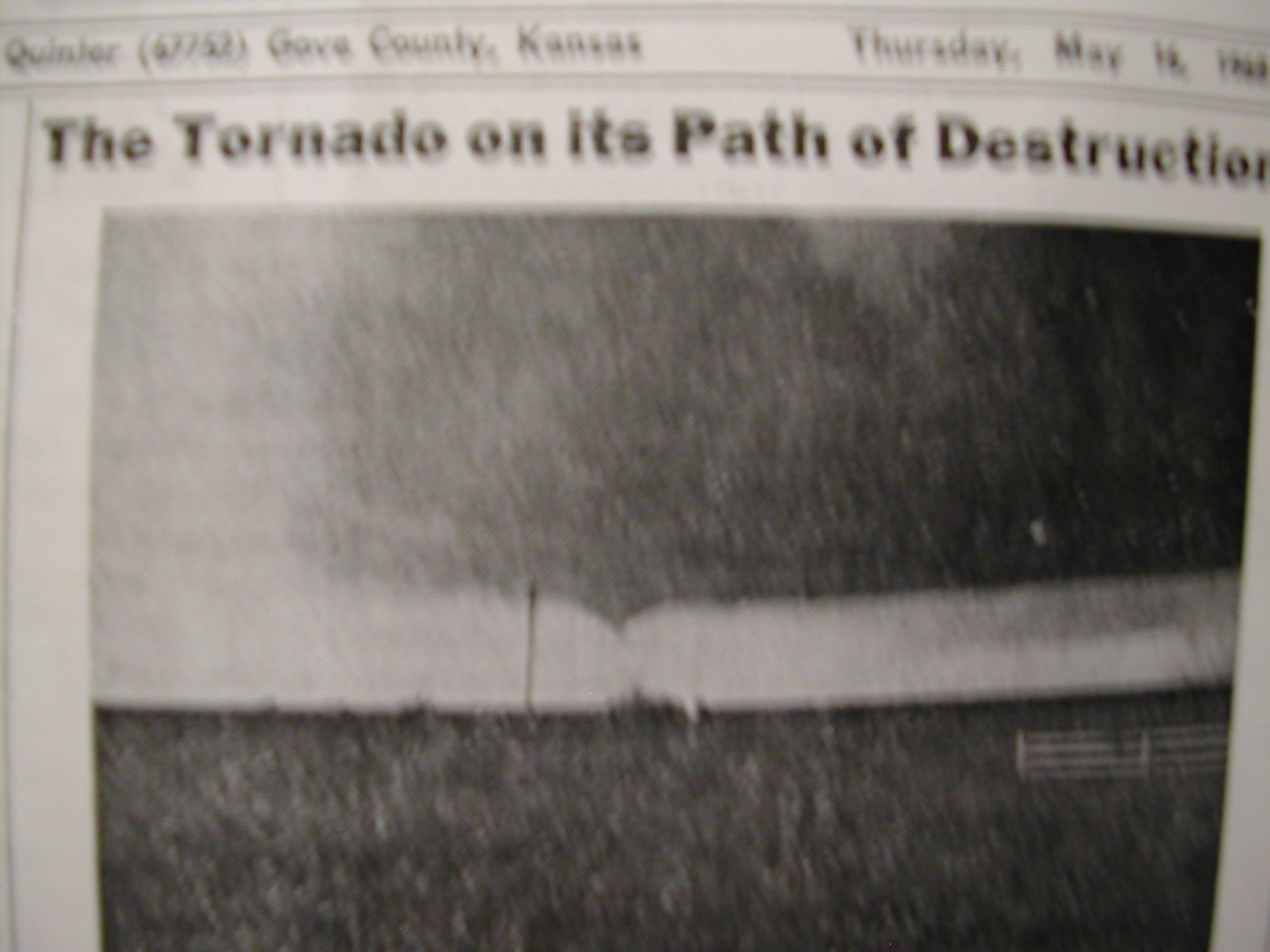
| 05-13-68 | 19Z | -10 | X | 00Z | 12Z 00Z | 00Z | X | KS OK NE | Gov1 Gov2 | X |
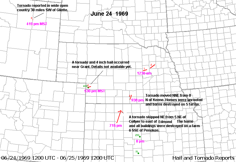
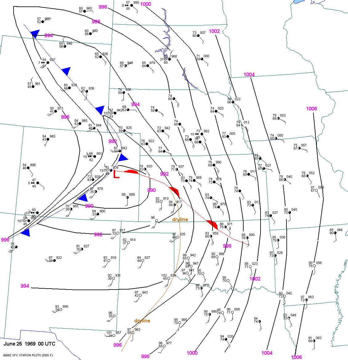
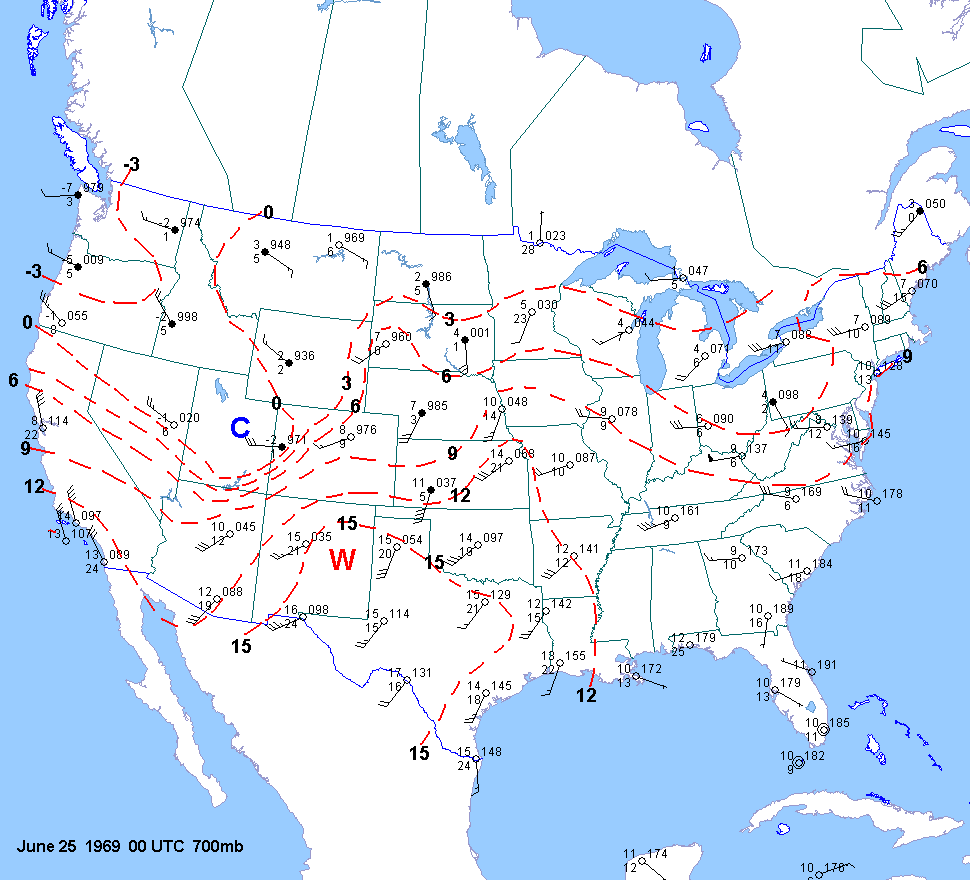
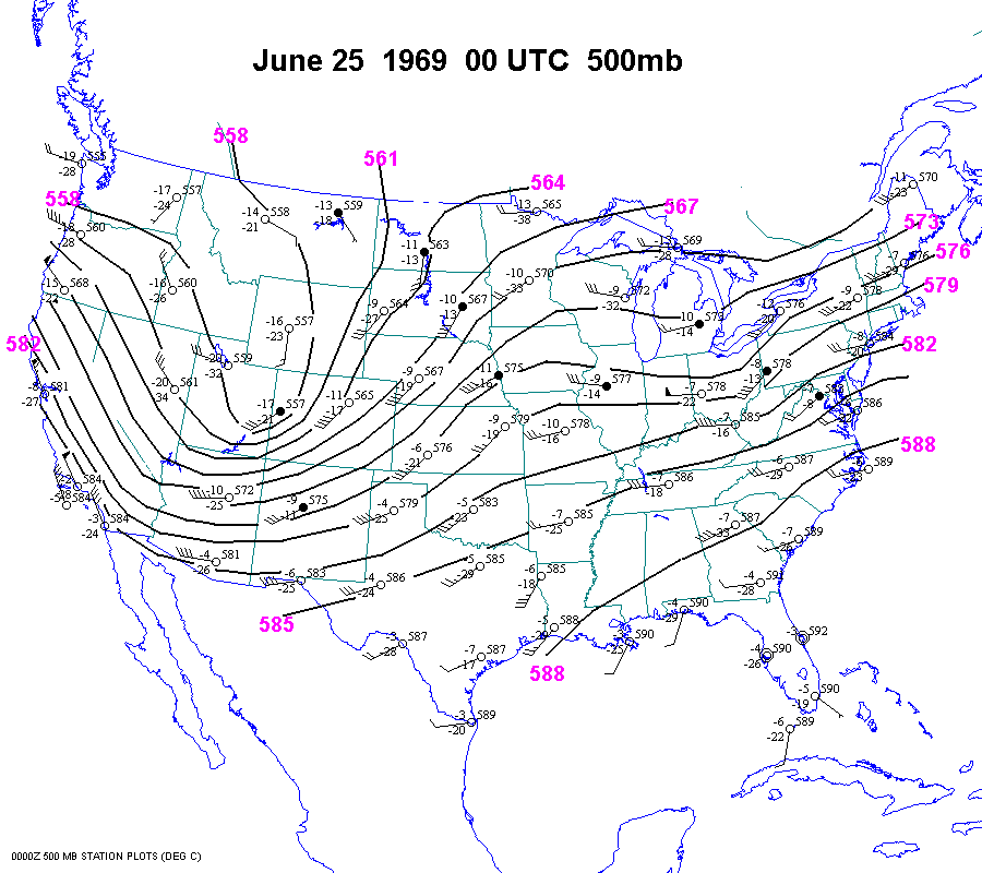
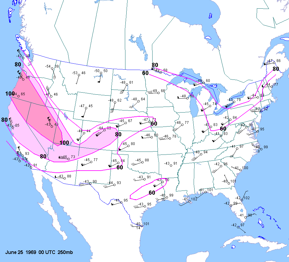
| 06-24-69 | 00Z | 00Z | 12Z 00Z | 00Z | NE KS WY | |||||
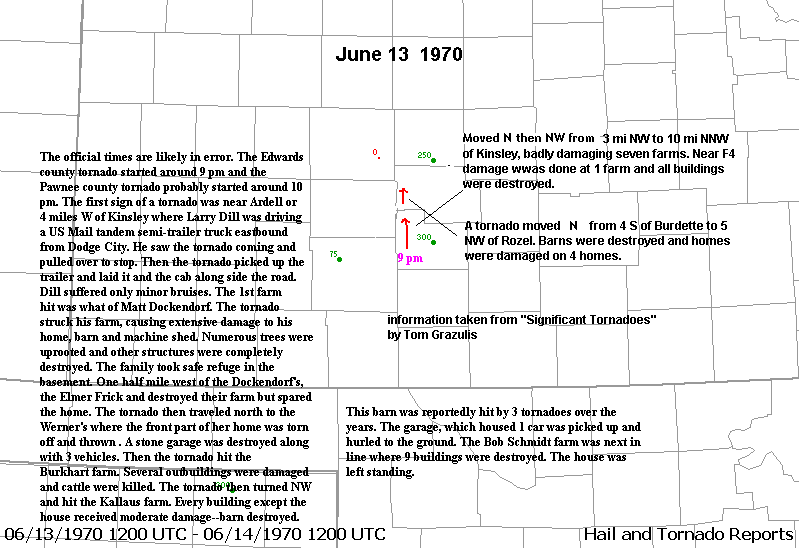
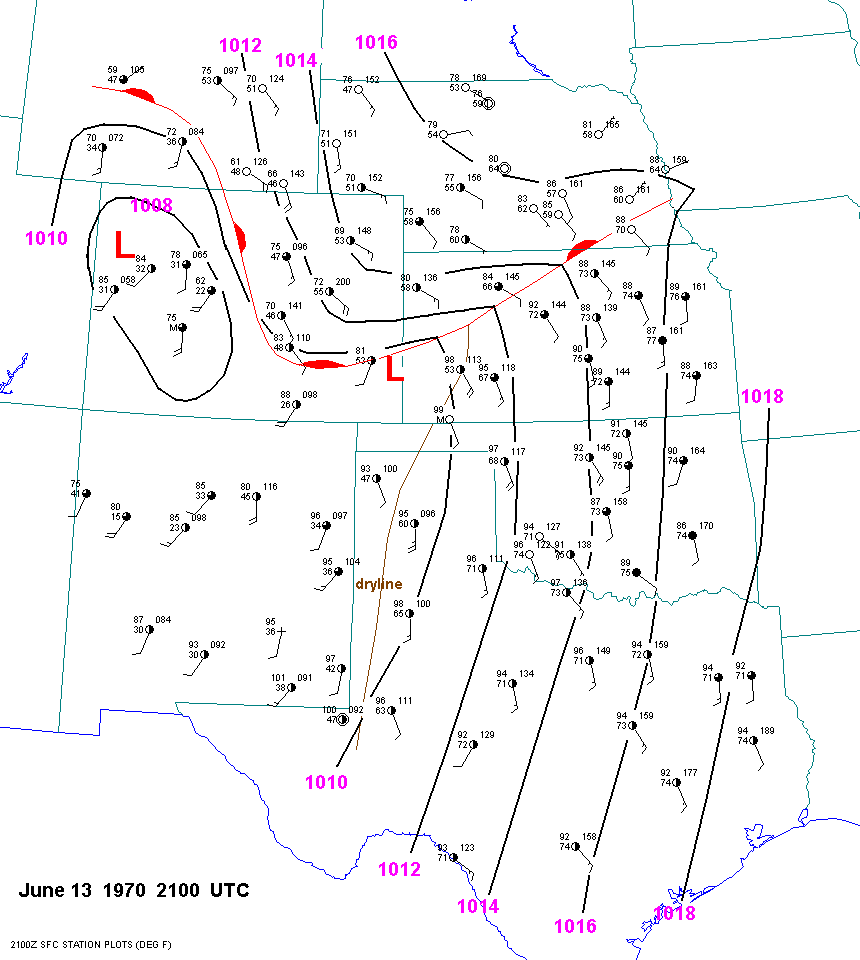
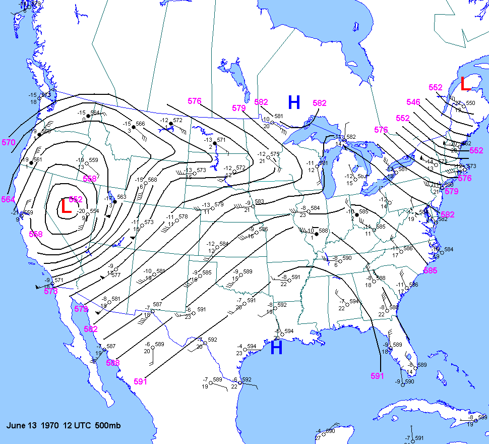
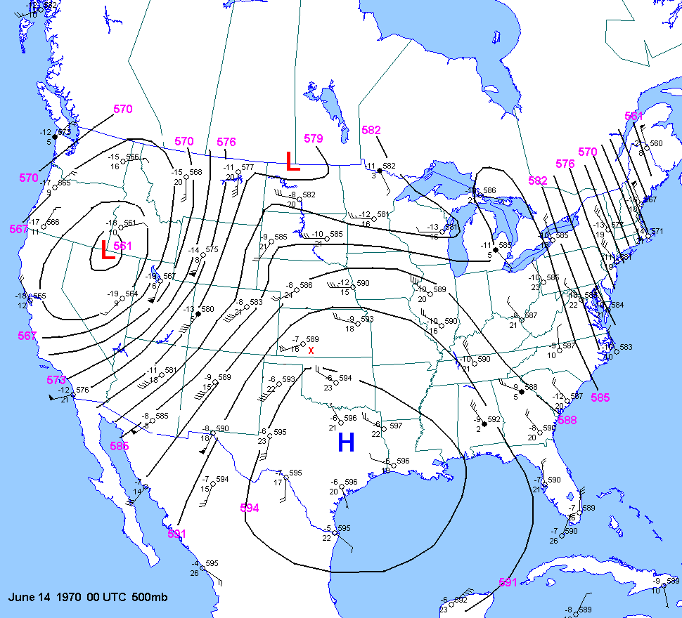
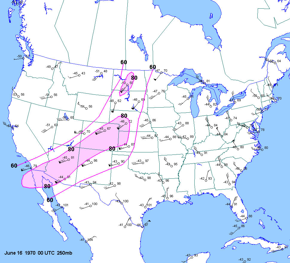
| 06-13-70 | 21Z | -10 | X | 0Z | 12Z 0Z 14 | 00Z | X | KS | X | X |
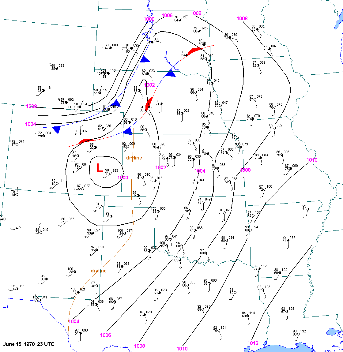
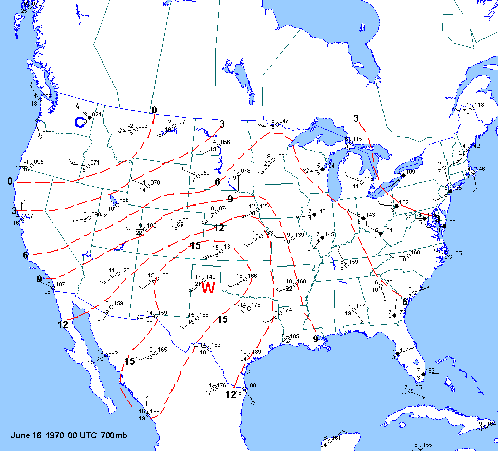
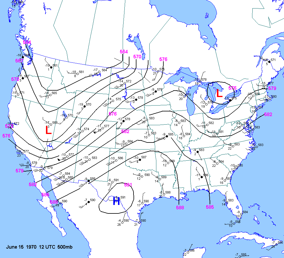
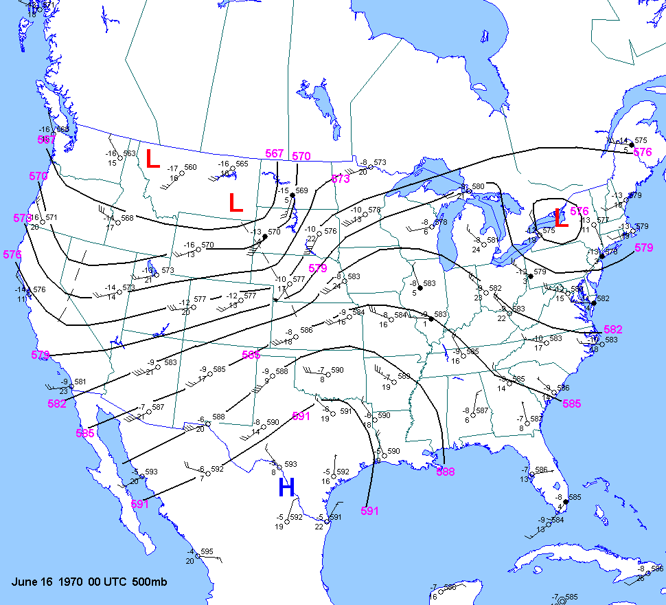
| 06-15-70 | 23Z | 0Z | 12Z 00Z | 0Z | KS SD | |||||
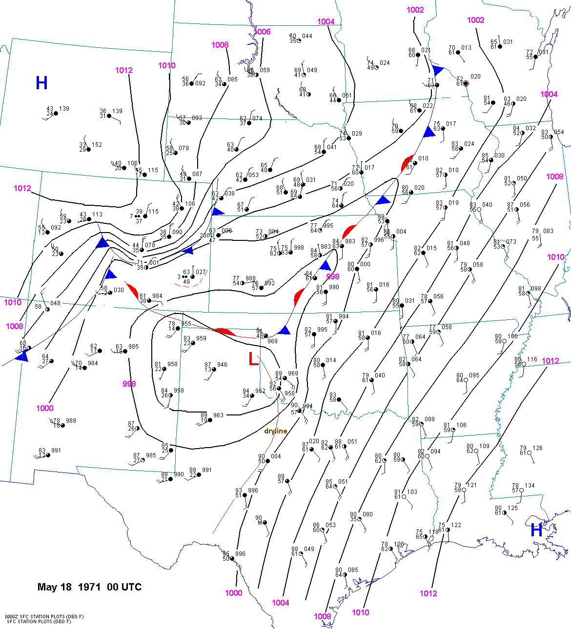
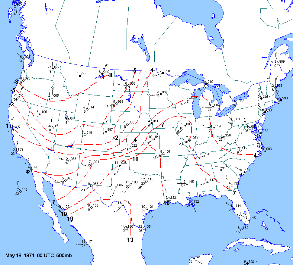
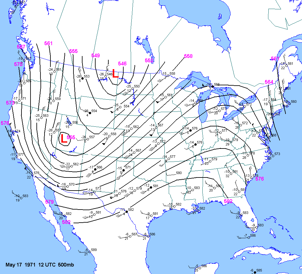
| 05-17-71 | 18Z 0Z | -8 to -9 | X | 00Z | 12Z 00Z | 00Z | X | KS | X | X |
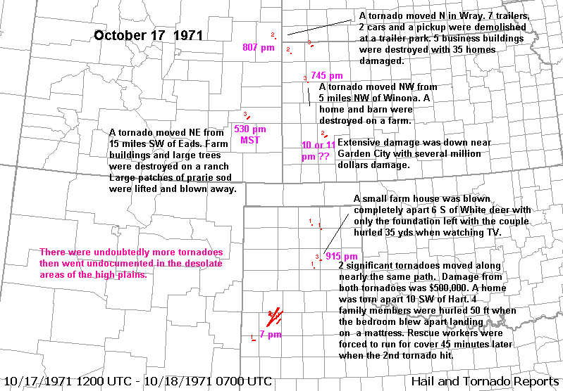
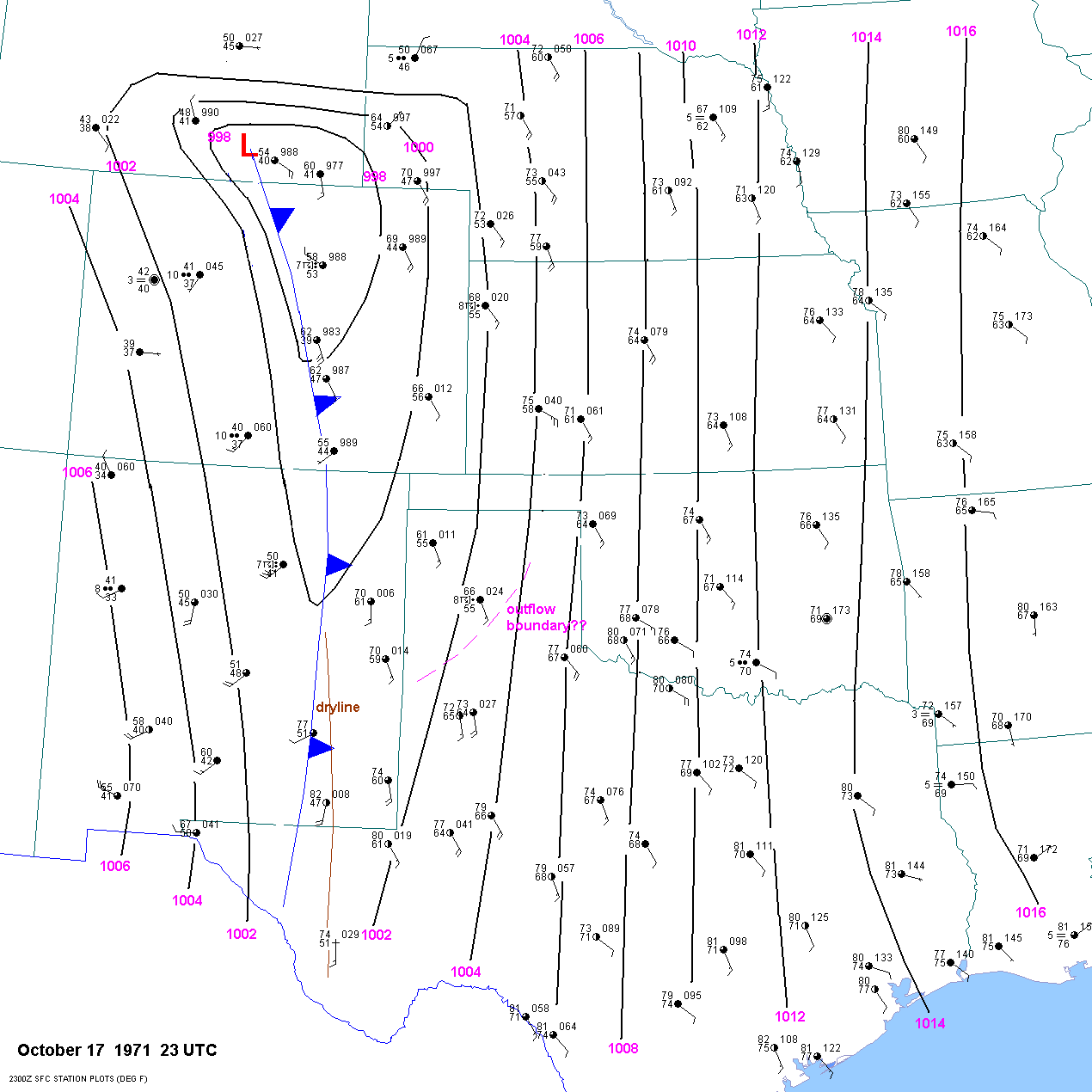
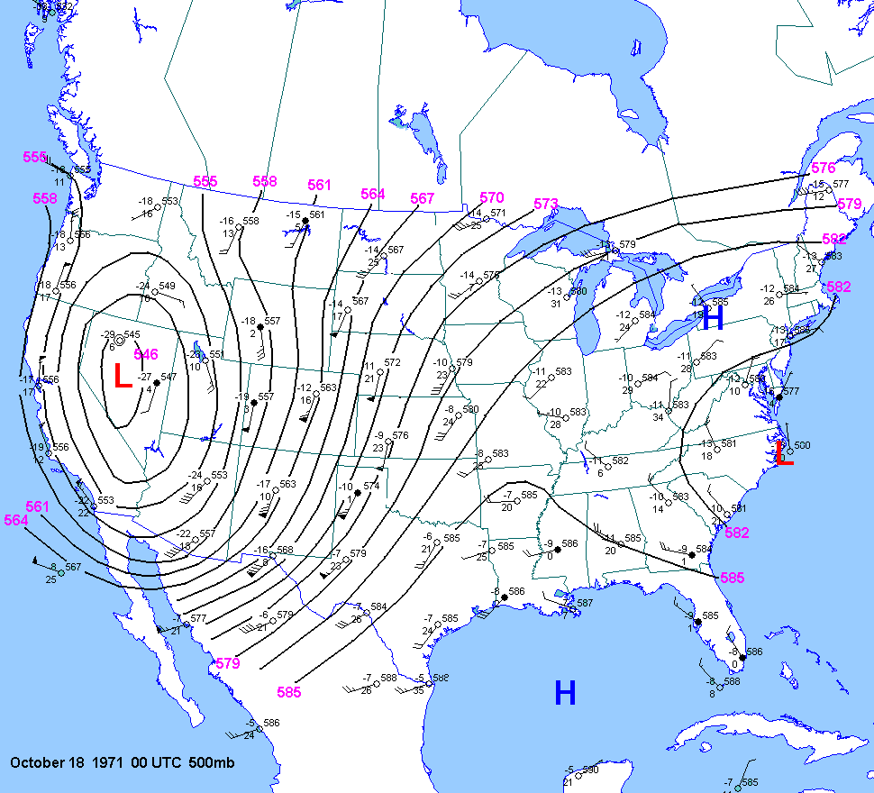
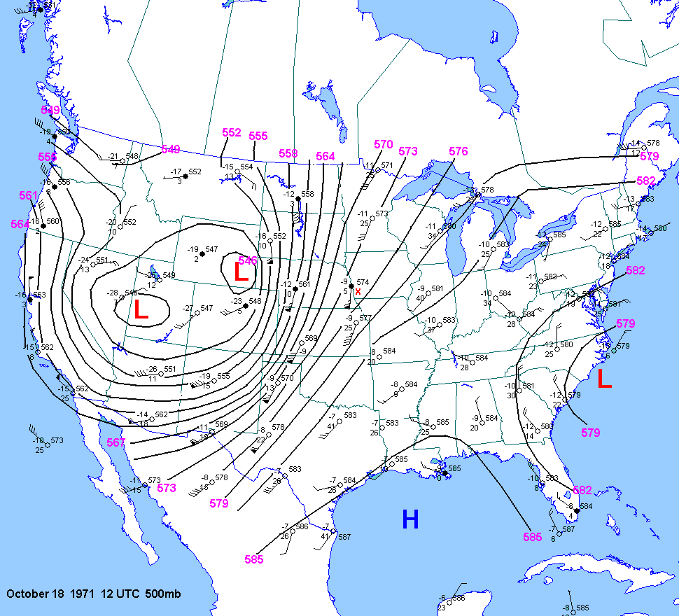
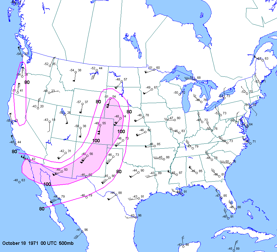
| 10-17-71 | 23Z | X | 00Z | 12Z 00Z 12Z |
00Z | X | TX CO KS | X | X | |
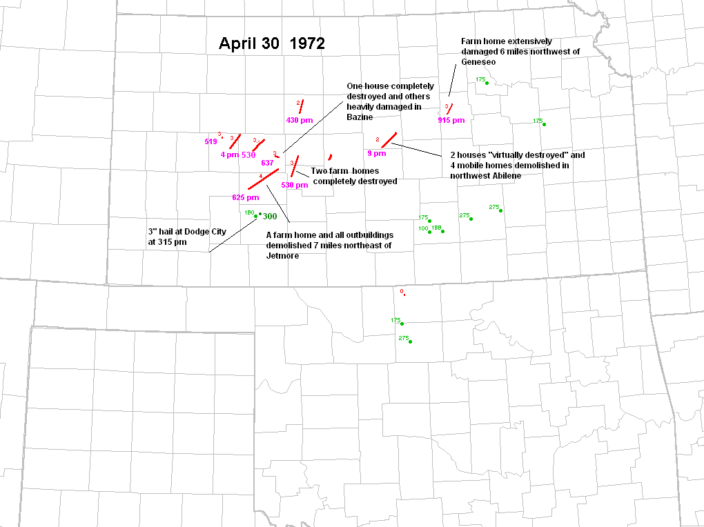
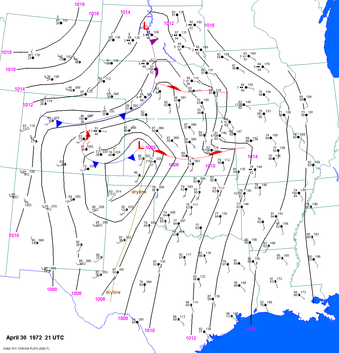
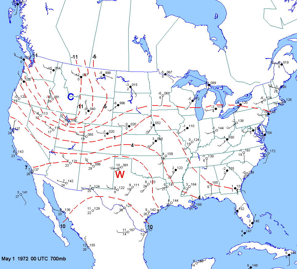
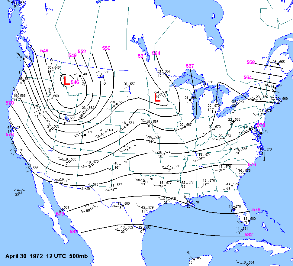
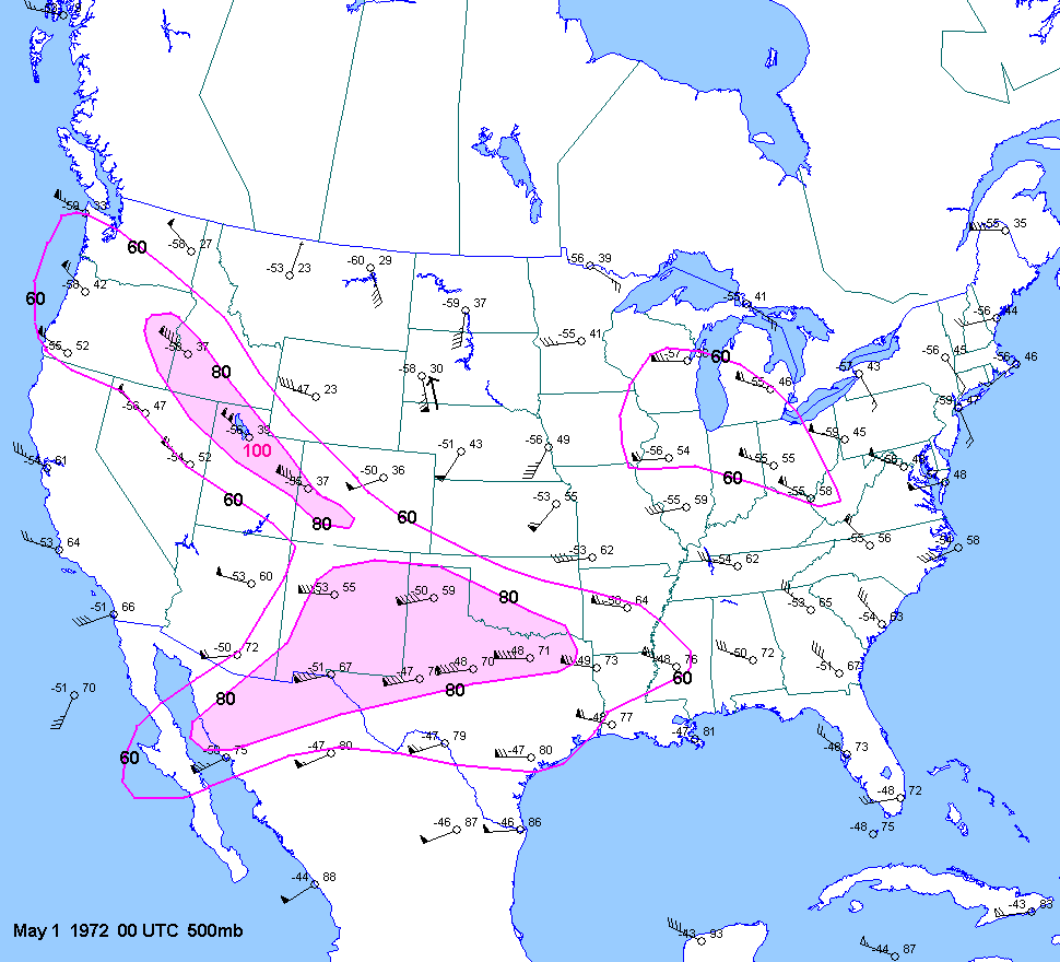
| 04-30-72 | 21Z | -10 to -12 | X | 00Z | 12Z 00Z 01 |
00Z | X | KS | X | X |
| 05-09-72 | ||||||||||
| 05-22-72 | ||||||||||
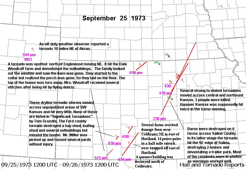
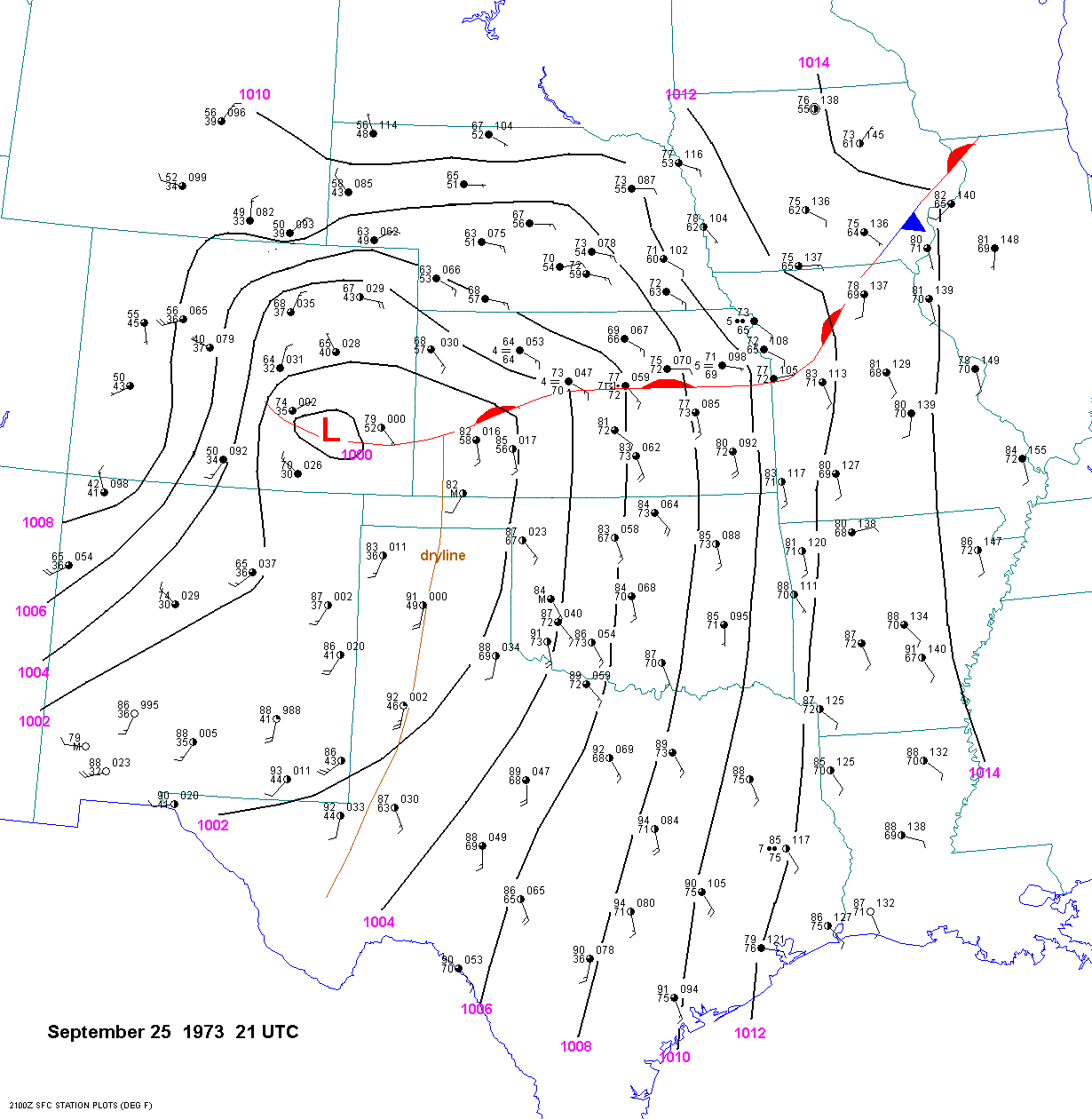
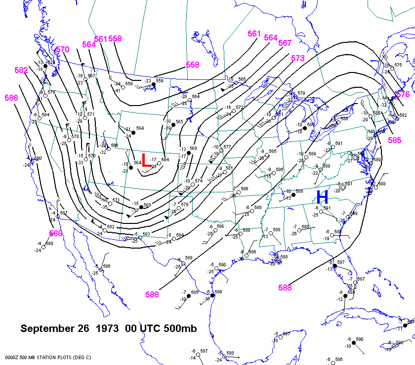
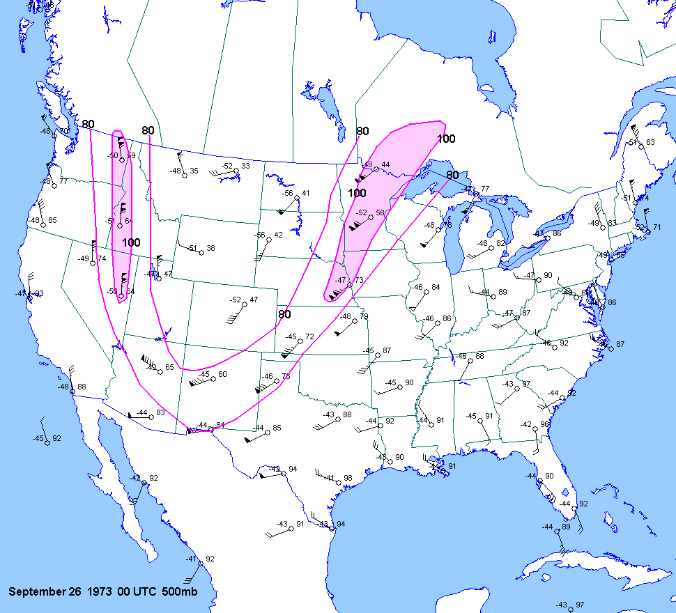
| 09-25-73 | 21Z | -10 | X | 00Z | 00Z 26 | 00Z | X | KS NE | X | X |
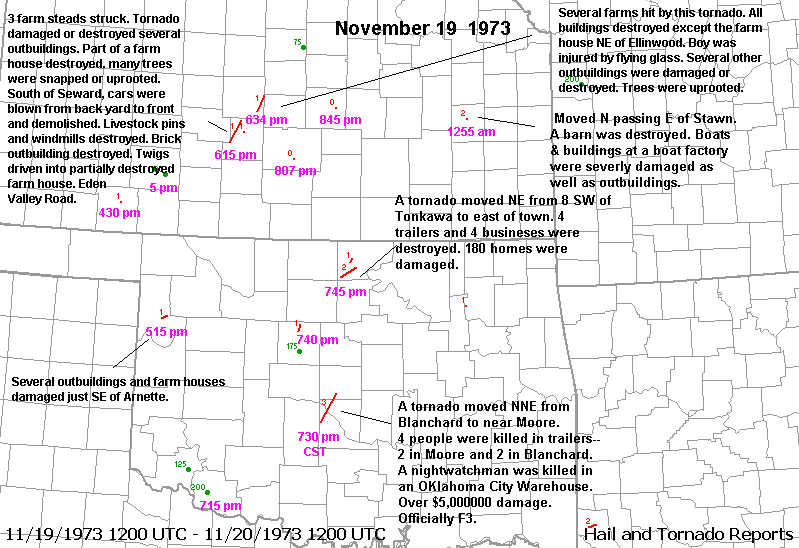
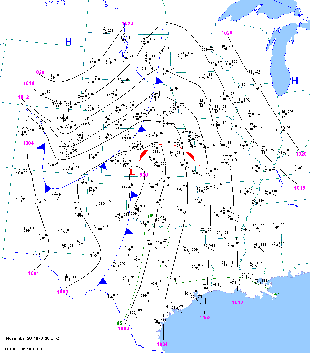
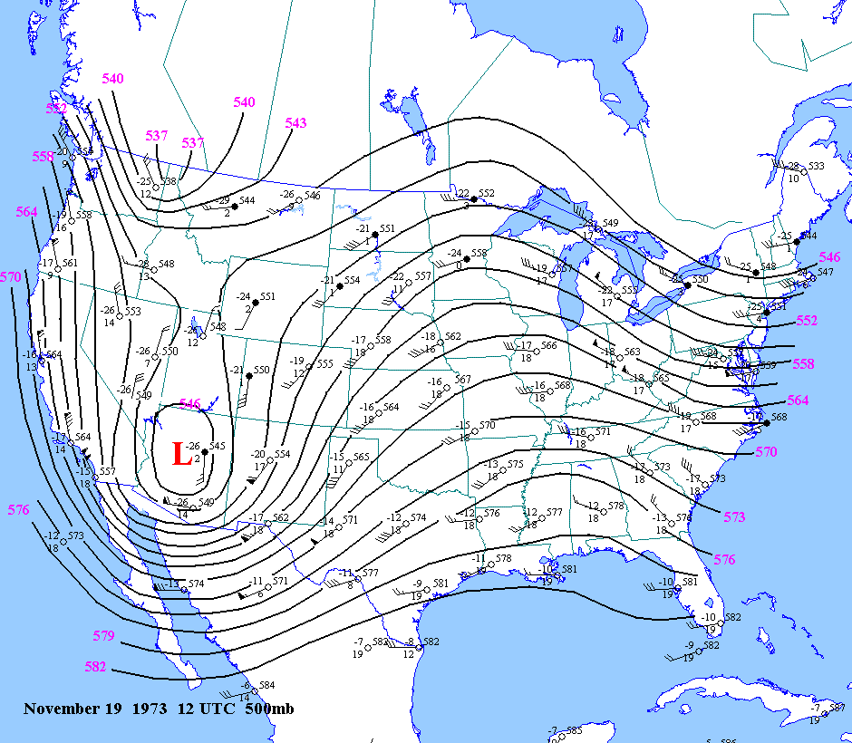
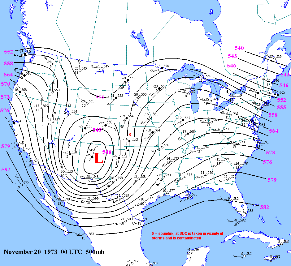
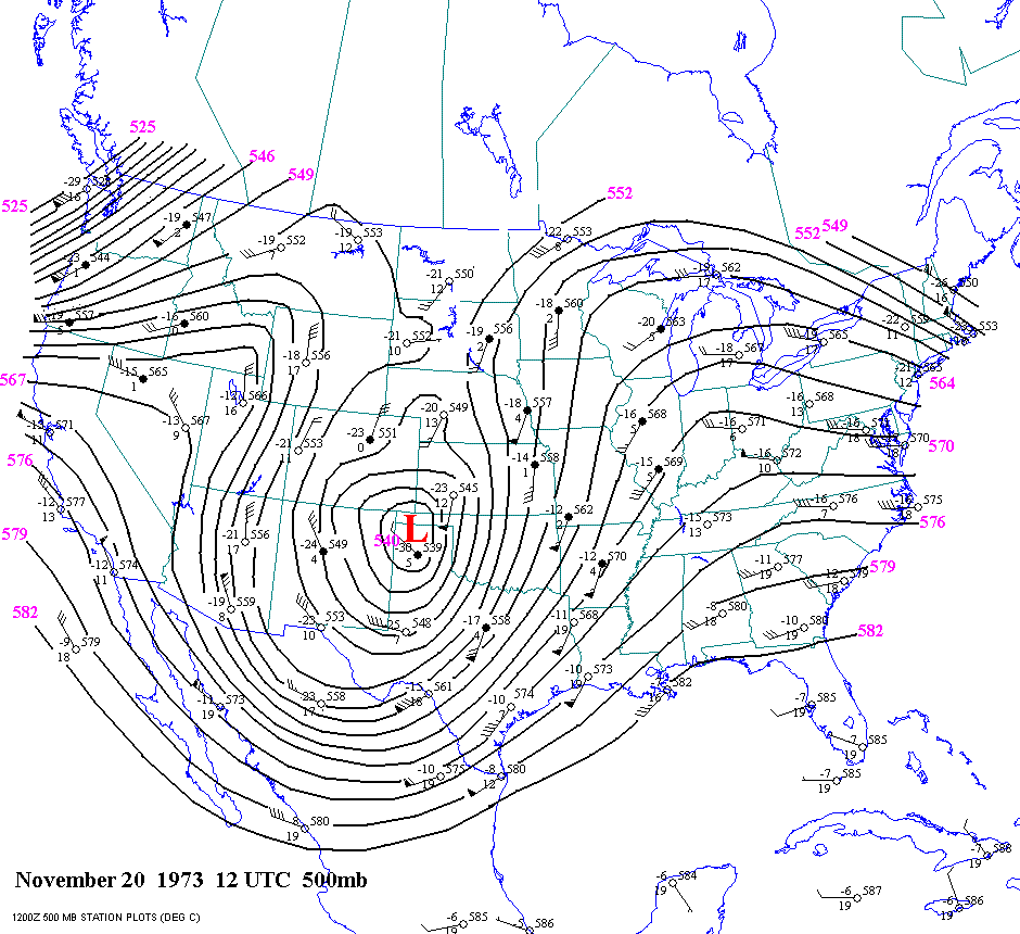
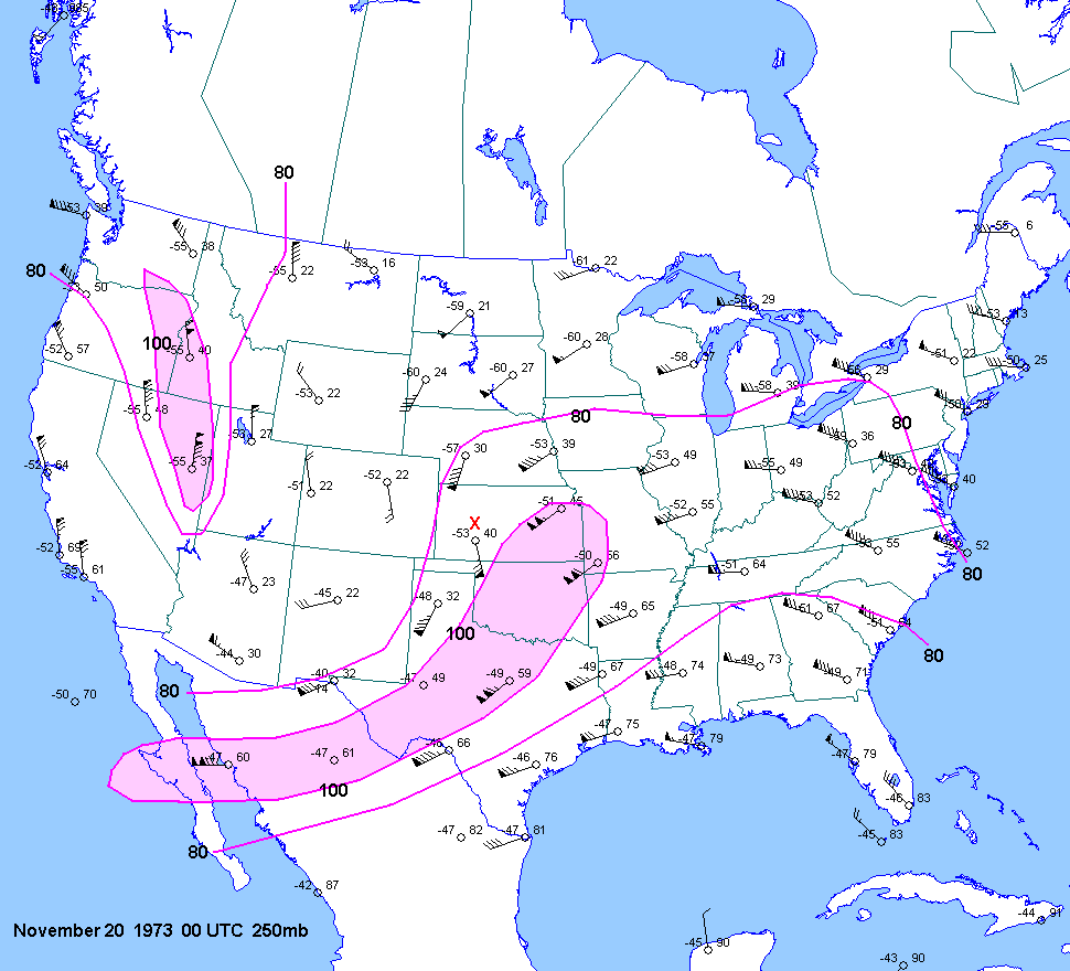
| 11-19-73 | 00Z 20 | -9 | X | 0Z | 12Z 0Z 12Z 20 | 00Z | X | KS OK | X | X |
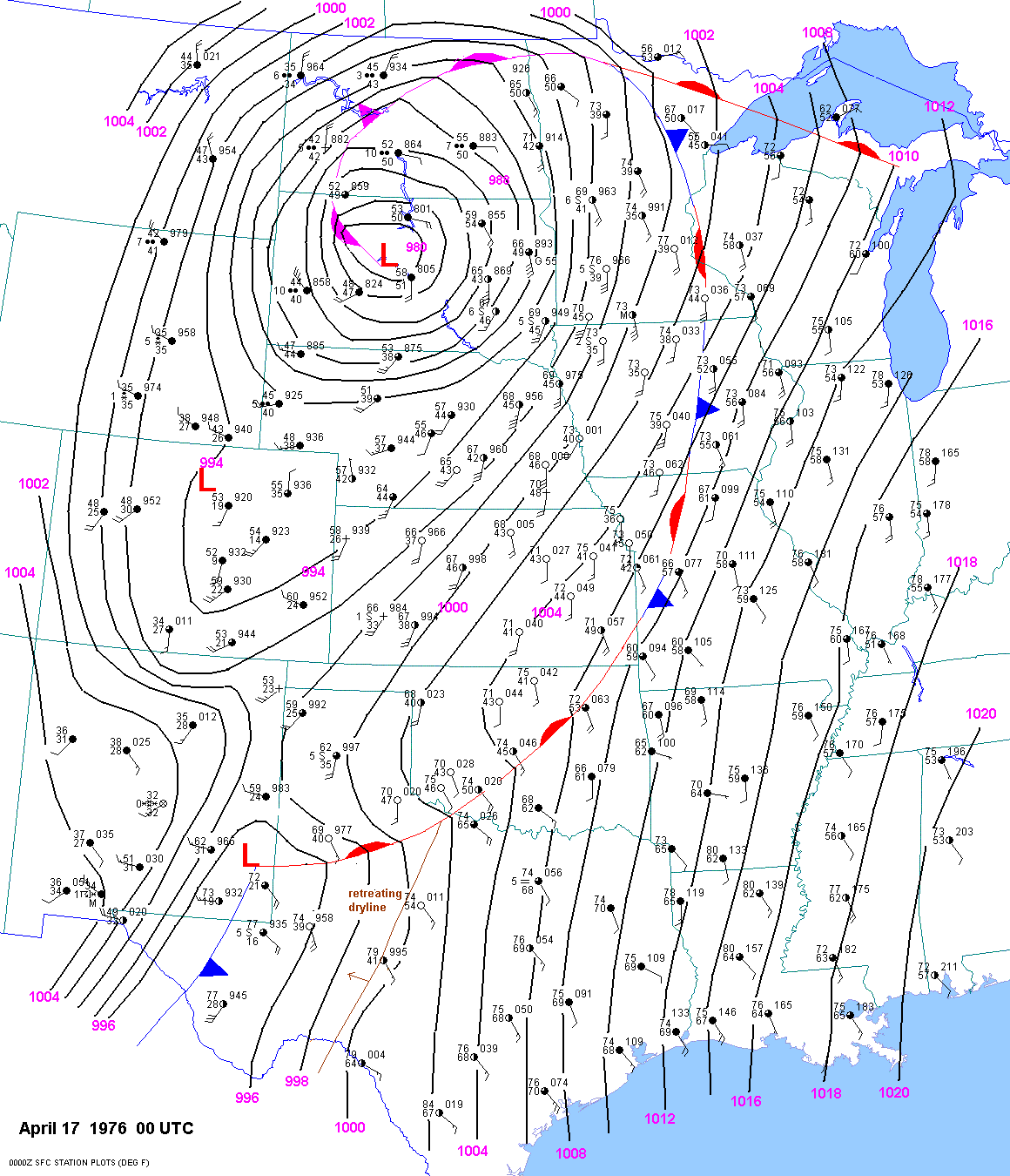
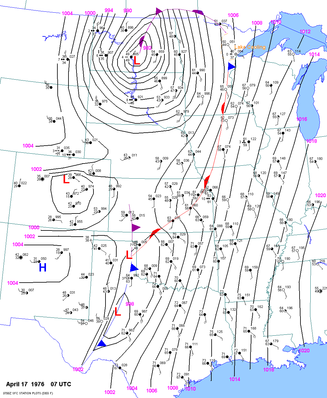
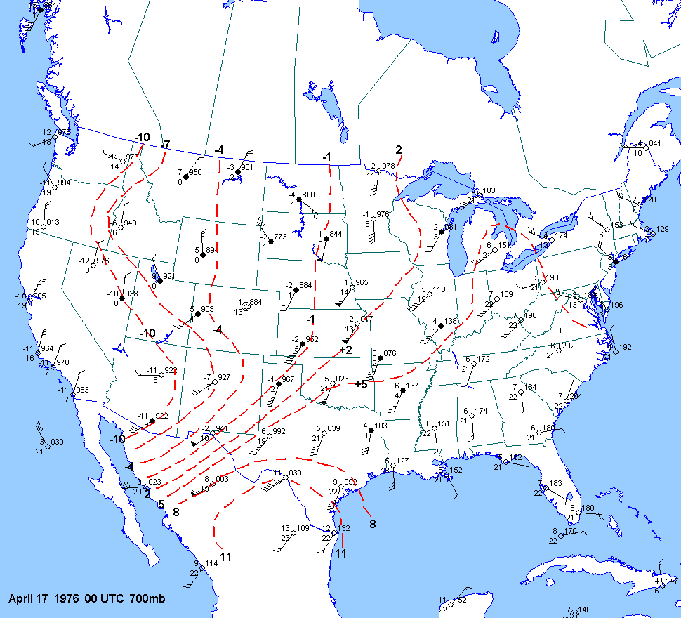
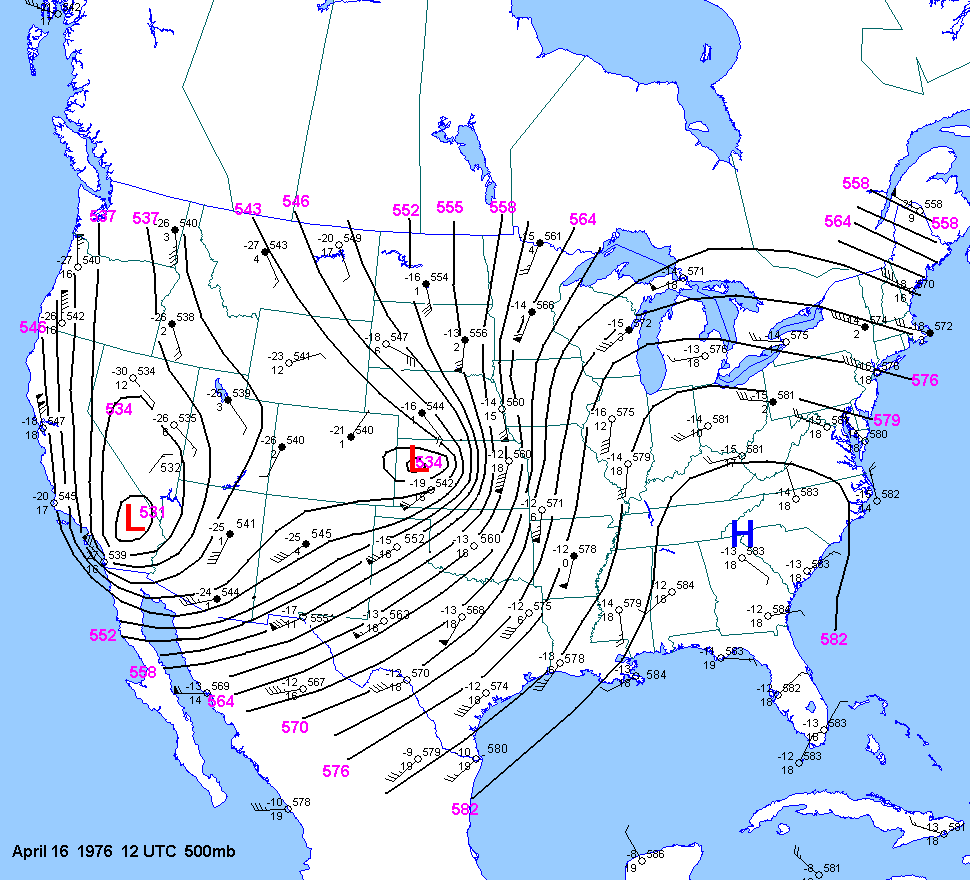
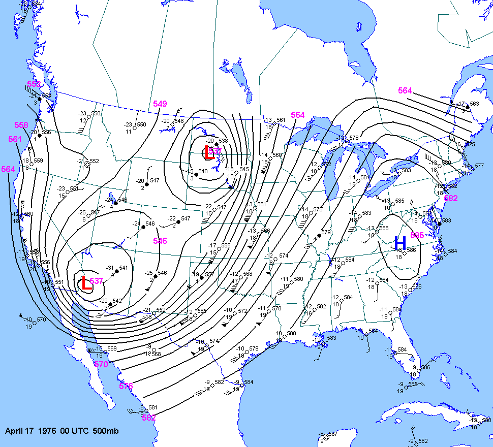
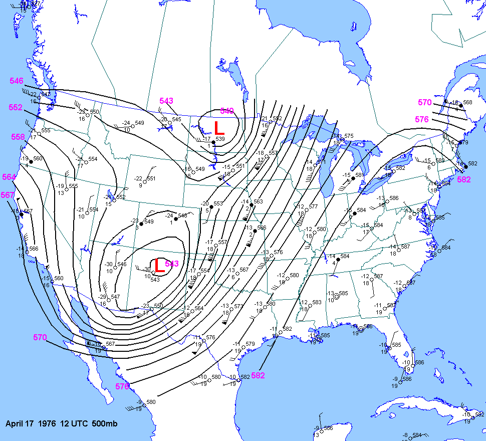
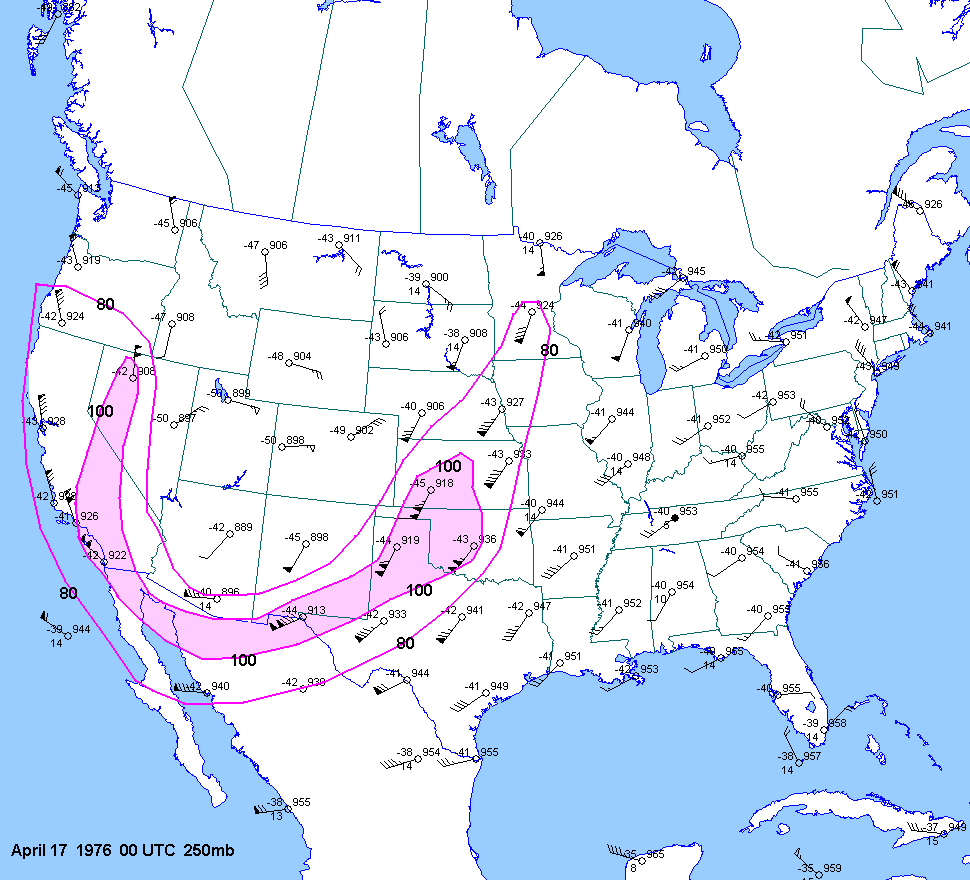
| 04-17-76 | 00Z 07Z | -6 to -7 | X | 00Z | 12Z 00Z 12Z | 00Z | X | KS OK TX | X | X |
| 06-23-76 | ||||||||||
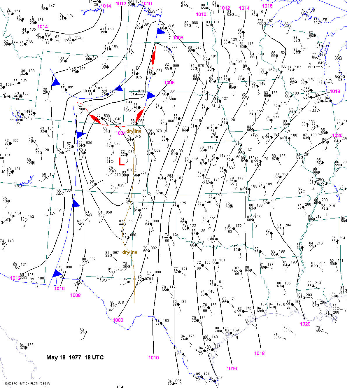
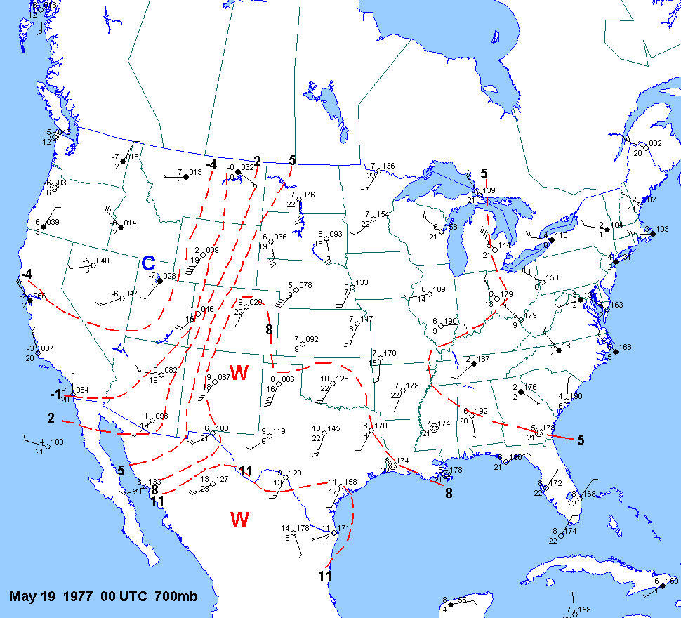
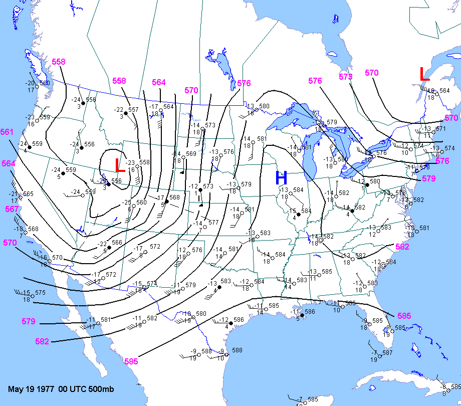
| 05-18-77 | 18Z | -11 to -12 | X | 00Z | 12Z 00Z | 00Z | X | CO OK KS | X | X |
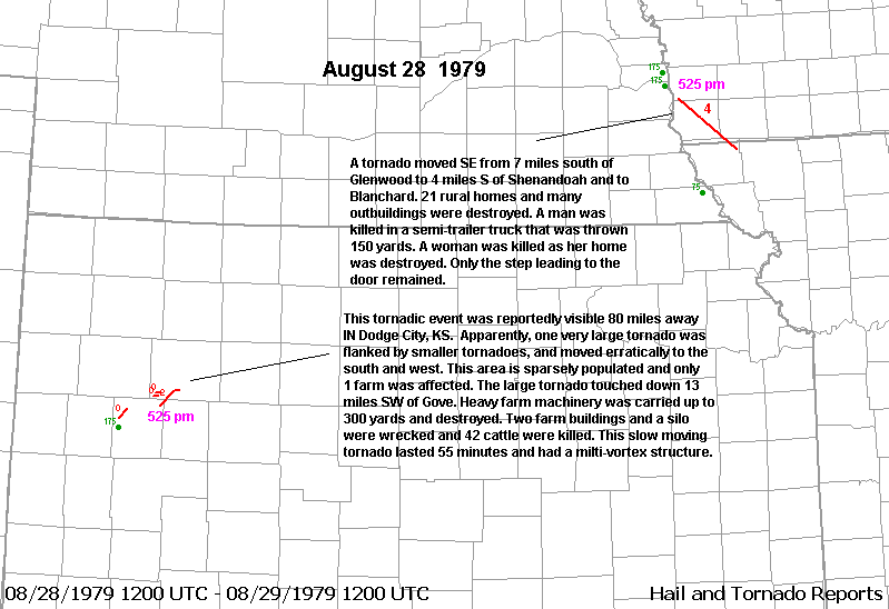
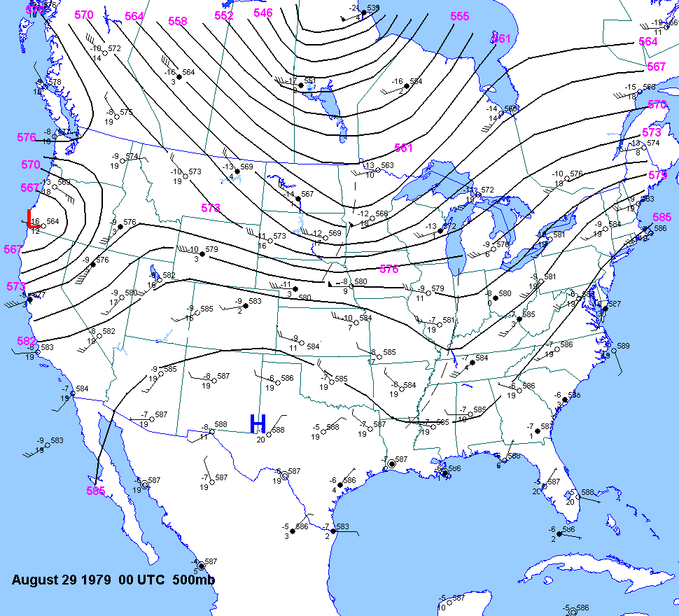
| 08-28-79 | 21Z | -8 to -9 | X | 12Z 00Z | X | KS | X | X | ||
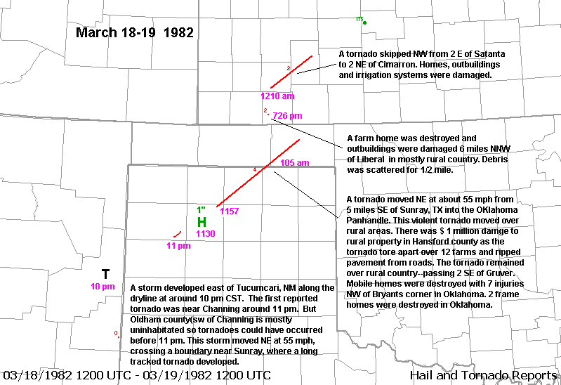
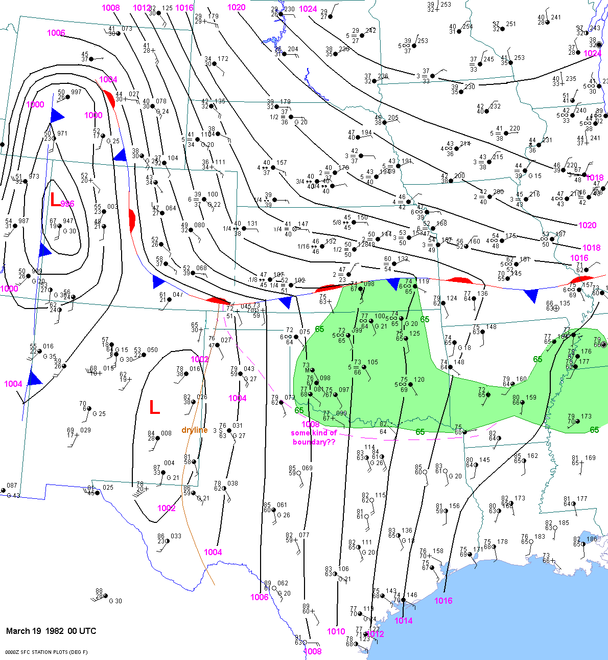
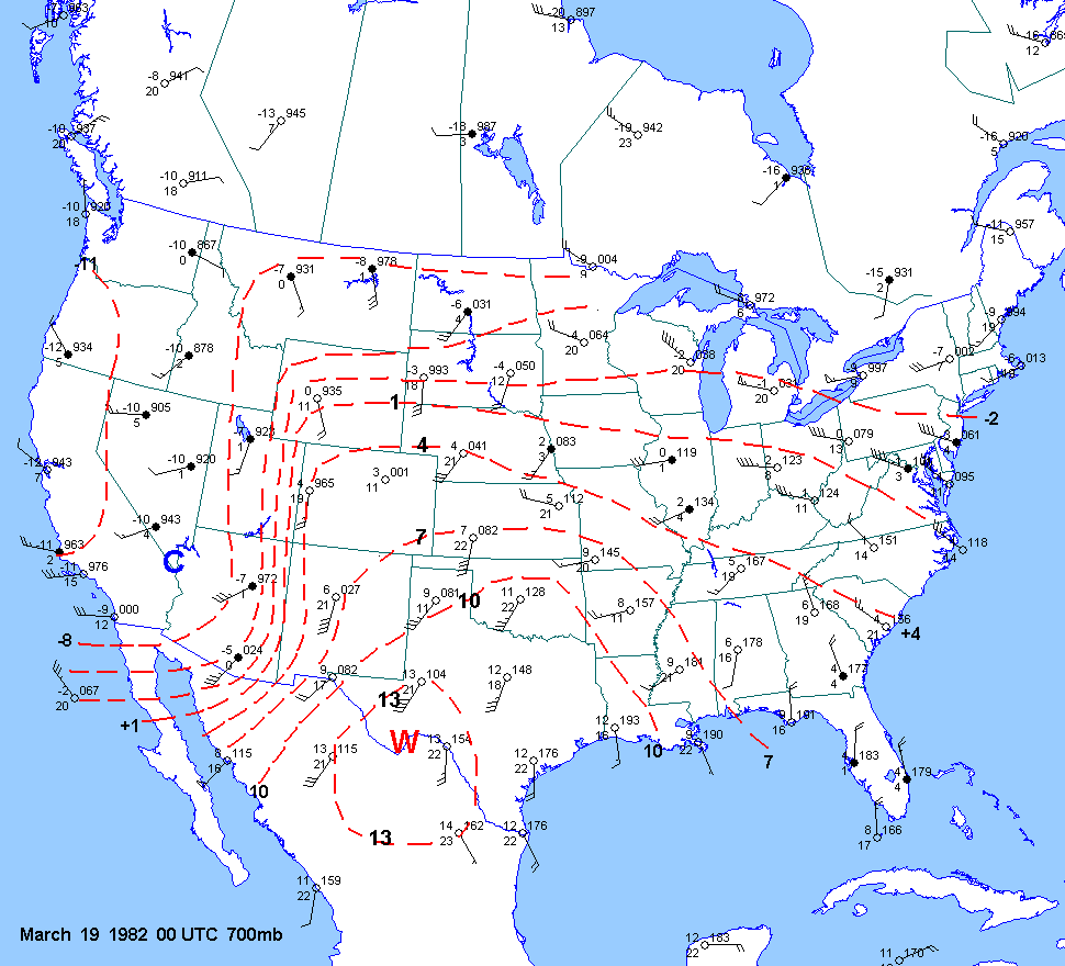
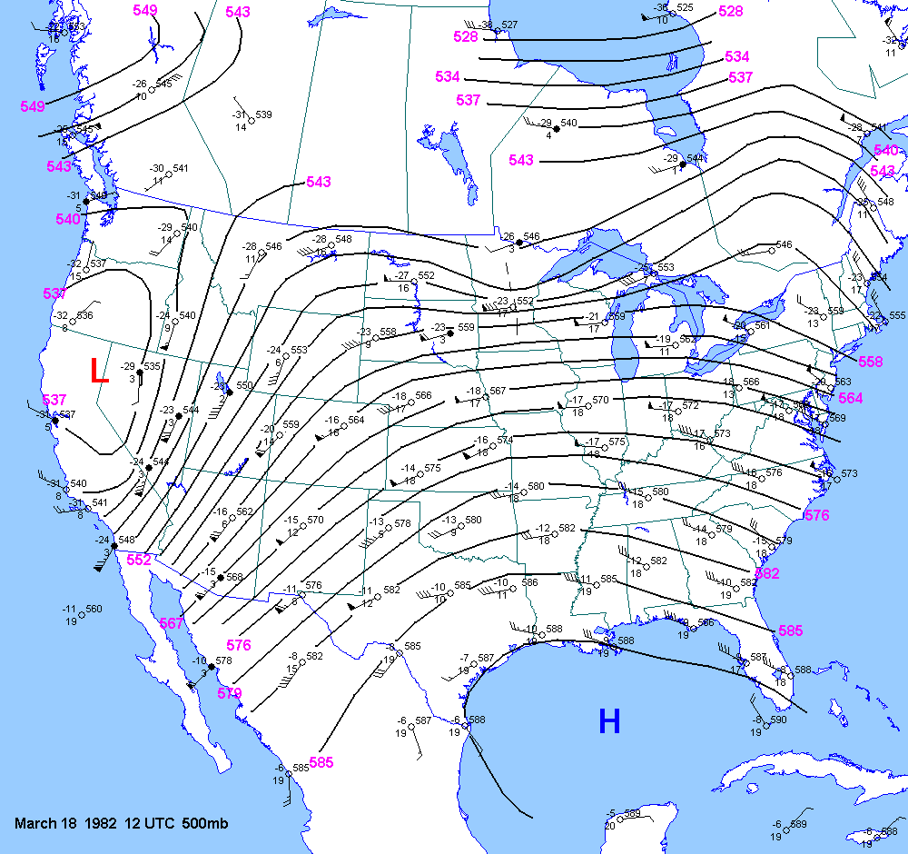
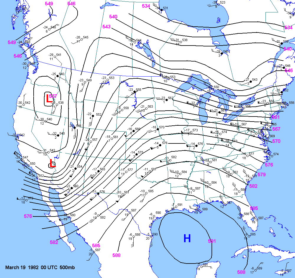
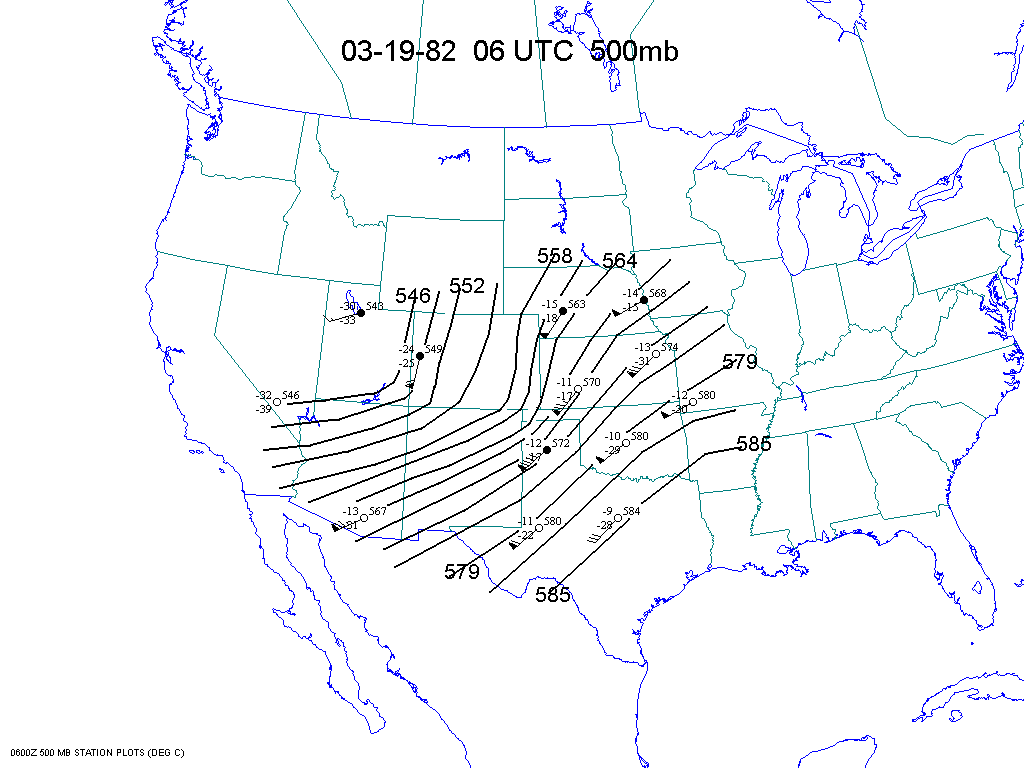
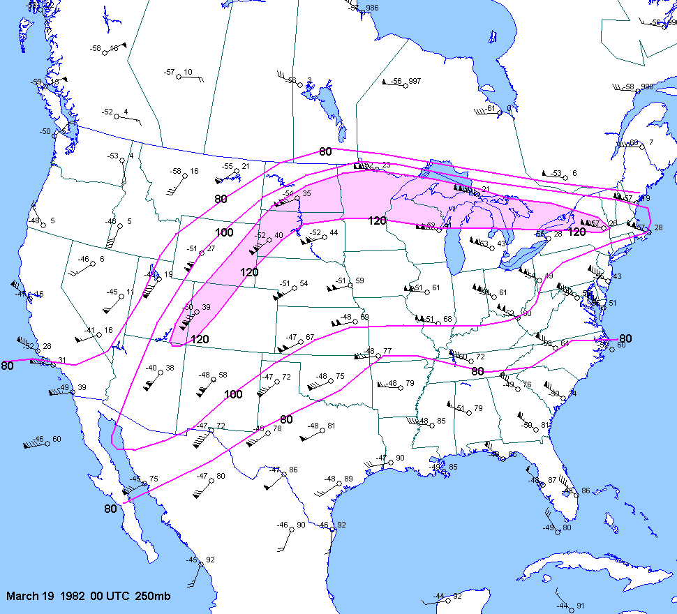
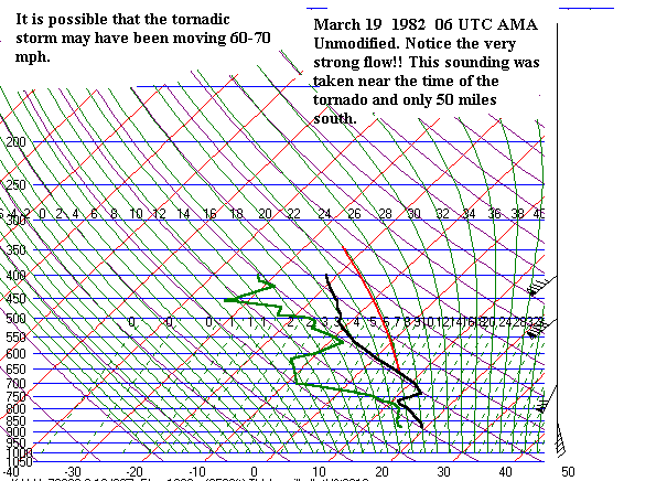
| 03-18-82 | 00Z | -6 | X | 0Z 19 | 12Z
18 0Z 19 06Z 12Z 19 |
00Z | approx. | TX OK KS | X | X |
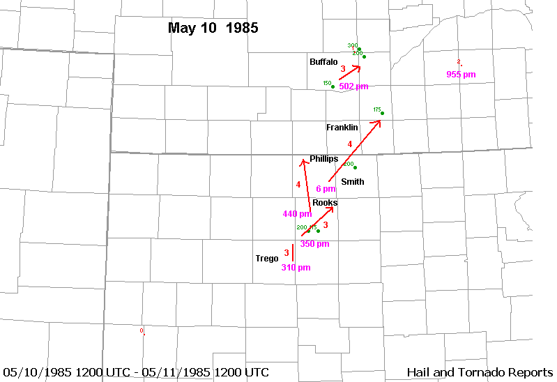
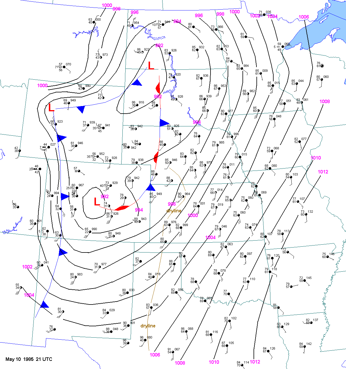
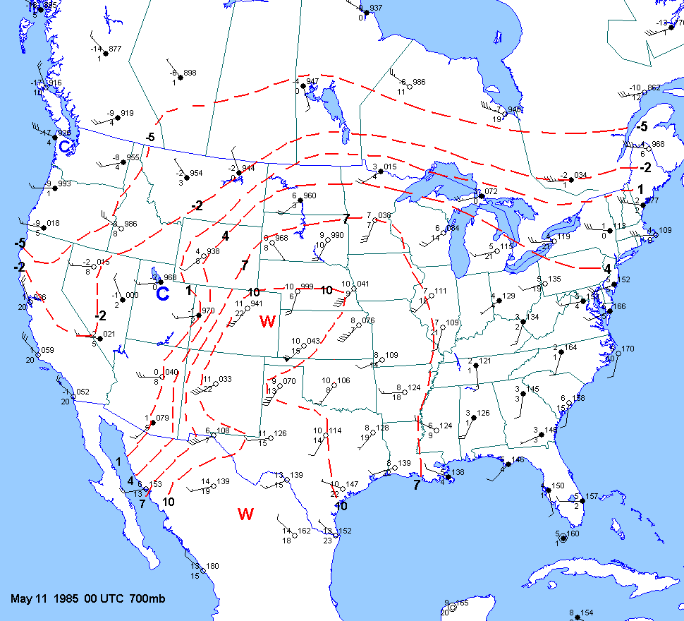
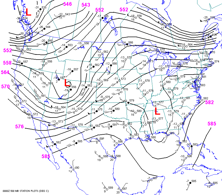
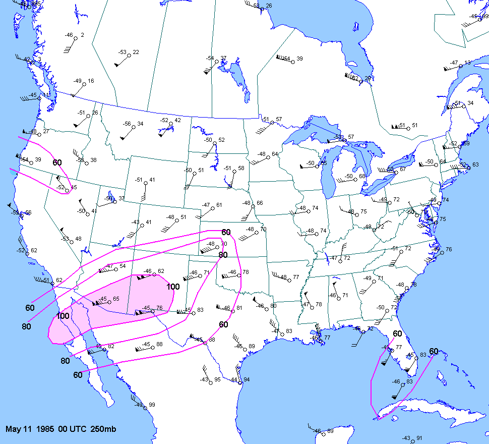
| 05-10-85 | 21Z | -9 | X | 00Z | 00Z 11 | 00Z | X | KS NE | XTors | X |
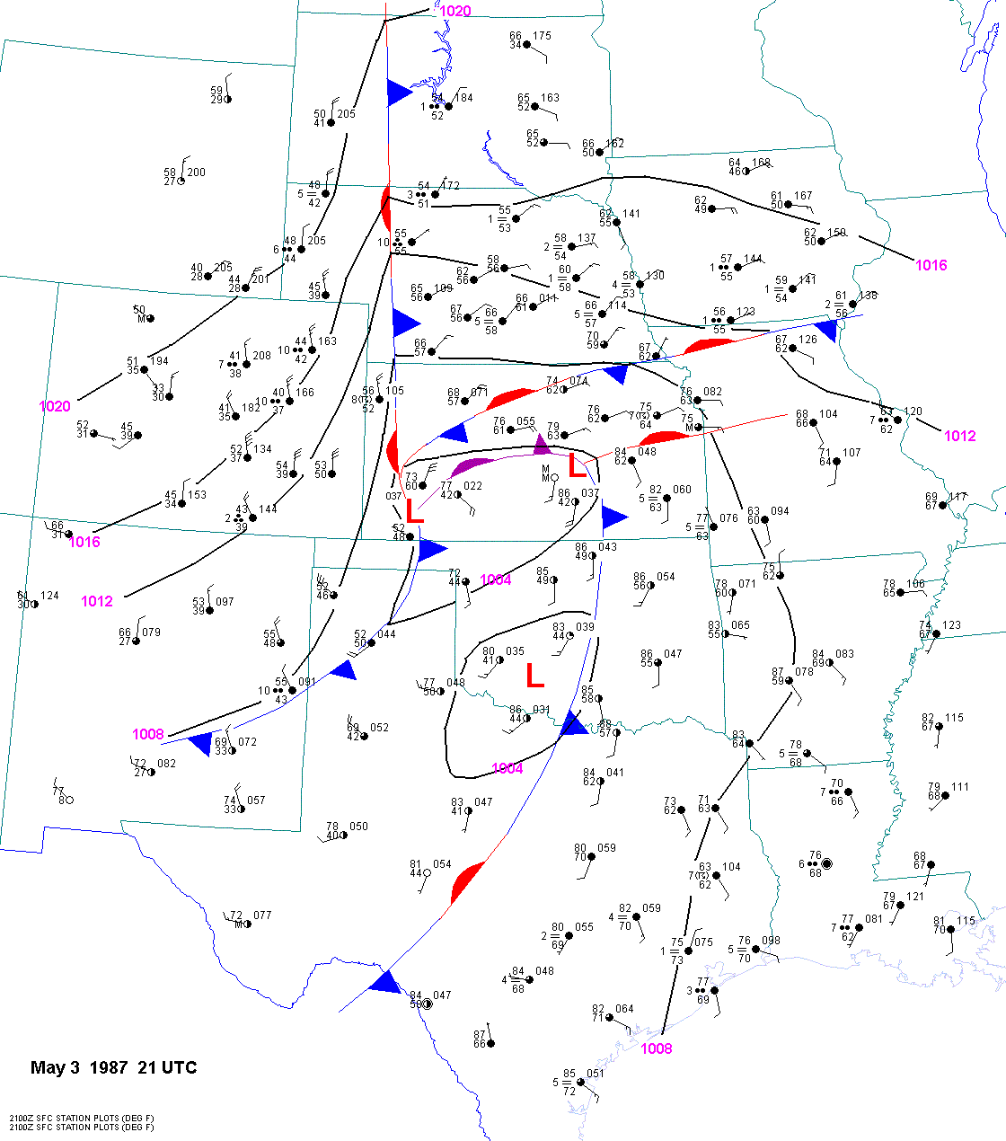
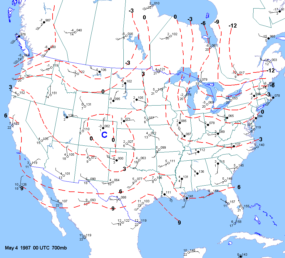
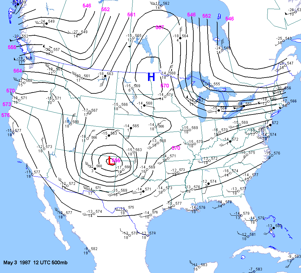
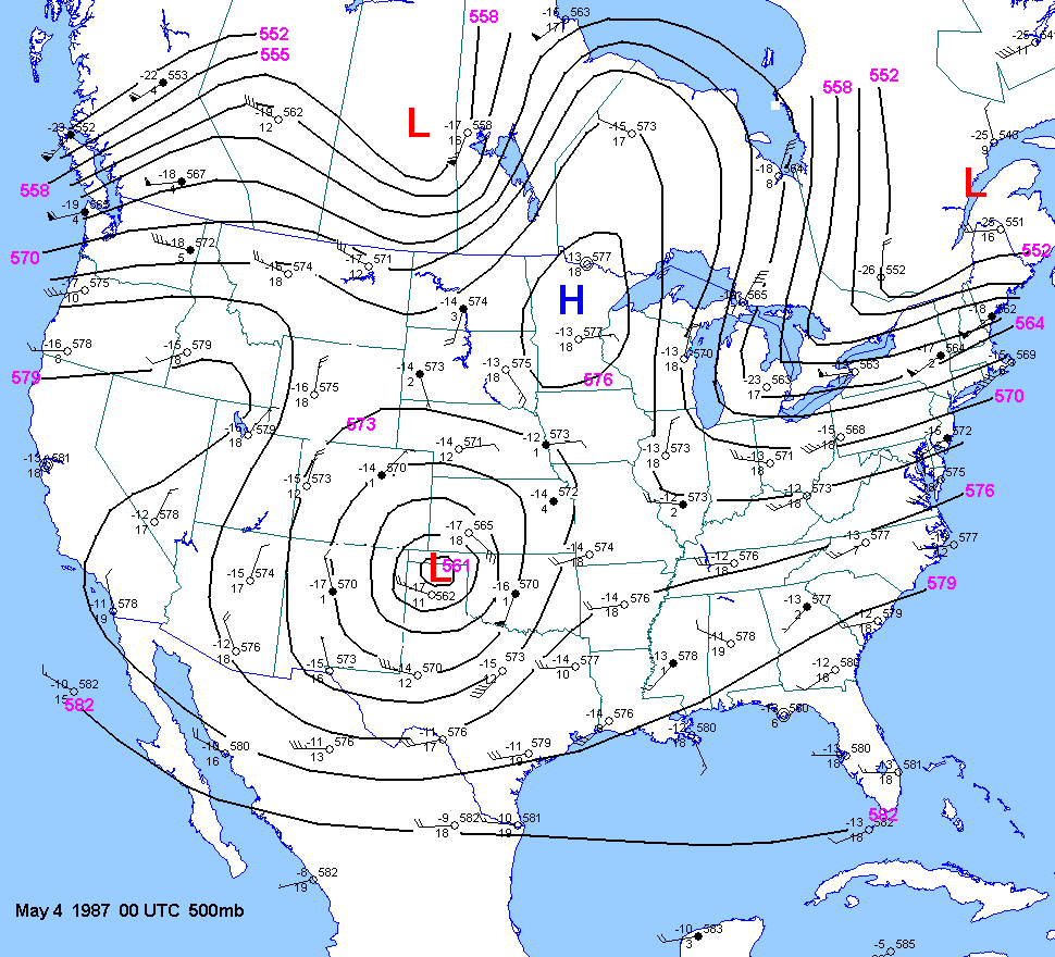
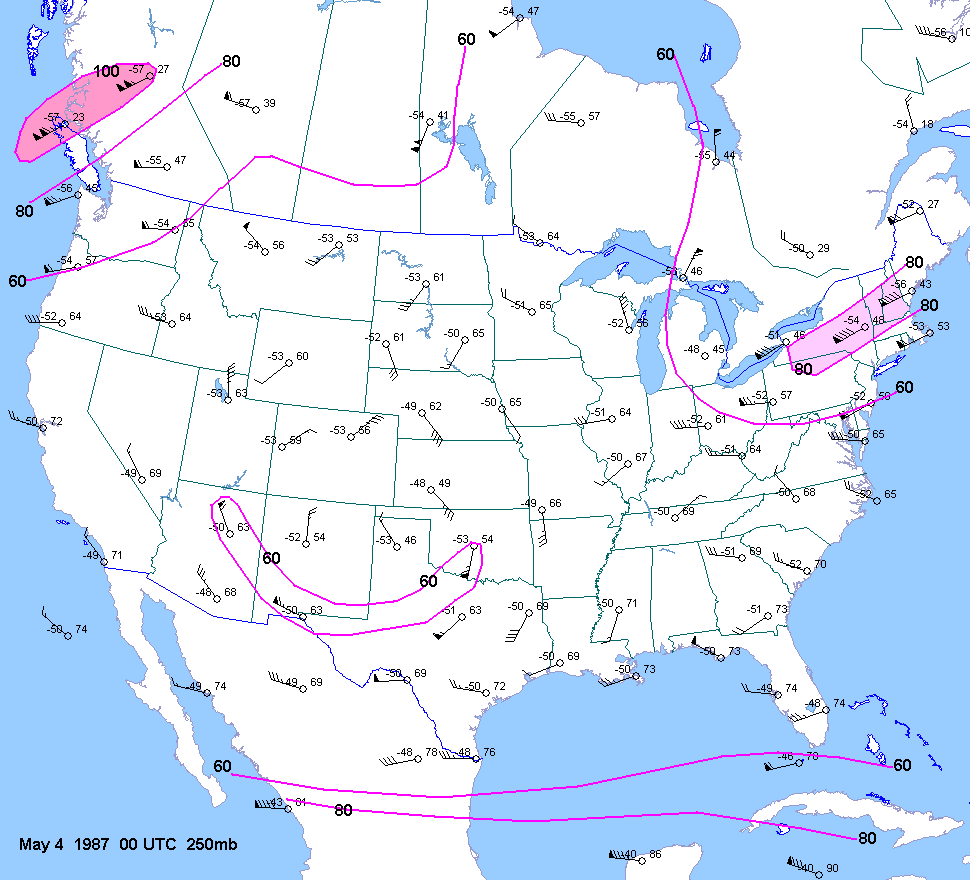
| 05-03-87 | 21Z | -8 to -10 | X | 00Z | 12Z 00Z | 00Z | X | KS | X | X |
| 05-02-88 | ||||||||||
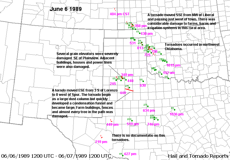
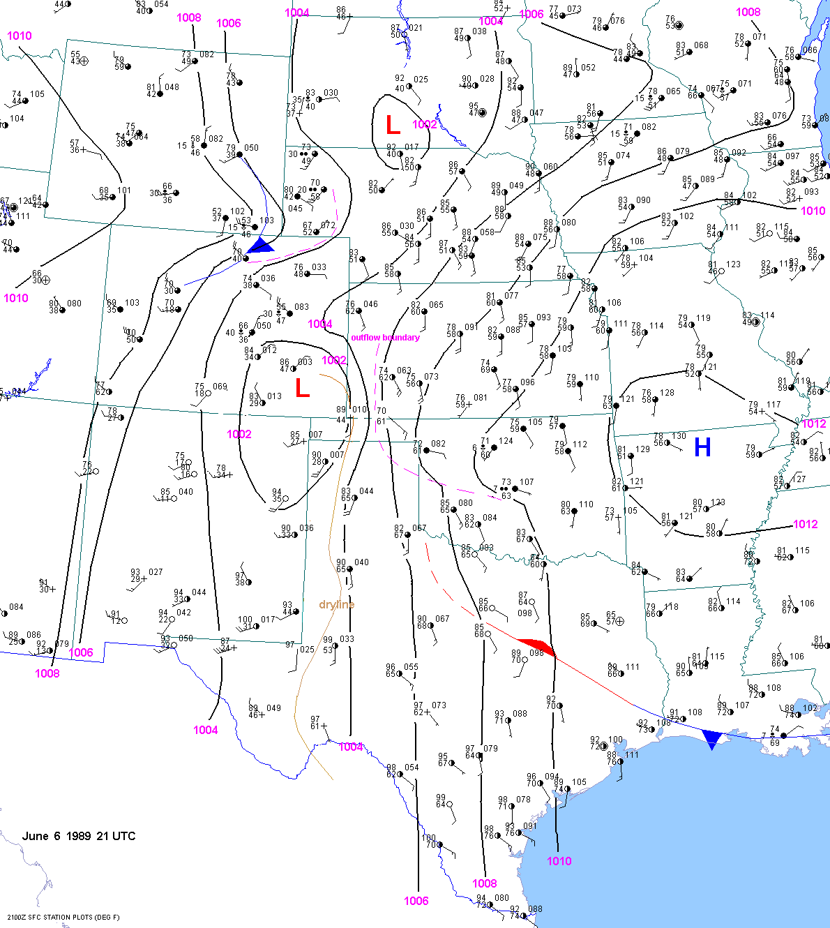
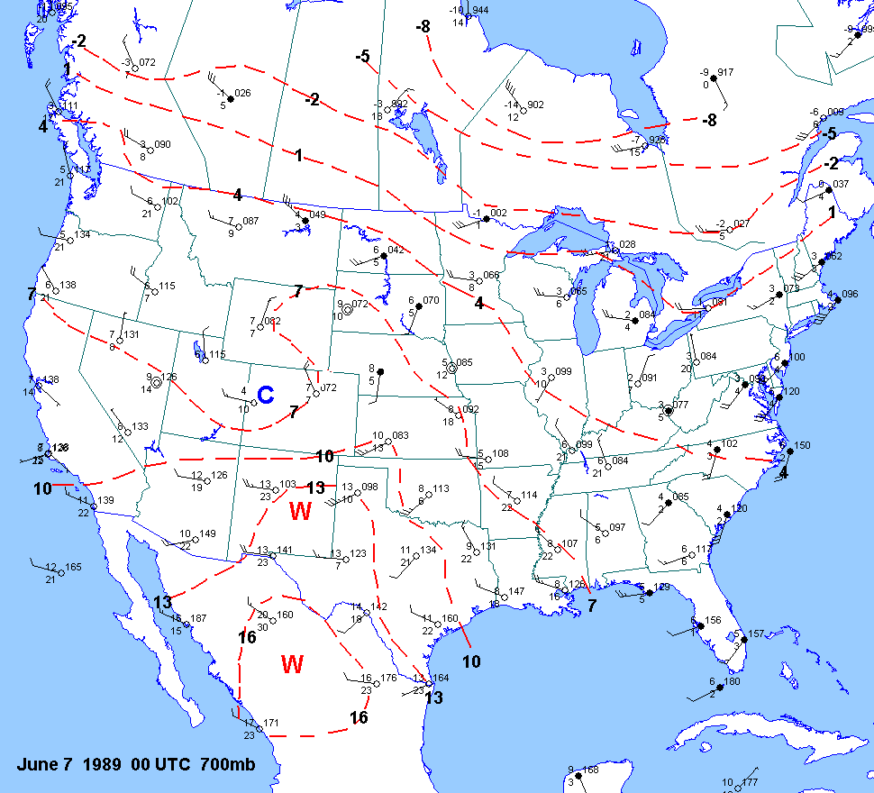
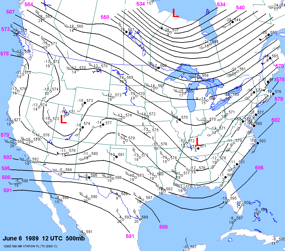
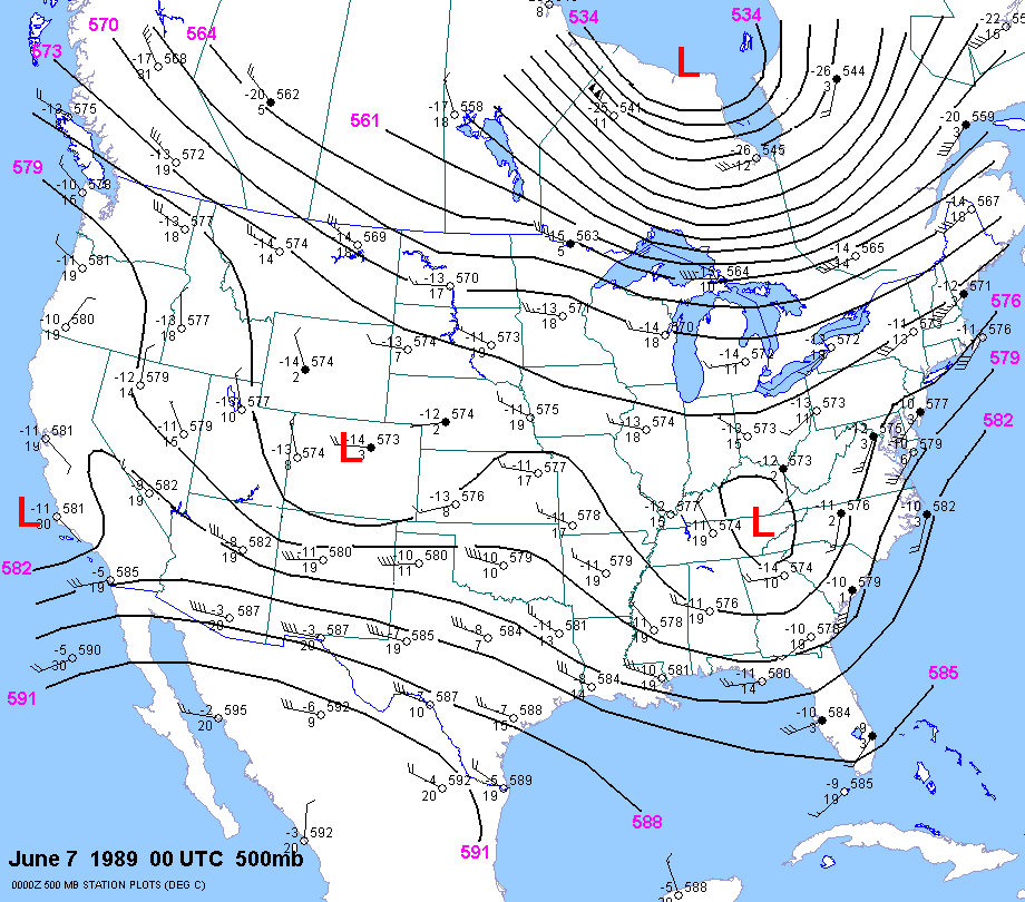
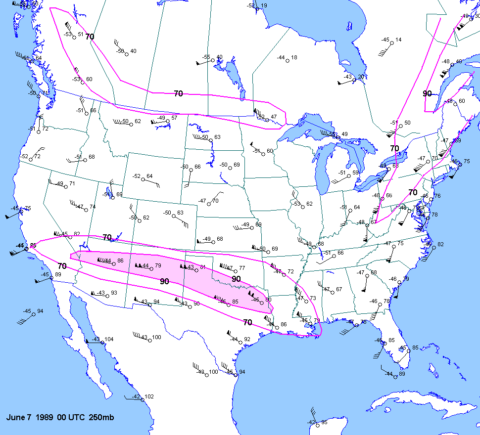
| 06-06-89 | 21Z | indeterm. |
X | 00Z | 12Z 00Z | 00Z | X | KS TX | X | X |
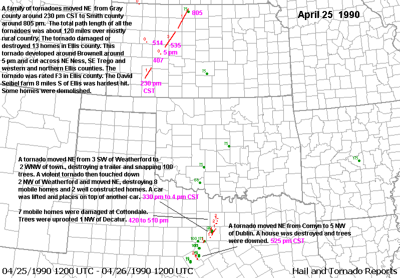
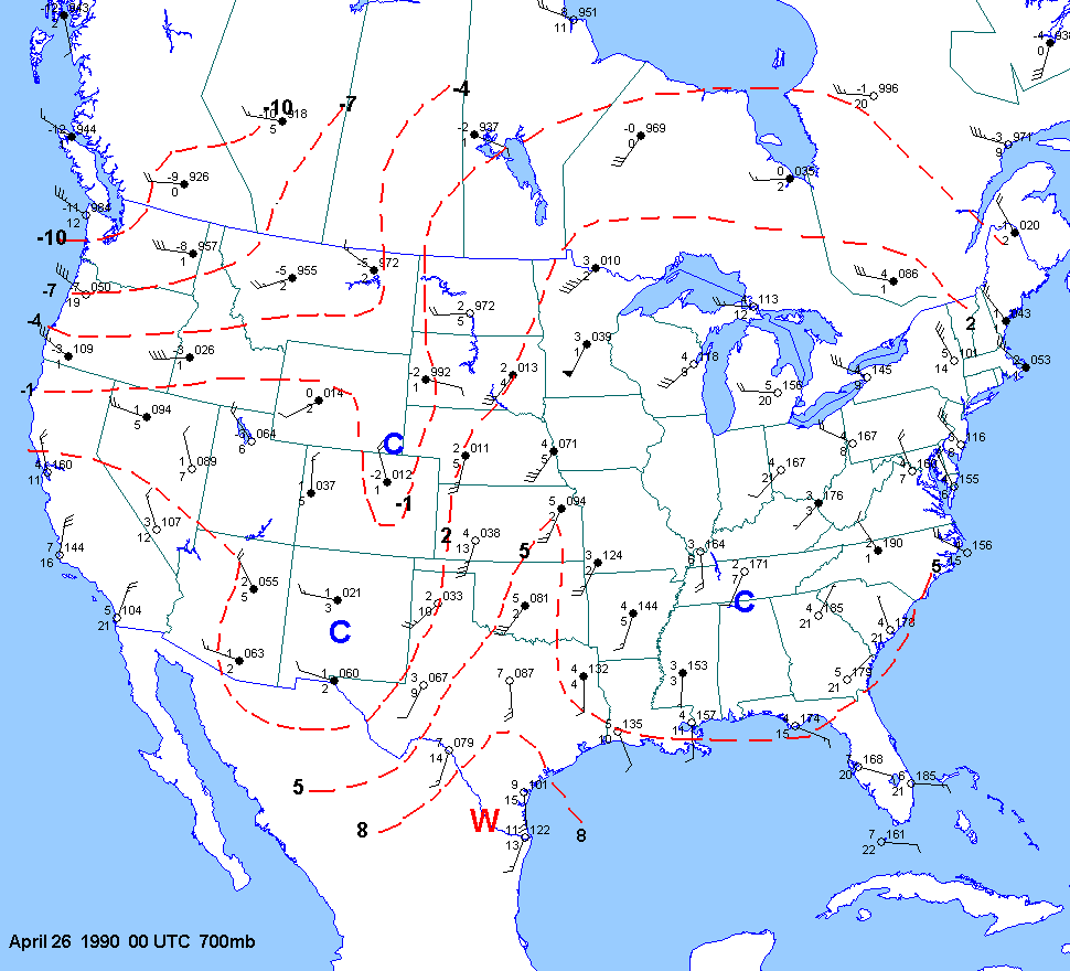
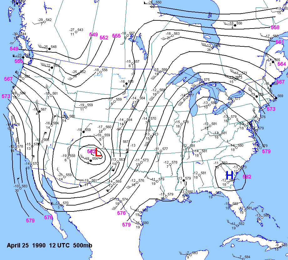
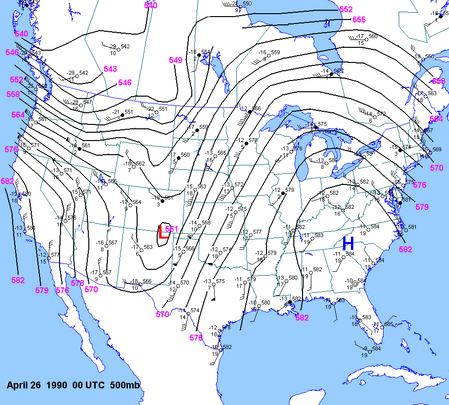
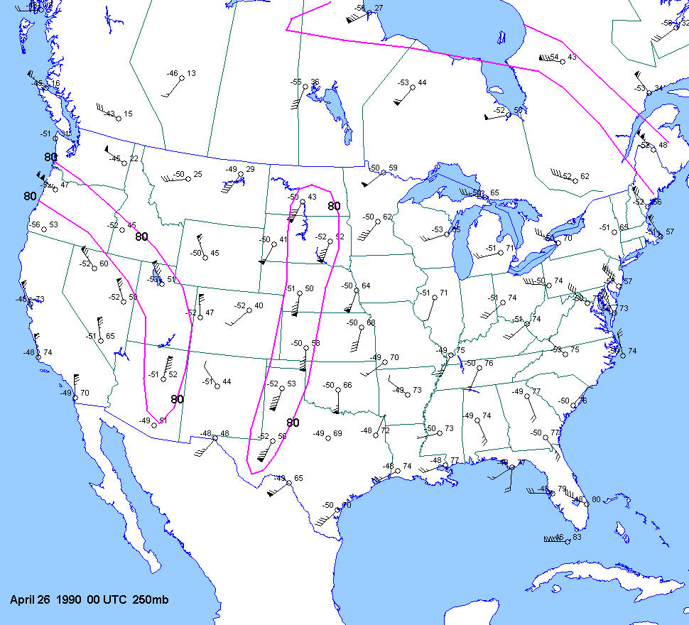
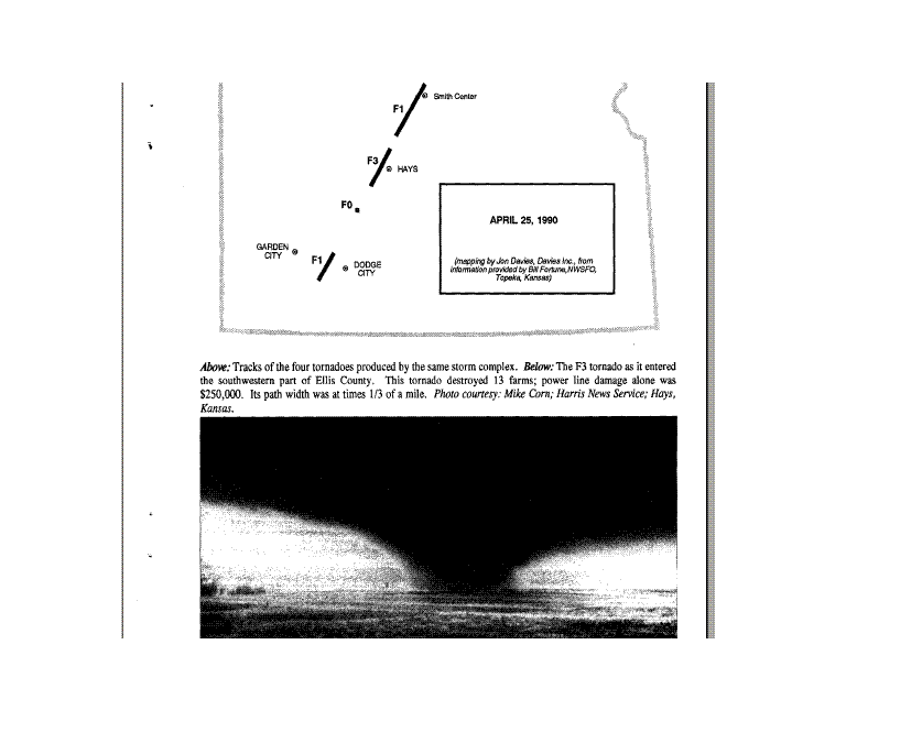
| 04-25-90 | 19Z | -7 | X | 00Z | 12Z
00Z 26 |
00Z | X | KS TX | XEllis | X |
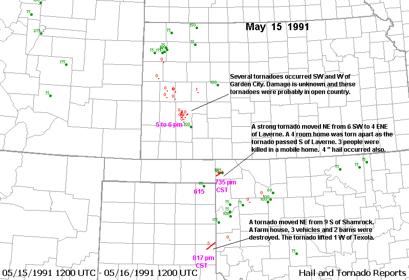
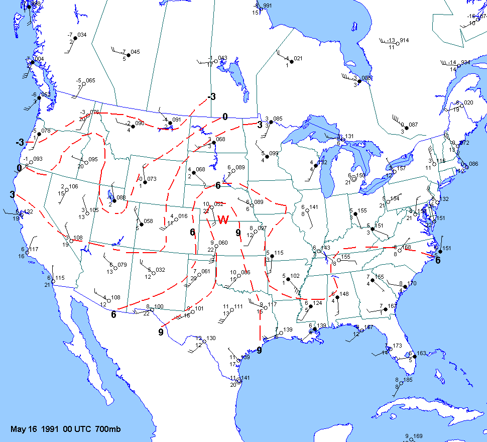
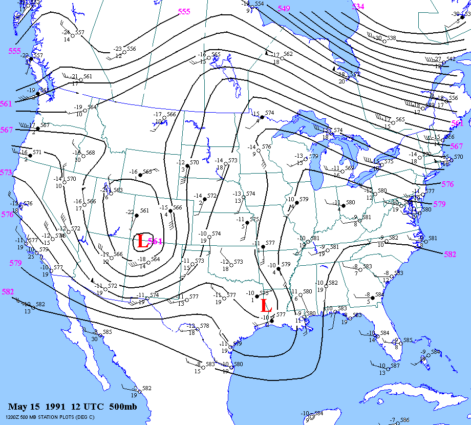
| 05-15-91 | 00Z | -9 | X | 00Z | 12Z 00Z | 00Z | X | TX OK KS | X | X |
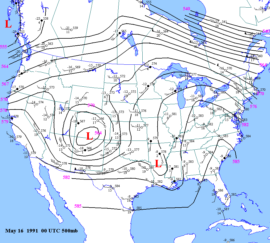
| 05-16-91 | ||||||||||
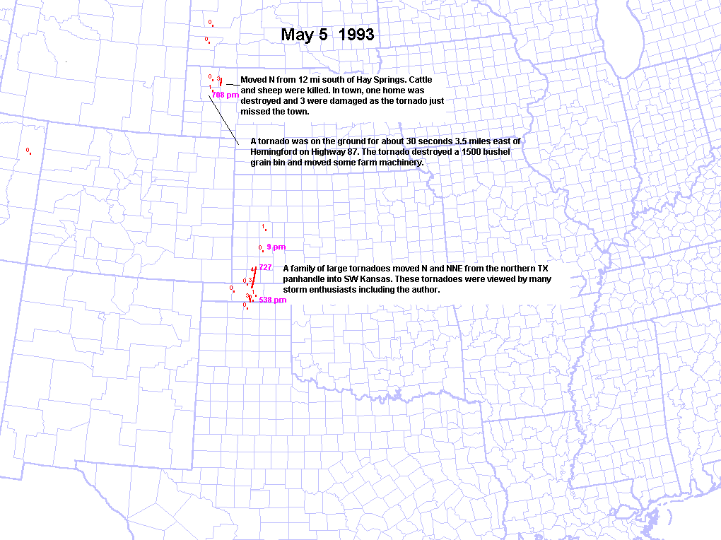
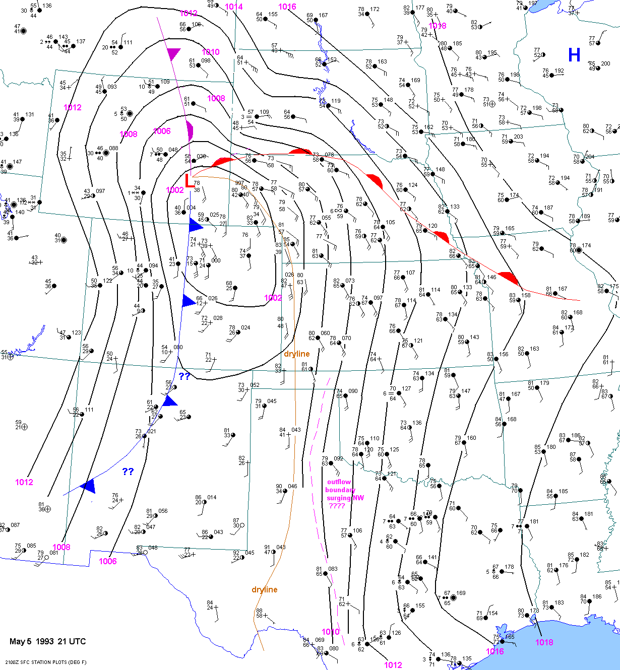
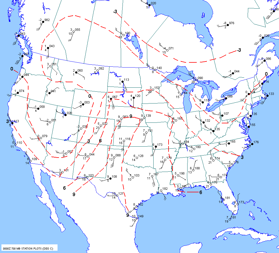
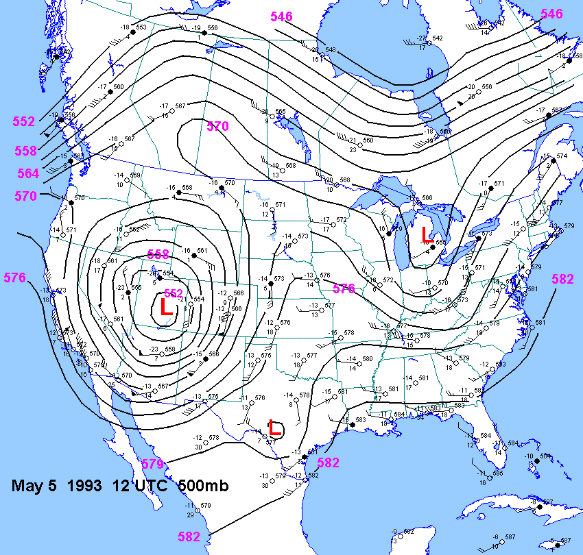
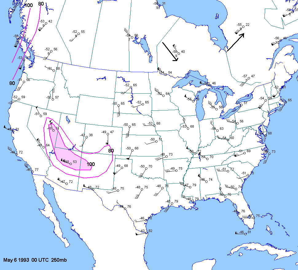
| 05-05-93 | 21Z | X | 00Z | 12Z 00Z | 00Z | NE TX KS OK | X1 2 | X | ||
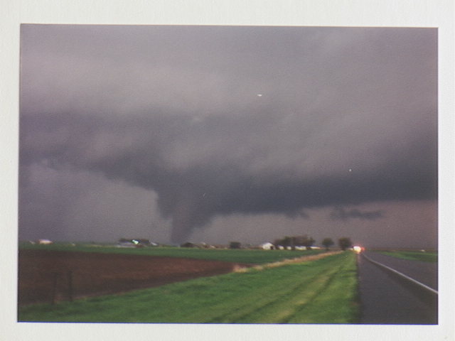
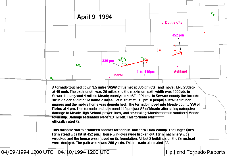
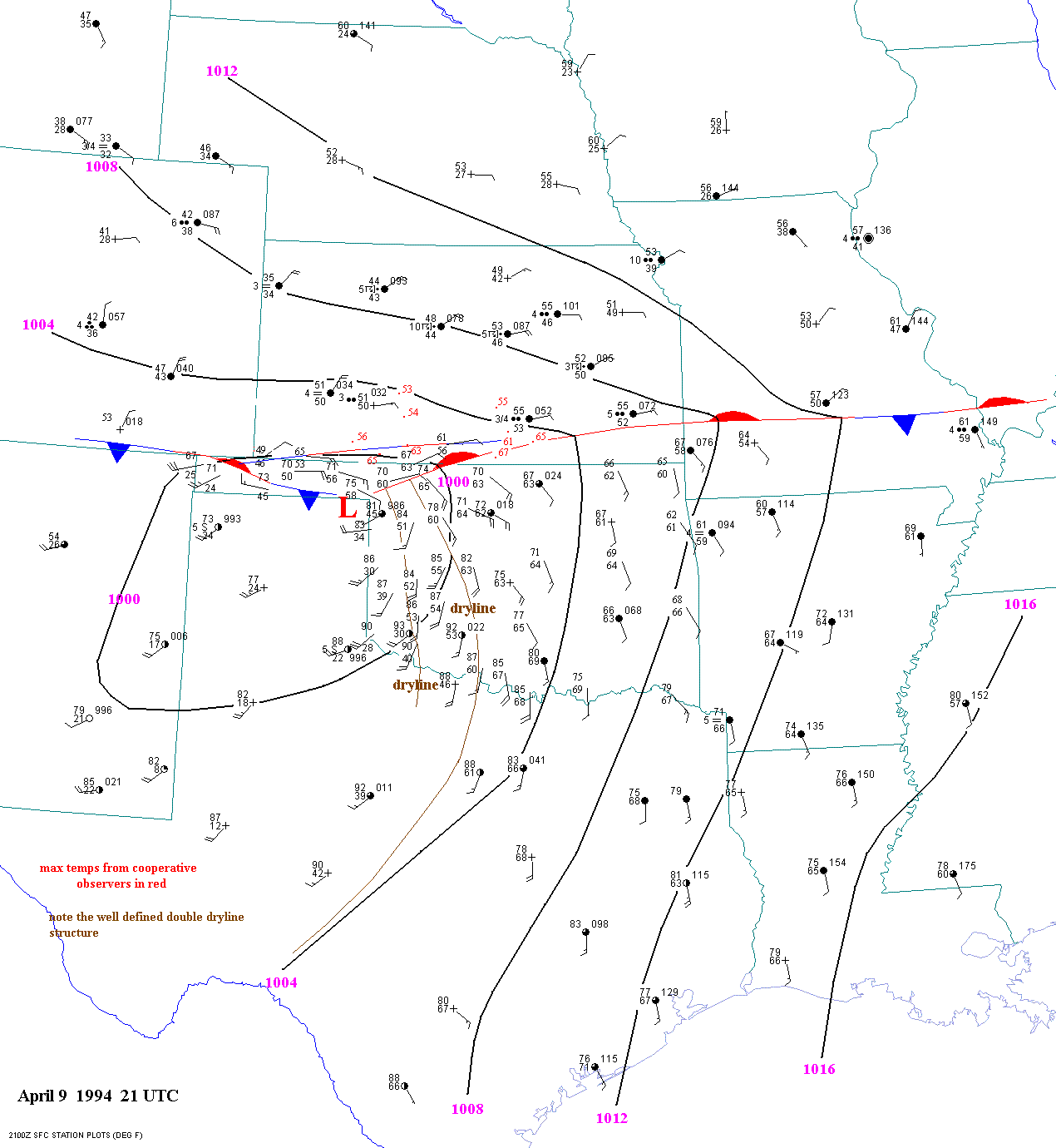
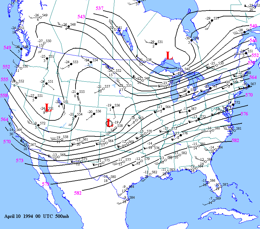
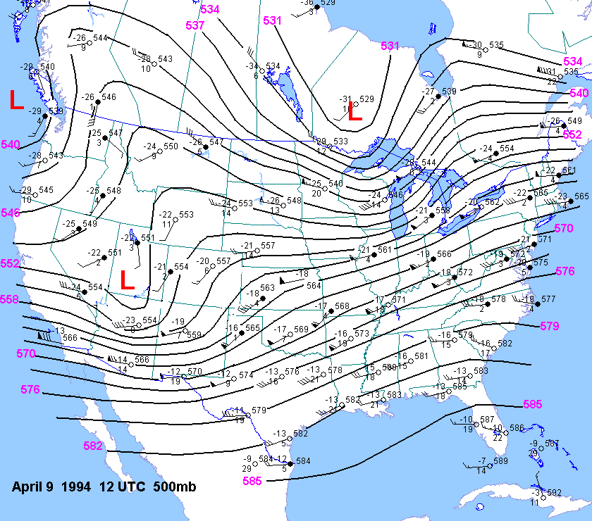
| 04-09-94 | 21Z | X | 12Z 00Z | X | KS | X | X | |||
| 05-15-95 | ||||||||||
| 05-16-95 | ||||||||||
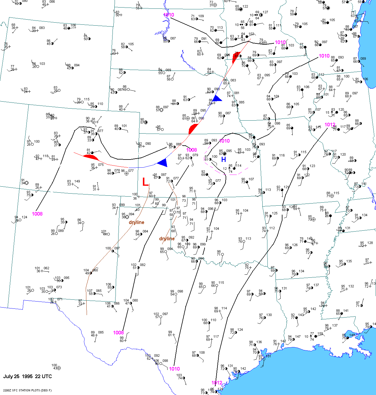
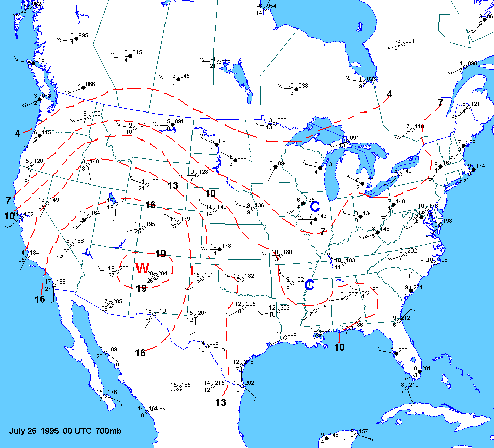
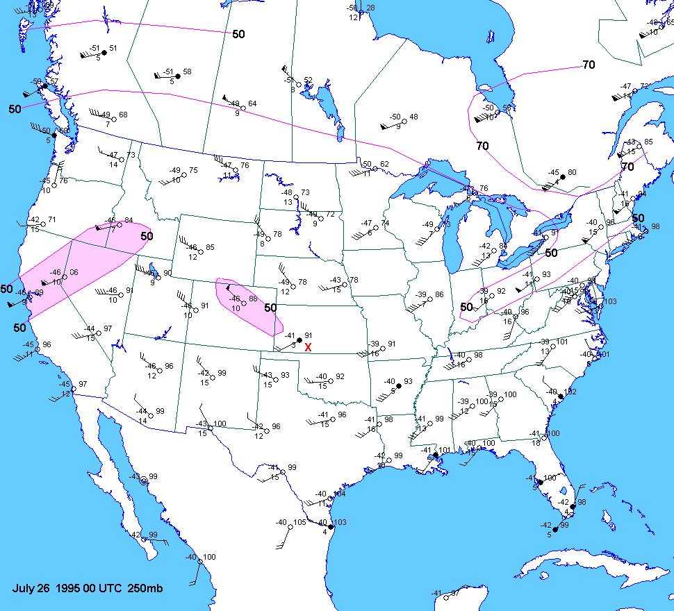
| 07-25-95 | 22Z | 00Z | 00Z | 00Z | KS | |||||
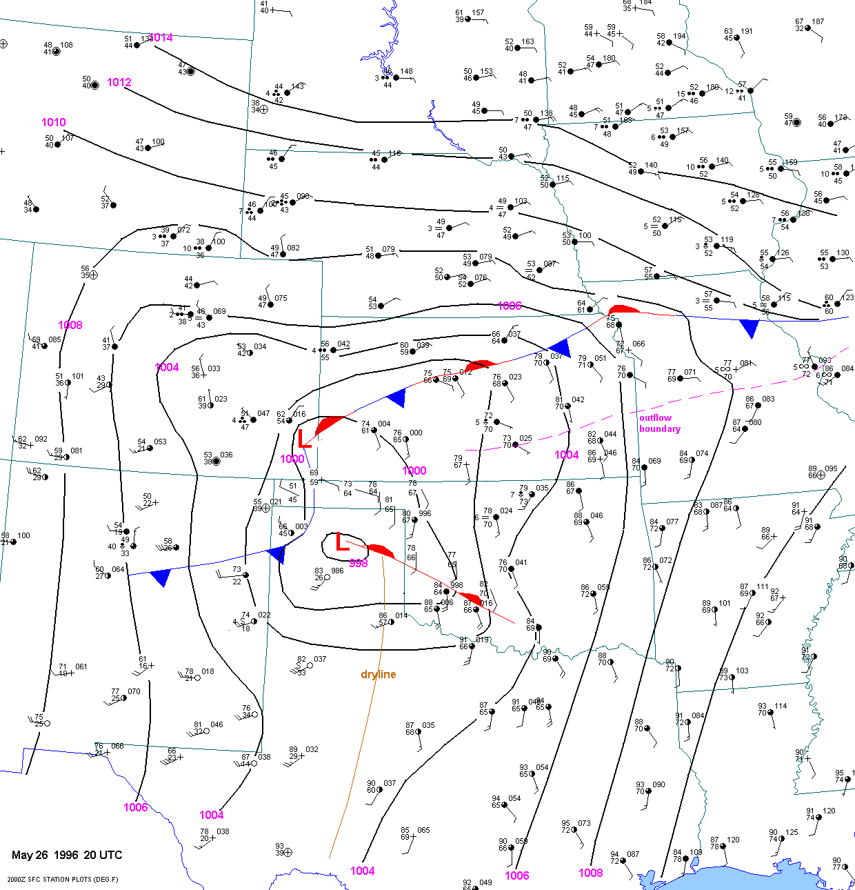
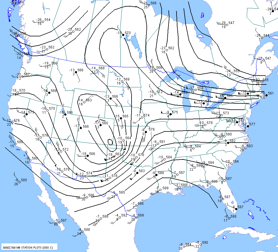
| 05-26-96 | 20Z | X | 12Z 00Z | X | KS OK | X | X | |||
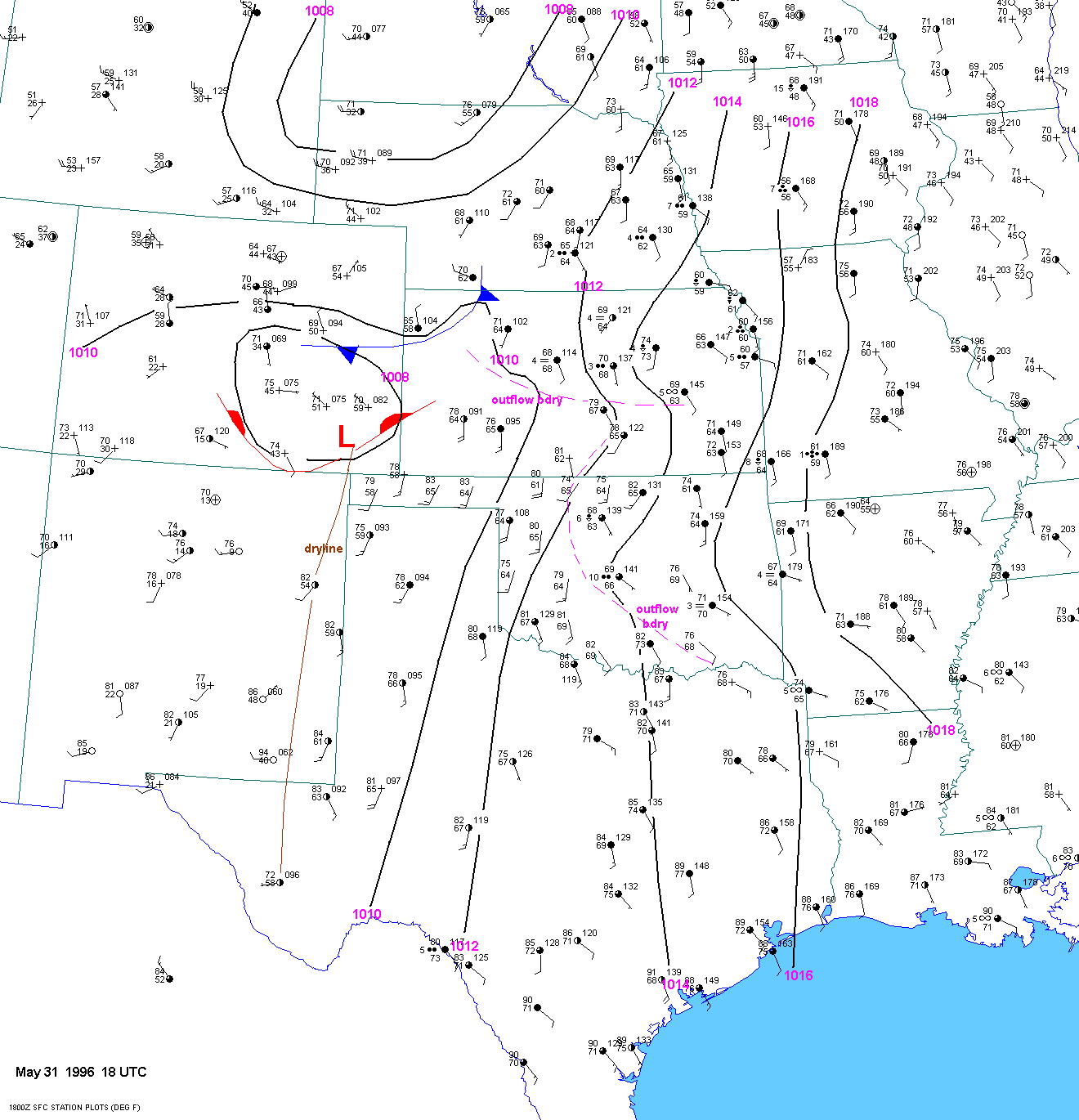
| 05-31-96 | 18Z | |||||||||
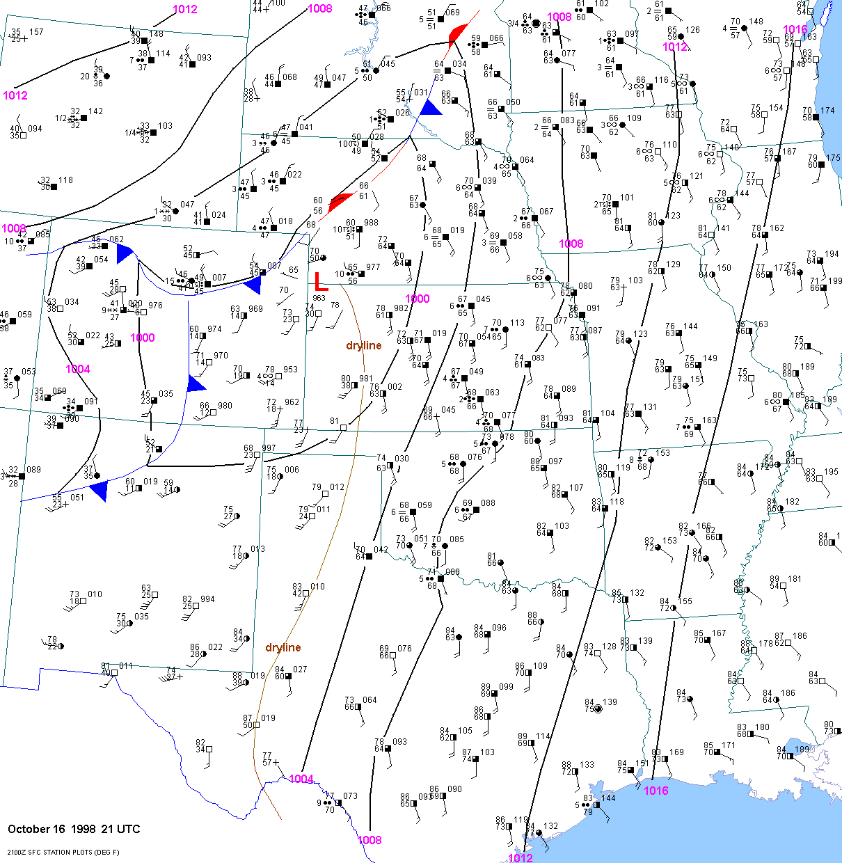
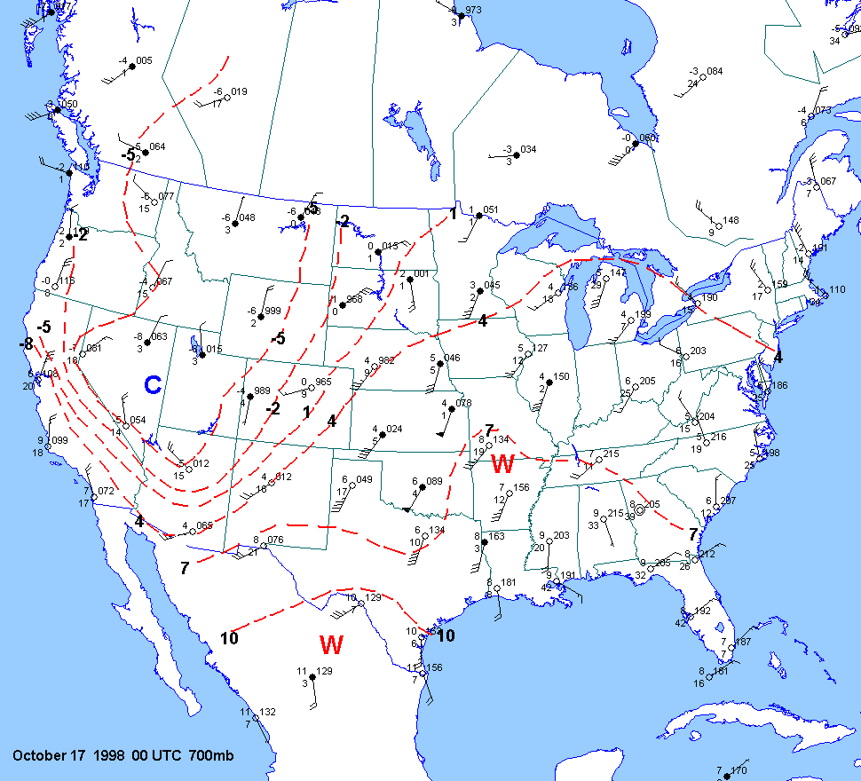
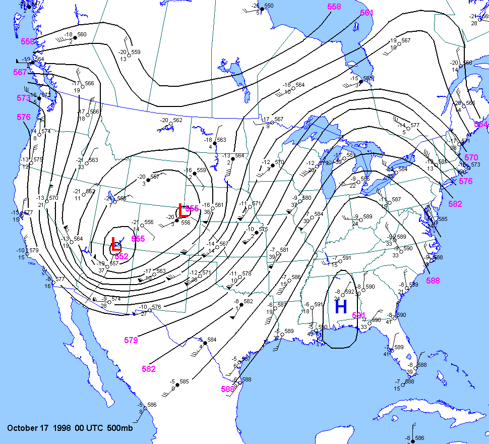
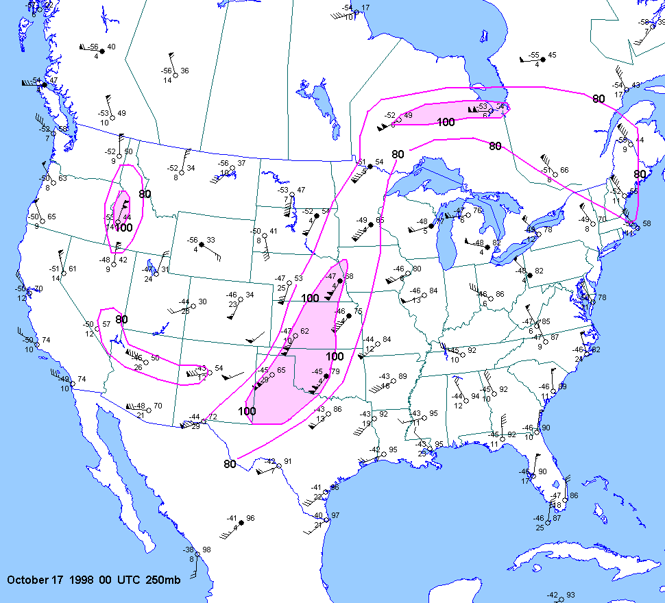
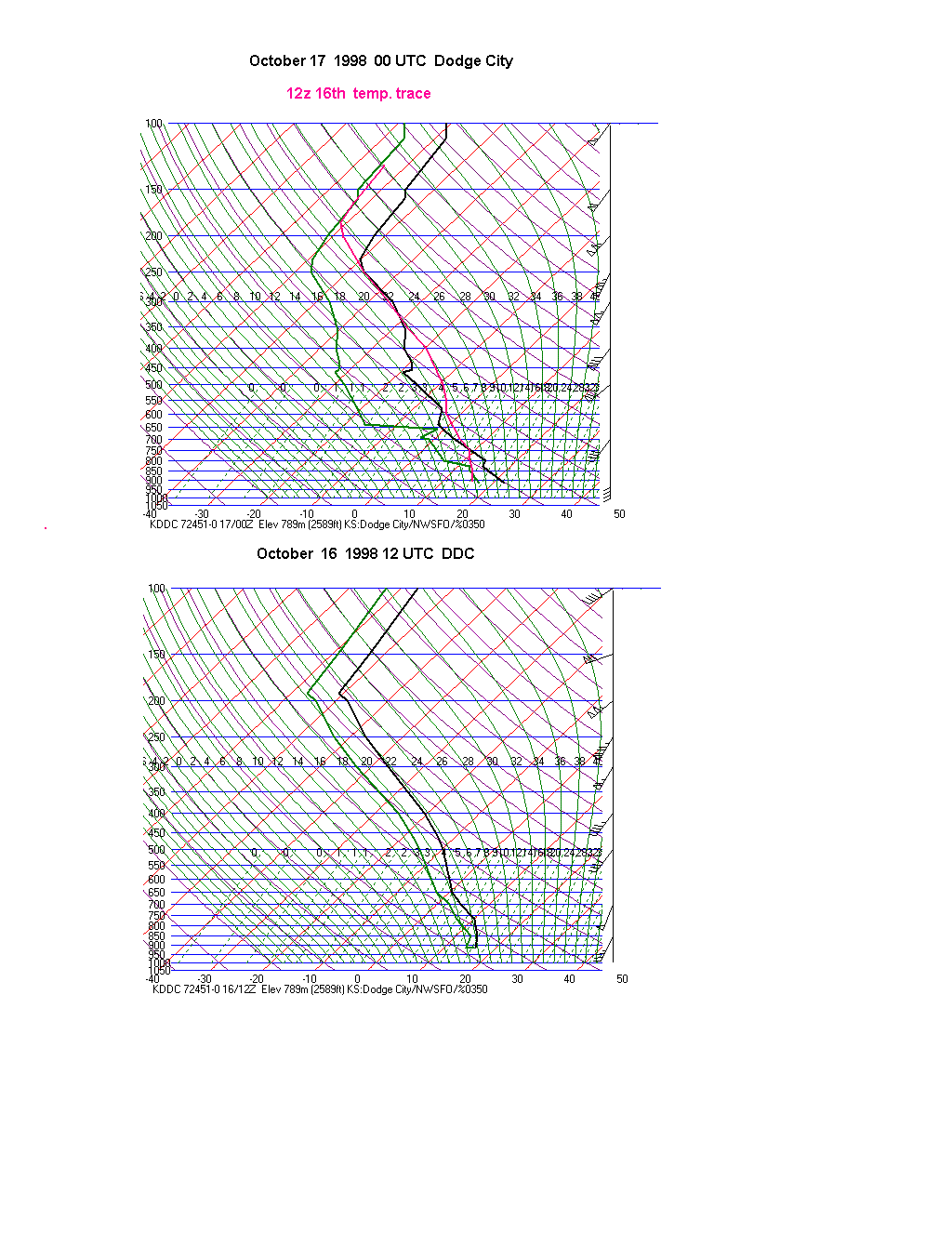
| 10-16-98 | 21Z | X | 00Z | 12Z 00Z | 00Z | DDC | KS NE | X | X | |
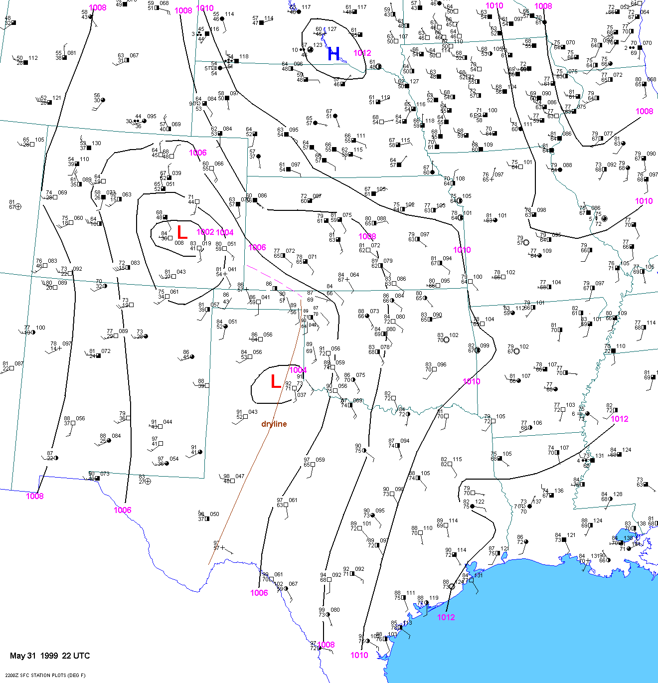
| 05-31-99 | 22Z | |||||||||
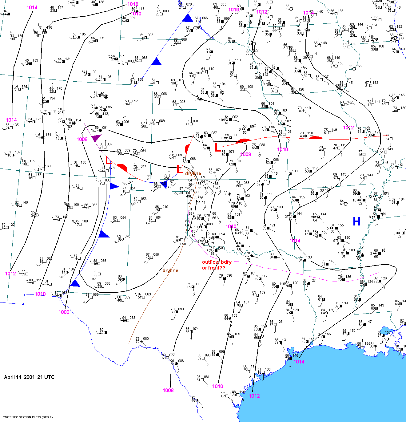
| 04-14-01 | 21Z | |||||||||
| 05-05-02 | ||||||||||
| 05-07-02 | ||||||||||
| 05-15-03 | ||||||||||
| 03-27-04 | ||||||||||
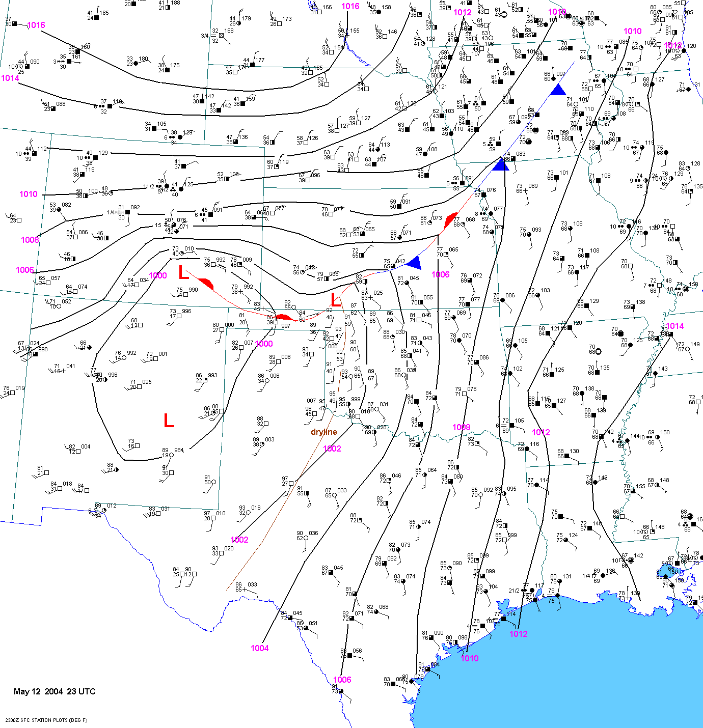
| 05-12-04 | 23Z | |||||||||
| 05-11-05 | ||||||||||
| 06-09-05 | ||||||||||
| 02-23-07 | ||||||||||
| 03-29-07 | ||||||||||
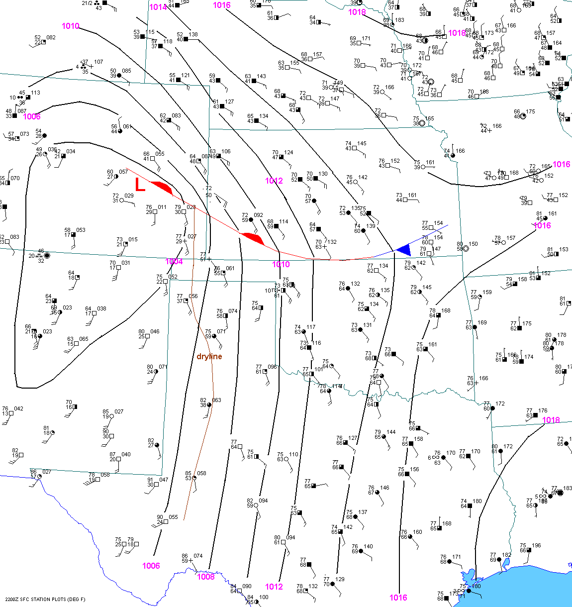
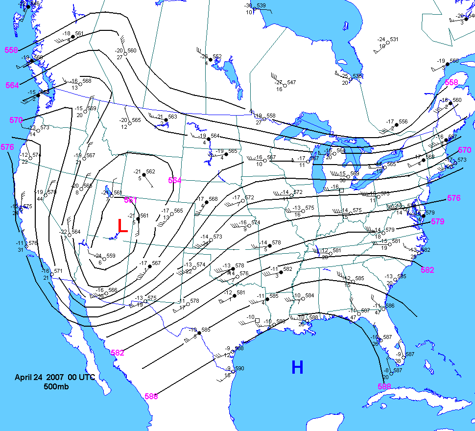
| 04-23-07 | 22Z | 00Z | ||||||||
| 05-04-07 | ||||||||||
| 05-22-08 | ||||||||||
| 05-23-08 | ||||||||||
| 04-18-09 | ||||||||||
| 04-30-09 | ||||||||||
| 06-15-09 | ||||||||||
| 04-22-10 |
Special Tornado Cases for Southwest Kansas
Jonathan
D. Finch