Bangladeshi picking up hail
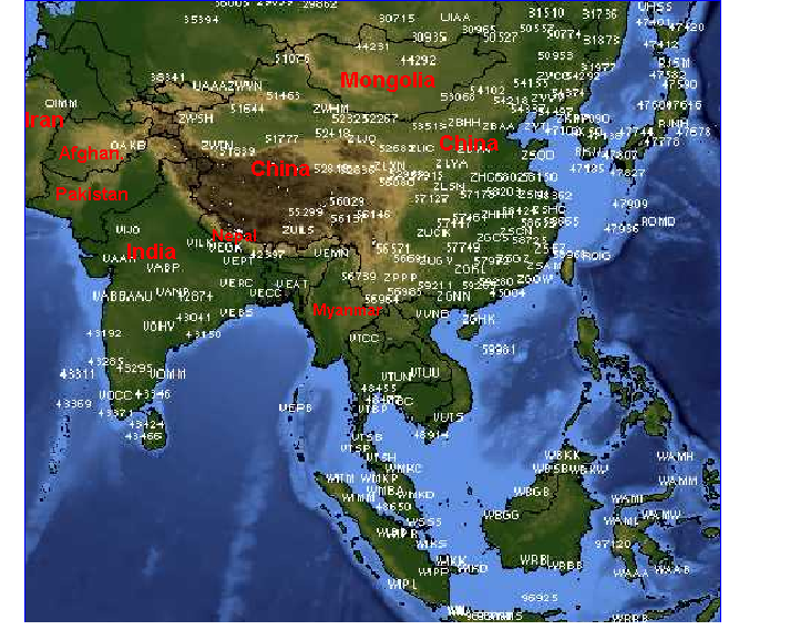
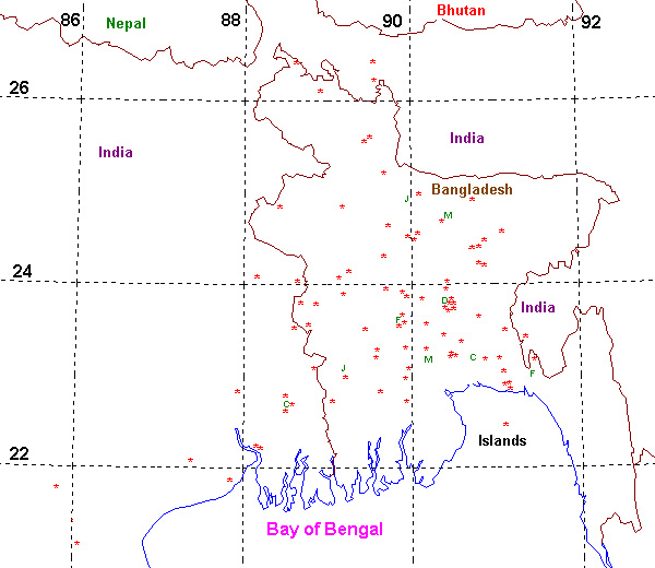
Map of the region
What are the causes of the Bangladesh severe weather alley?
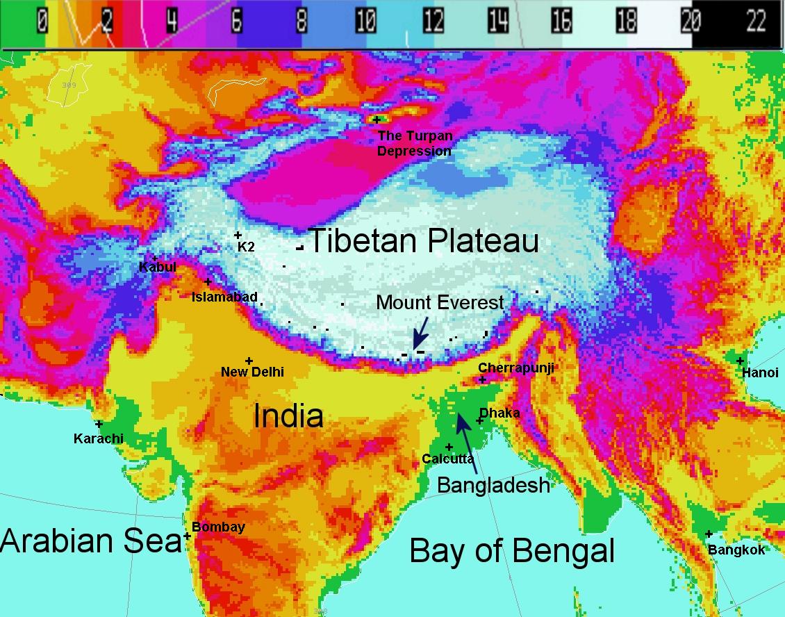
Land-Sea distribution and topography
An illustration of the
Bangladesh/East Indian severe storm environment can be found here.
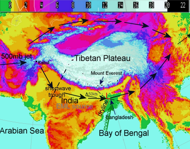
Elevated terrain of north India is EML source region.
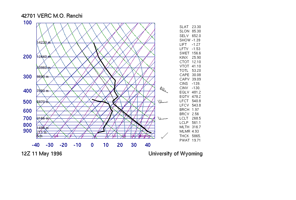
Ranchi, India
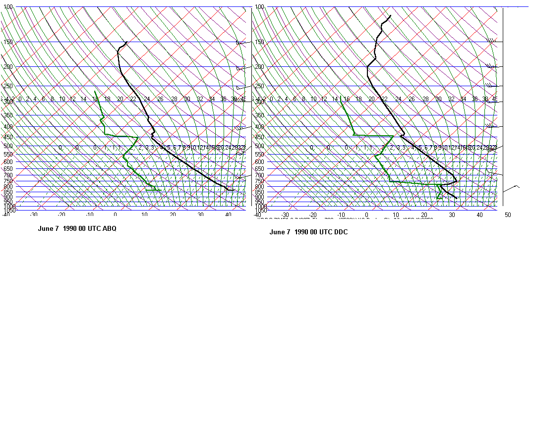
Albuquerque(June 21 1960)
The dryline separates the hot and dry EML source region and the most air over Bangladesh.
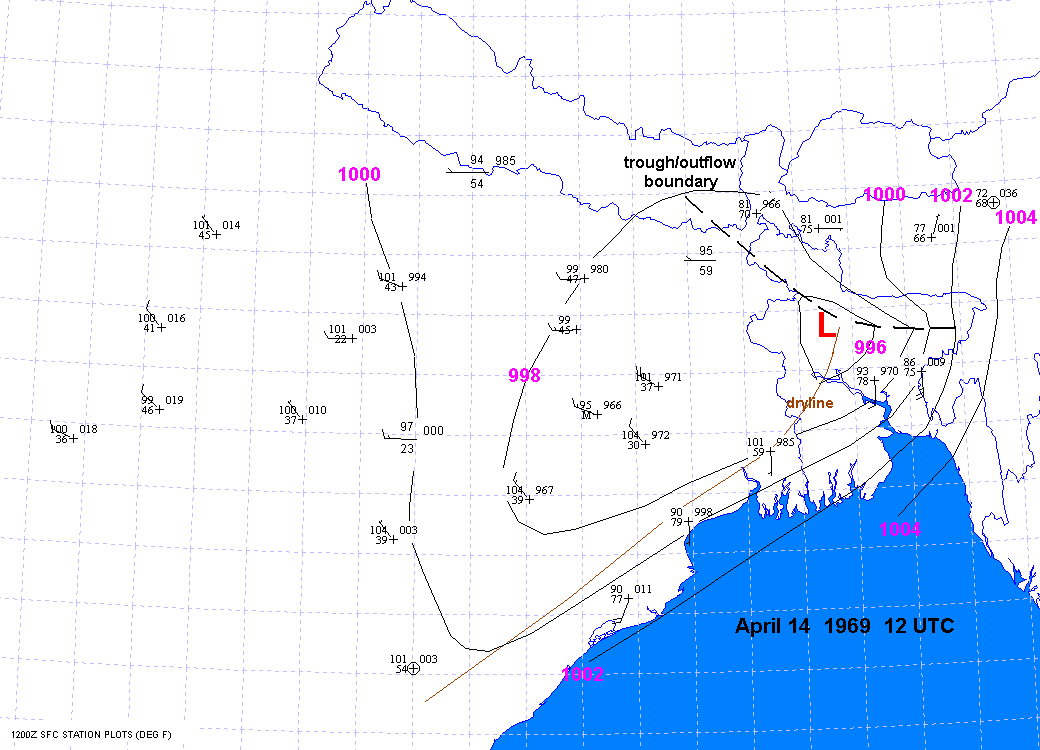
April 14, 1969
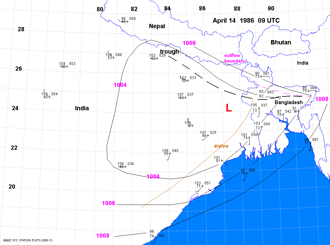
April 14, 1986
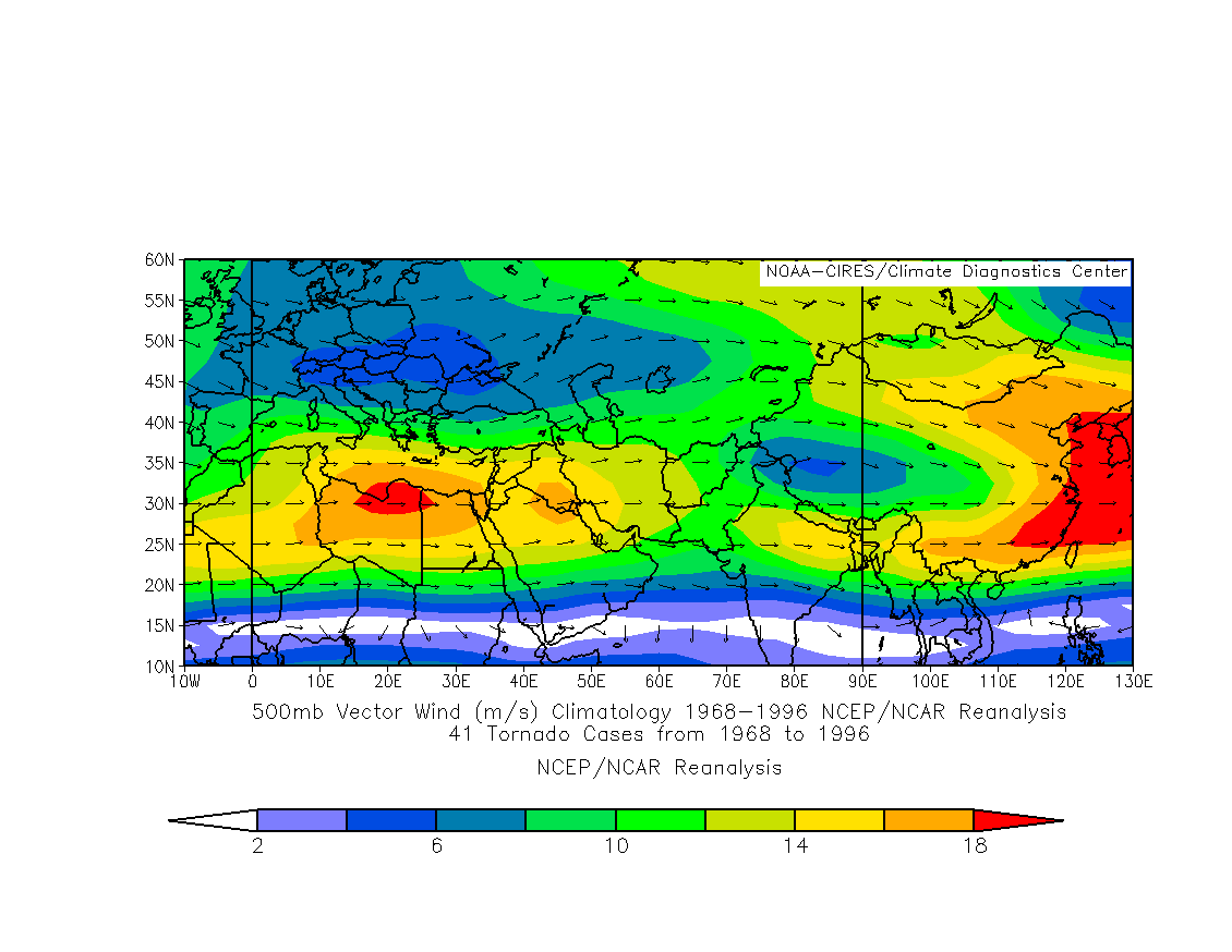
Tibetan Plateau enhances the mid level flow over north India and Bangladesh.
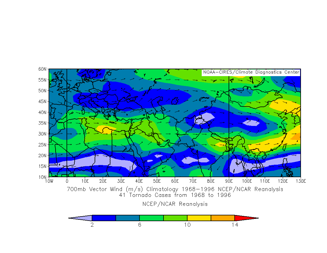
April 6 2006 12 hr UKMET 700mb winds
Nocturnal storms over the Khasi Hills near Cherrupunji leave outflow boundaries
over northern Bangladesh. These nocturnal storms are probably caused by
the low
level jet impinging on the Khasi Hills of Meghalaya, India.
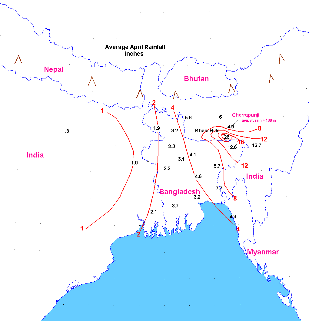
Average Rainfall for April
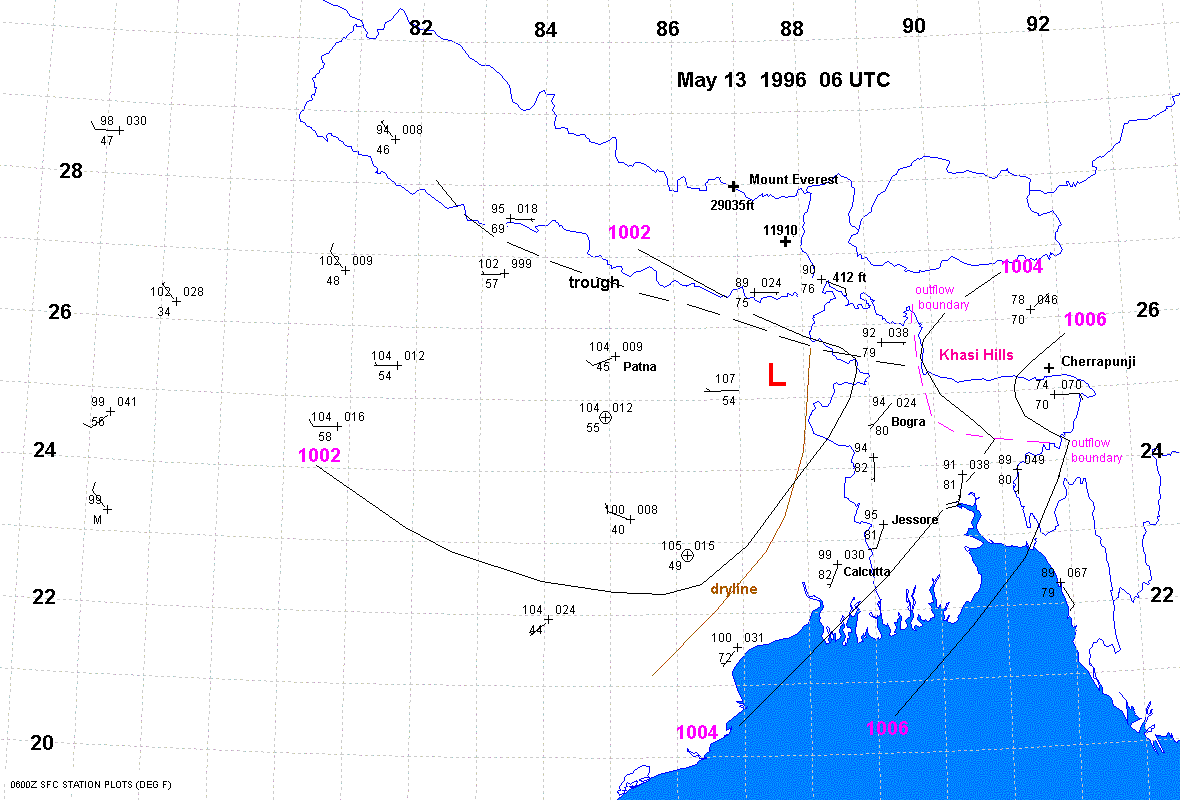
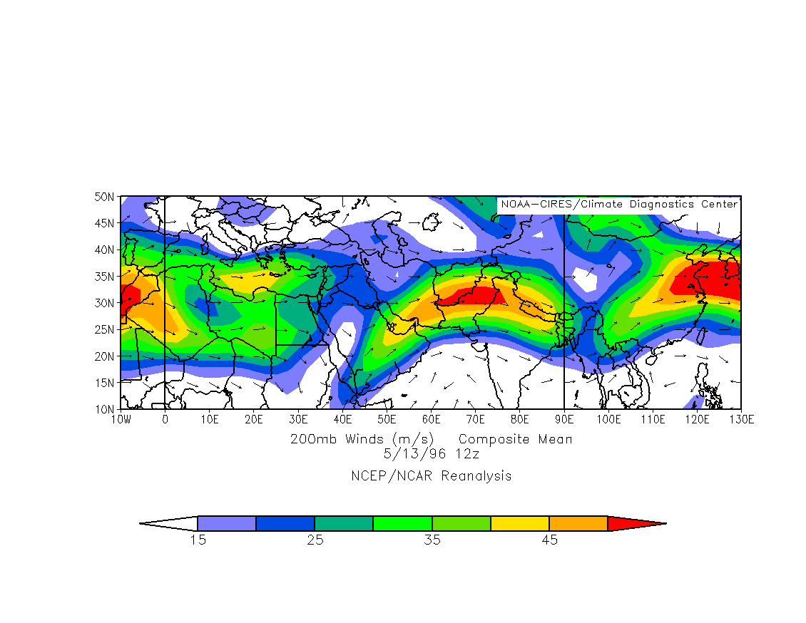
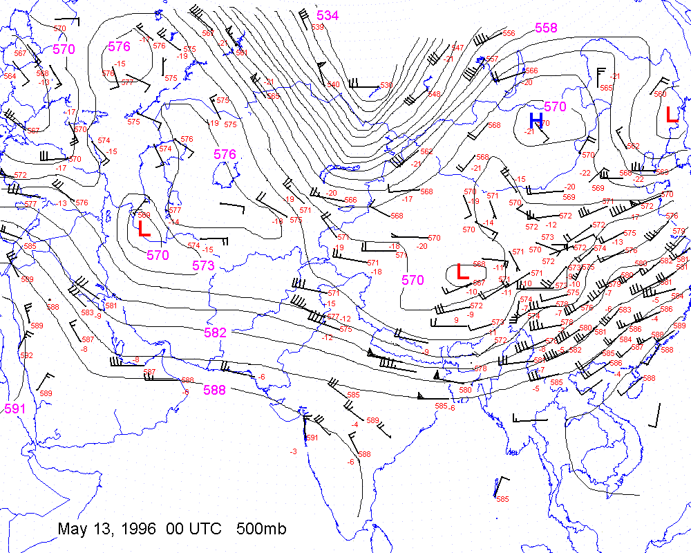
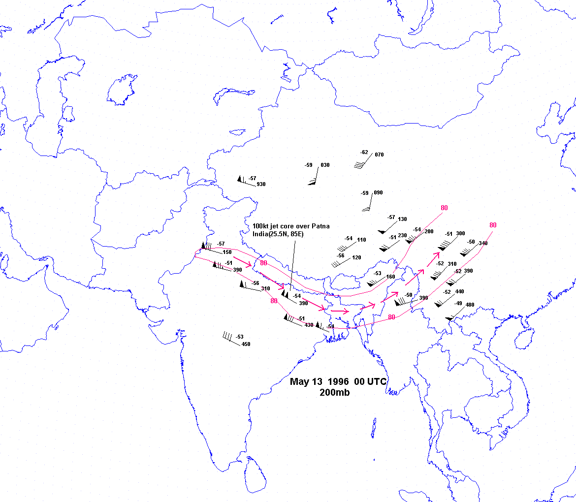
May 13 1996
Apr 14 2004
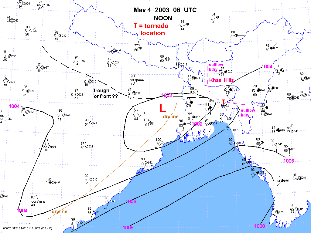
May 04 2003
April 5 2006 Aqua MODIS polar orbiting shot shows outflow boundary.
Dryline is evident on edge of
vegetation.
A front of
sorts often stretches across central Bangladesh and into north India.
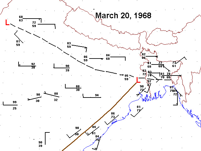
Mar 20 1968
Apr 14 2004
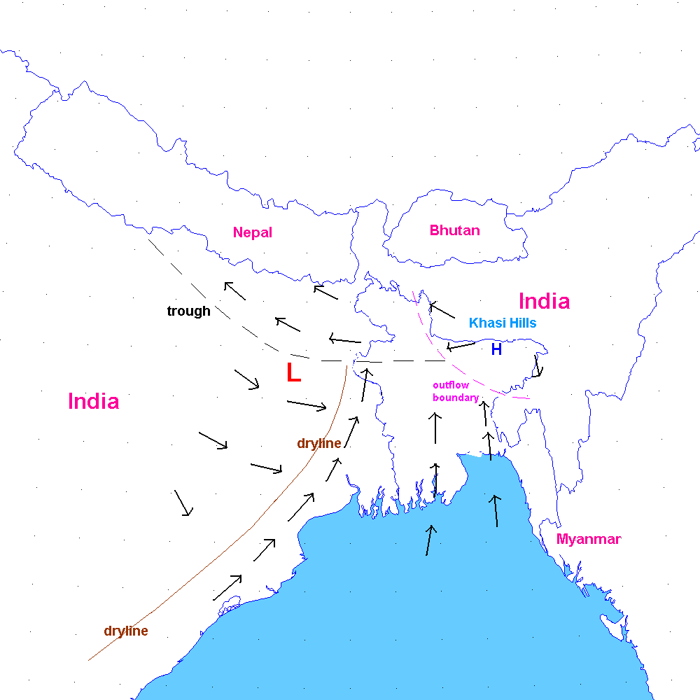
Mean position of dryline and other boundaries in early April severe weather regime.
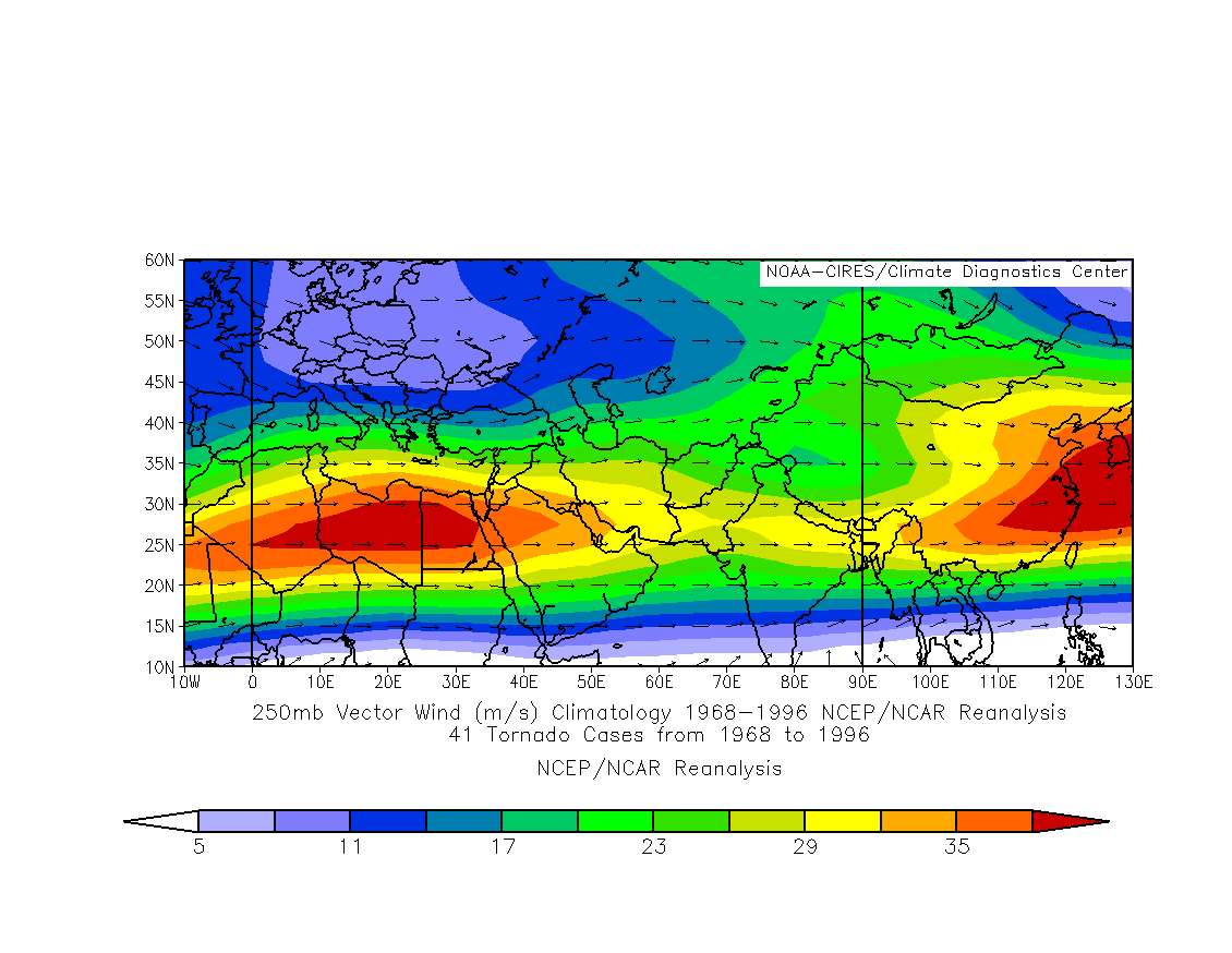
High level jet
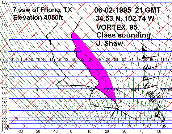
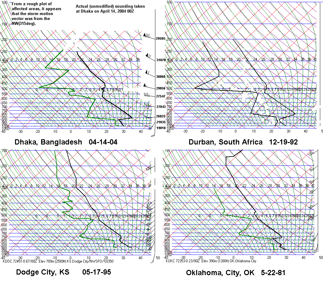
The sounding
The result is classic
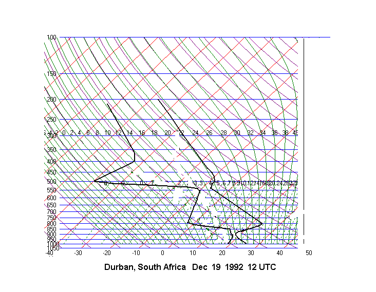
"loaded gun" type sounding that we see here in the plains and in South
Africa.
May 22 1981 Oklahoma City
June 02 1995 Friona, TX
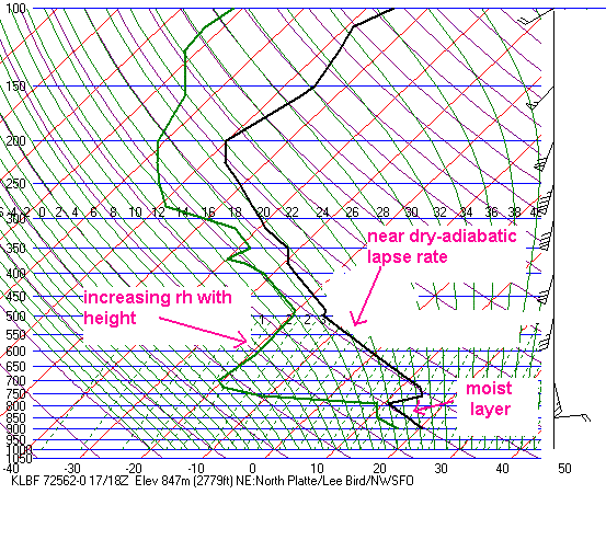
May 17 2000 North Platte
December 19 1992 Durban, South Africa
April 14 2004 Dhaka, Bangladesh
April 15 2004 Dhaka, Bangladesh
Places in the world that have extremely large hail and tornadoes
typically have elevated mixed layers.
Sounding Comparison
The Timeline
Several factors lead to a very
short but active severe
weather season across Bengal.
North and central India heats
up and dries out in late March or early April. A deep, dry mixed
layer develops. Low level
flow from the Bay of Bengal increases markedly during this time.
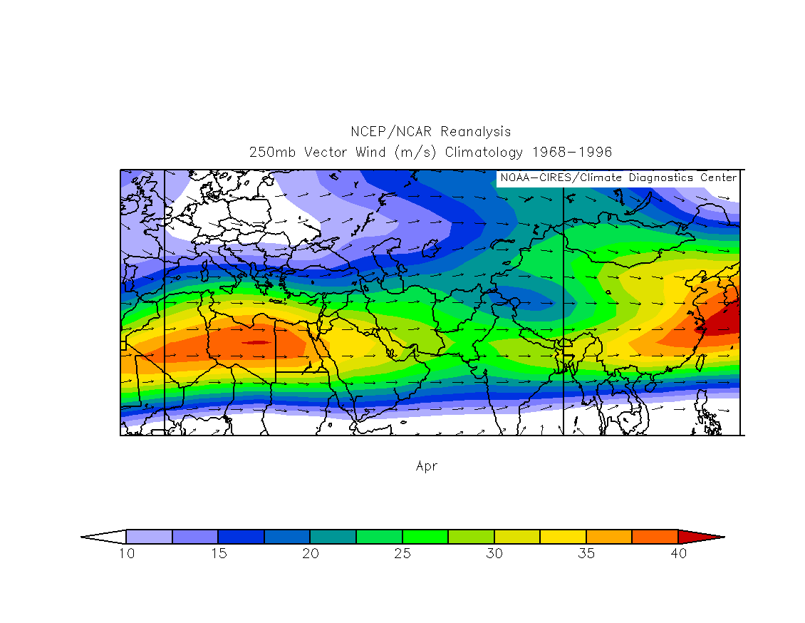
Westerly mid-level flow
around the Tibetan Plateau advects the Indian mixed layer over
the Bengal
moist tongue. This leads to the elevated
mixed layer. Note that parts of the Indian
desert are
"elevated"(1-3000ft) compared to Bangladesh which is near sea level.
The mid level flow is still
fairly strong in April with 30-50kt 700mb flow and 35 to 50 kt 500mb
flow fairly common.
The high level jet is usually over or just north of Bengal in April.
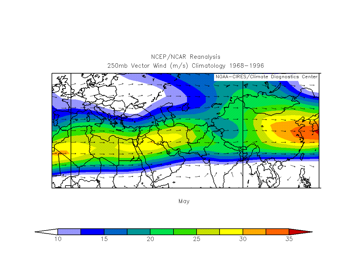
The southern branch of
the polar jet often retreats north of the Tibetan Plateau by May, leaving
light, mid to high level flow across the Bengal region.
By June the high level flow is light.
All these factors result in a tornado maximum in early to mid April. In short, vertical wind shear
and instability are maximized and the jet is in a favorable position during this time.
Bangladesh and east Indian Tornado Documentation
Previous tornado documentation
Peterson and
Mehta(1981 and 1995), Ono(1997), Qayyum and others
Individual tornado studies in
journals
Peterson and Mehta (1981 and 1995) documented 36 spring tornadoes. (Most comprehensive)
Ono (1997) documented 28 spring events from 1990 to 1994 using a fairly liberal
set of criteria.
Goldar(2001) documented 36 "possible tornadoes" which partially filled the gap
in the 1890s
and early 1900s. Again a liberal definition was used.
Myself and Ashraf M. Dewan searched through old newspaper microfilm for March-May from
the 1950s through the 1980s.
We came up with a comprehensive tornado climatology for Bangladesh
which builds on the previous work by Peterson, Mehta and Ono.
Thirty-six tornadoes were previously undocumented for a total of 89 tornadoes through 2005.
Tornado Criteria
1. Specifics such as path length, path width, sharp gradients in damage or damage intensity or description of funnel.
2. Heavy objects, people or animals were thrown long distances.
3. Flying debris such as corrugated
iron sheets caused lacerations, decapitation, or loss of limbs.
4. The tornado caused catastrophic
damage (for example, entire villages reduced to rubble and/or photos showing
tornadic
damage).
5. At least 15 deaths occurred
inland, that can be shown to be unrelated to tropical cyclones, single building collapse,
or capsizing of boats. The evidence of widespread straight-line winds was lacking.
6. There was a very short duration
of violent winds.
All tornadoes
30 or more deaths
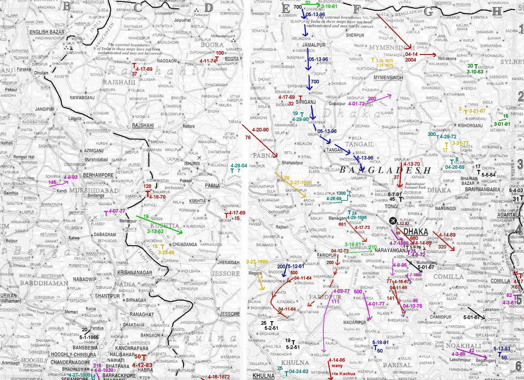
tornado paths
tornado details
Tornado Cases
Surface and upper air charts for Bangladesh and east Indian tornadoes can be found here.
April 14 2004
March 20 2005
May 04 2003
Mar 23 2005 High winds and hail(possibly tornadoes)
May 13 1996
Surface
500mb
200mb
200mb reanalysis
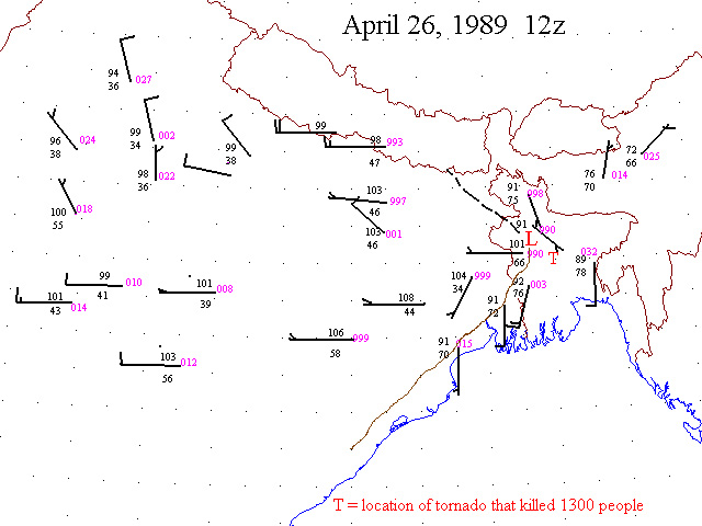
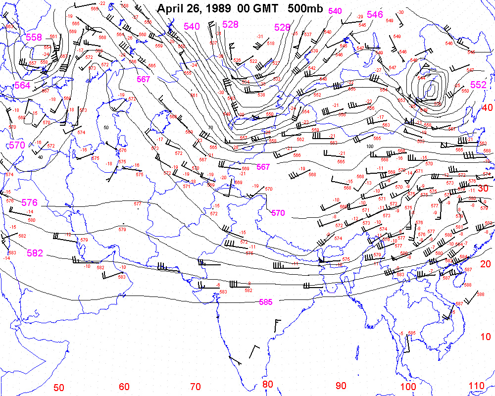
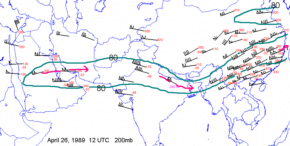
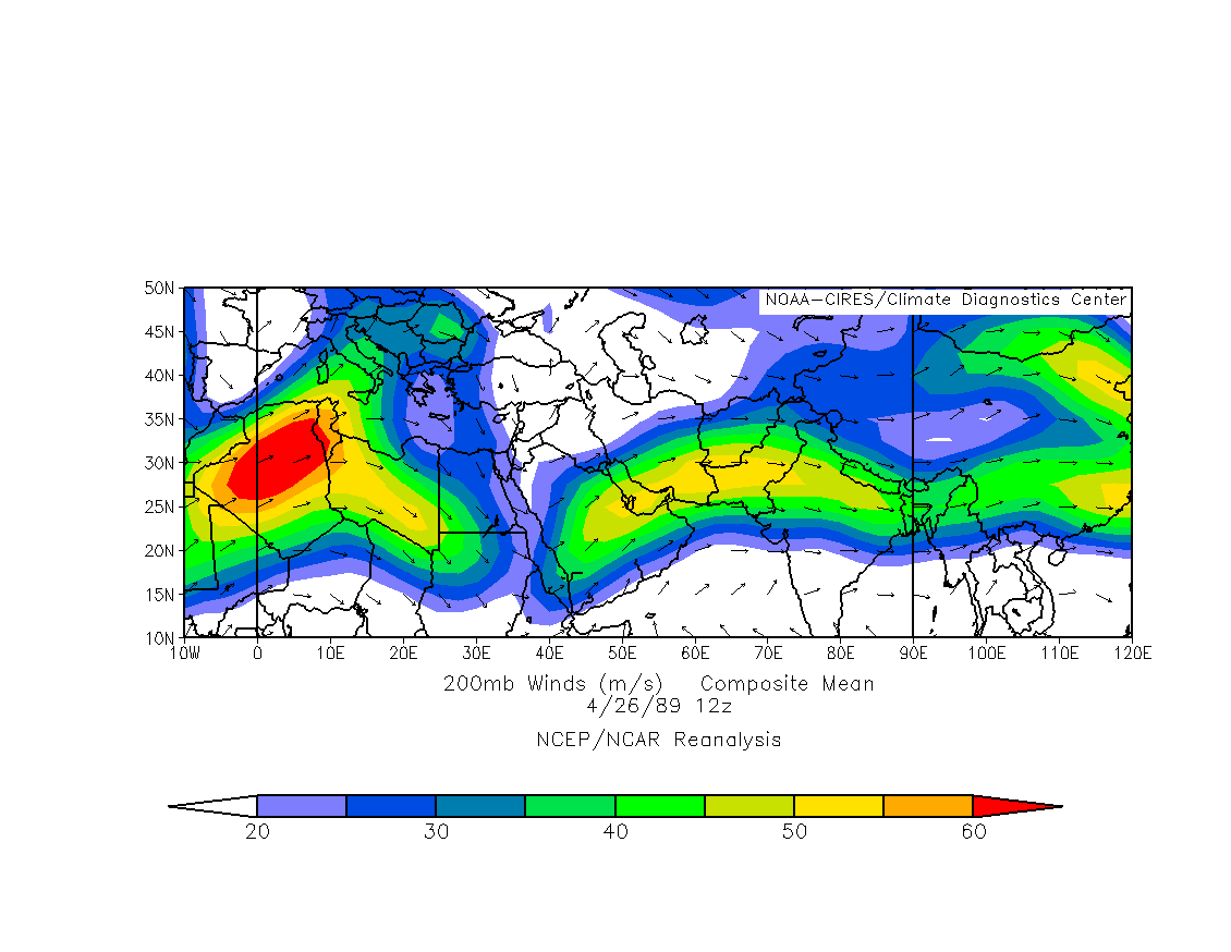
April 26 1989
Surface
500mb
200mb
200mb reanalysis
Recent severe storm outbreak
April 3 2006 severe weather outbreak
Severe storms exploded along an outflow boundary and
along the dryline.
March 31 outlook
120 hr ECMWF forecast from March 29
day 2 high risk forecast
tornado watch
00 UTC surface
09 UTC surface
0908 UTC radar image
250mb
500mb
700mb
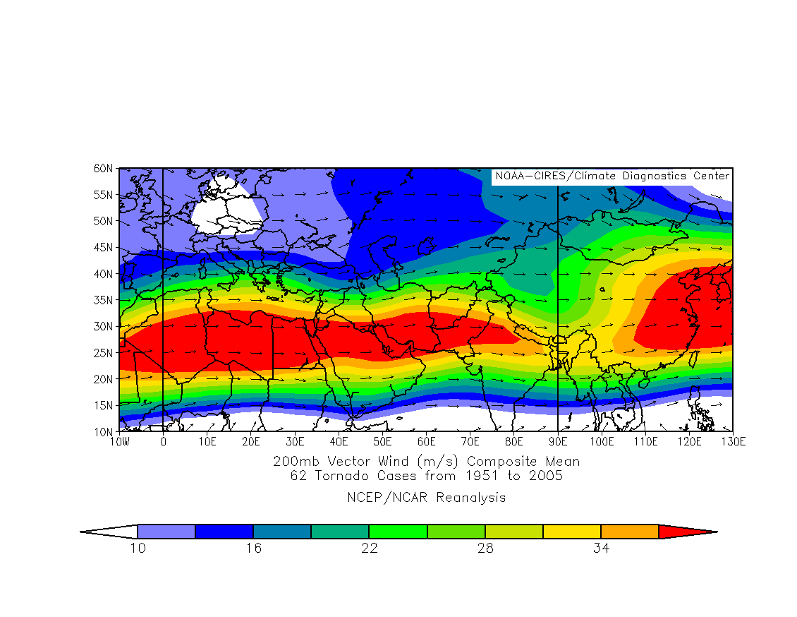
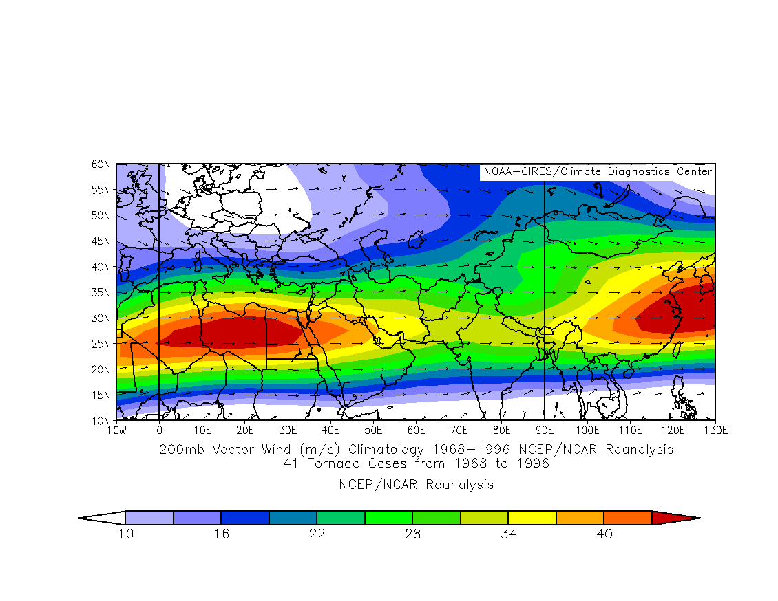
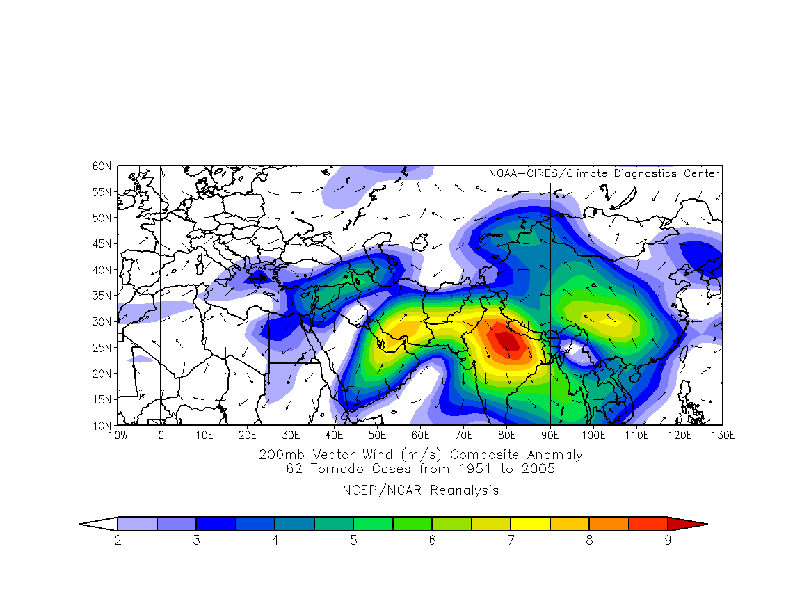
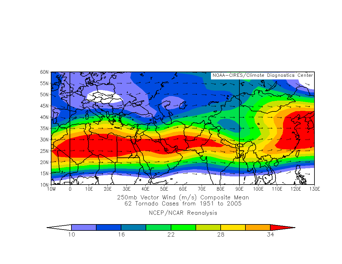
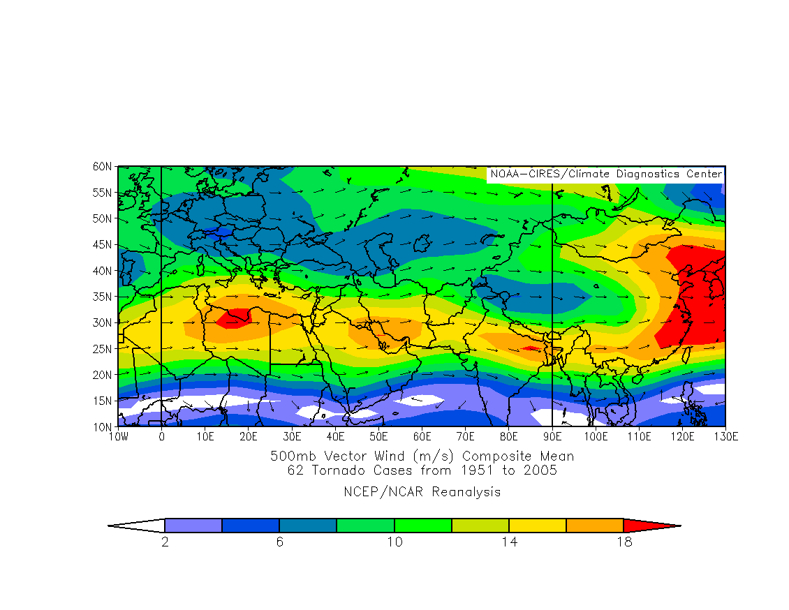
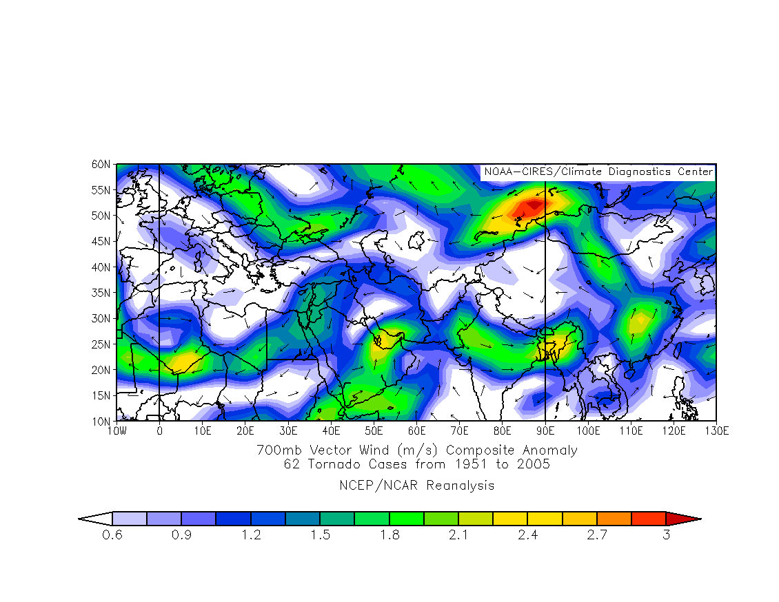
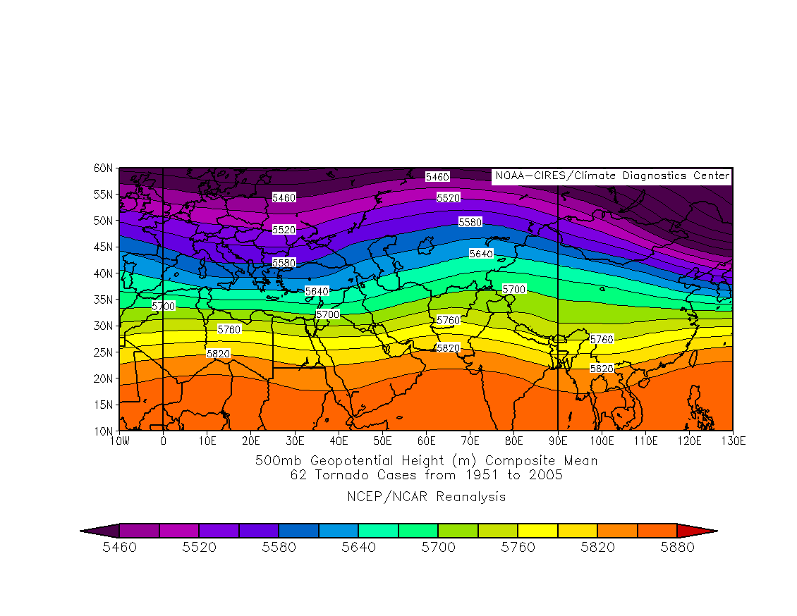
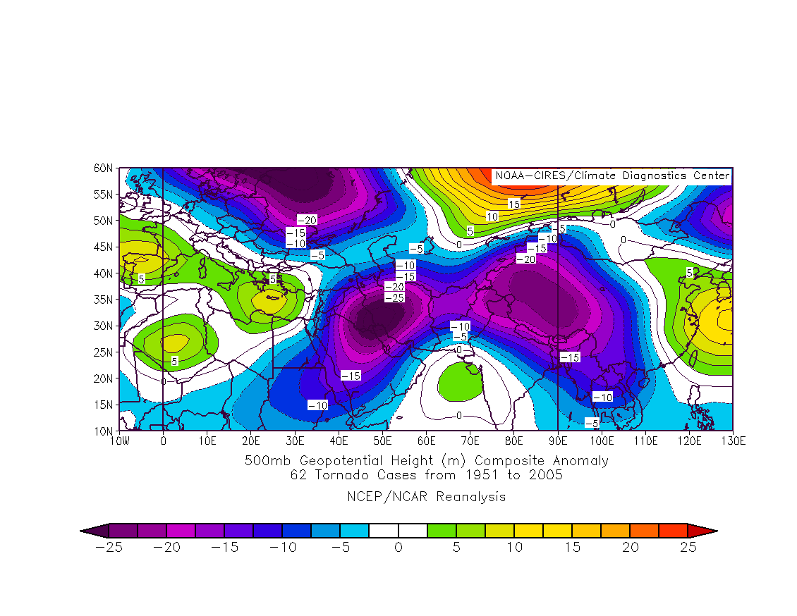
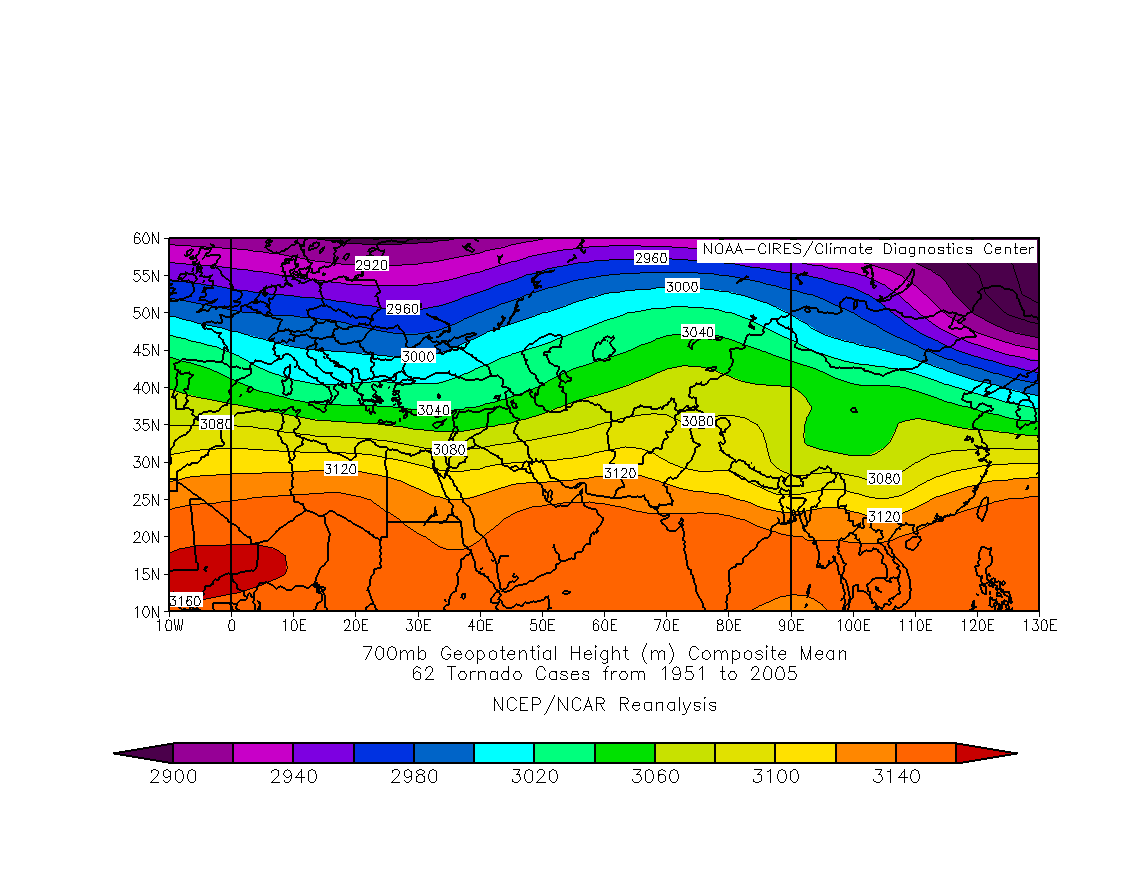
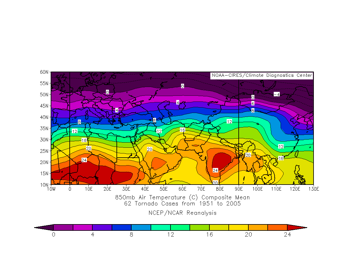
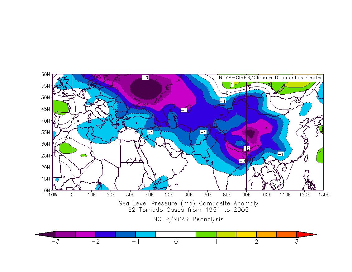
Reanalysis Composites for all tornadoes
62 tornado cases from 1951 to 2005
200mb wind m/s
climatology
anomaly
250mb wind m/s
climatology
anomaly
500mb wind m/s
climatology
anomaly
700mb wind m/s
climatology
anomaly
500mb height
anomaly
700mb height
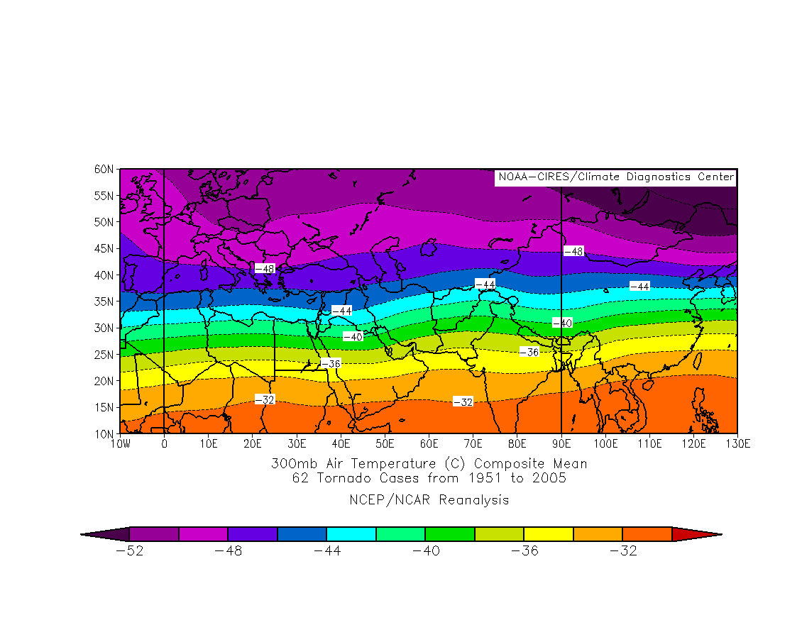
300mb temps
anomaly
400mb temps
anomaly
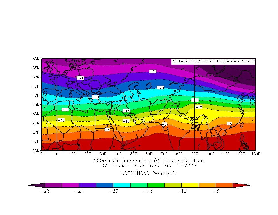
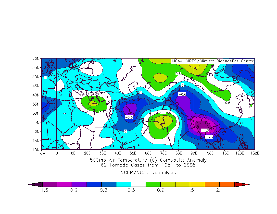
500mb temps
anomaly
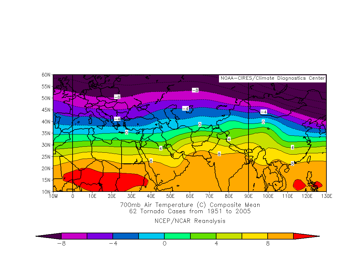
700mb temps
850mb temps
Sea Level Pressure
anomaly
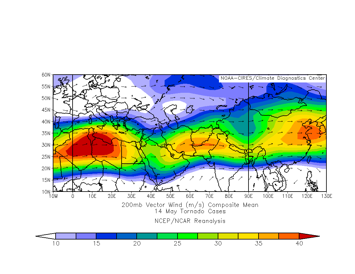
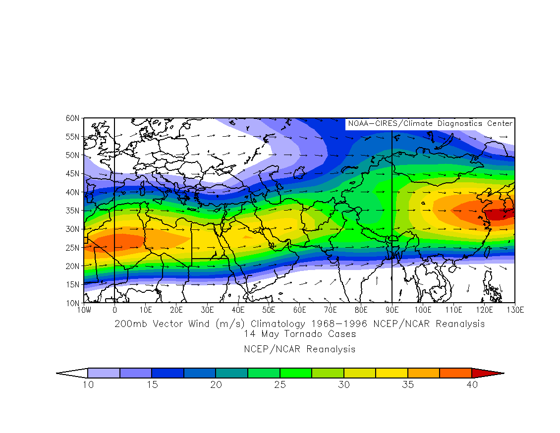
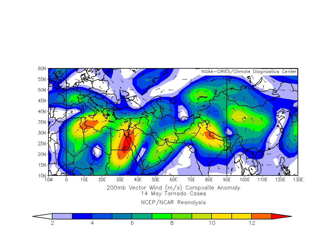
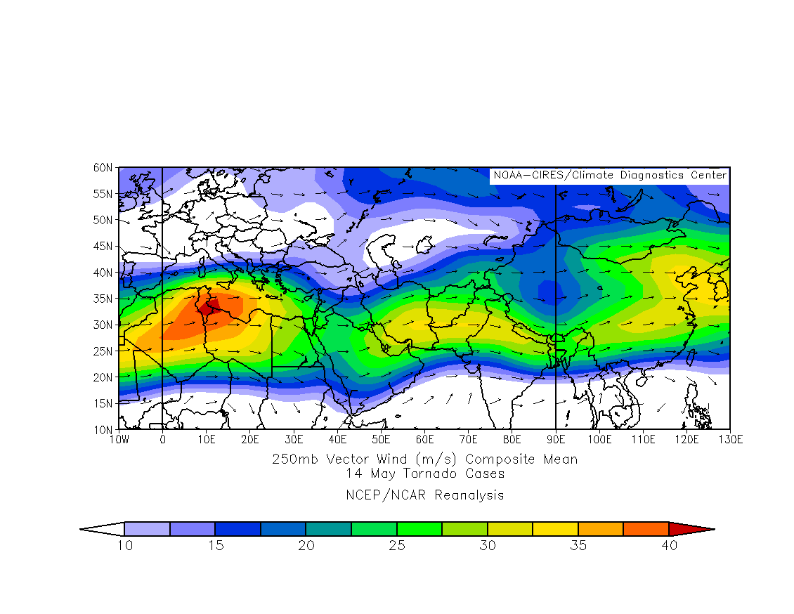
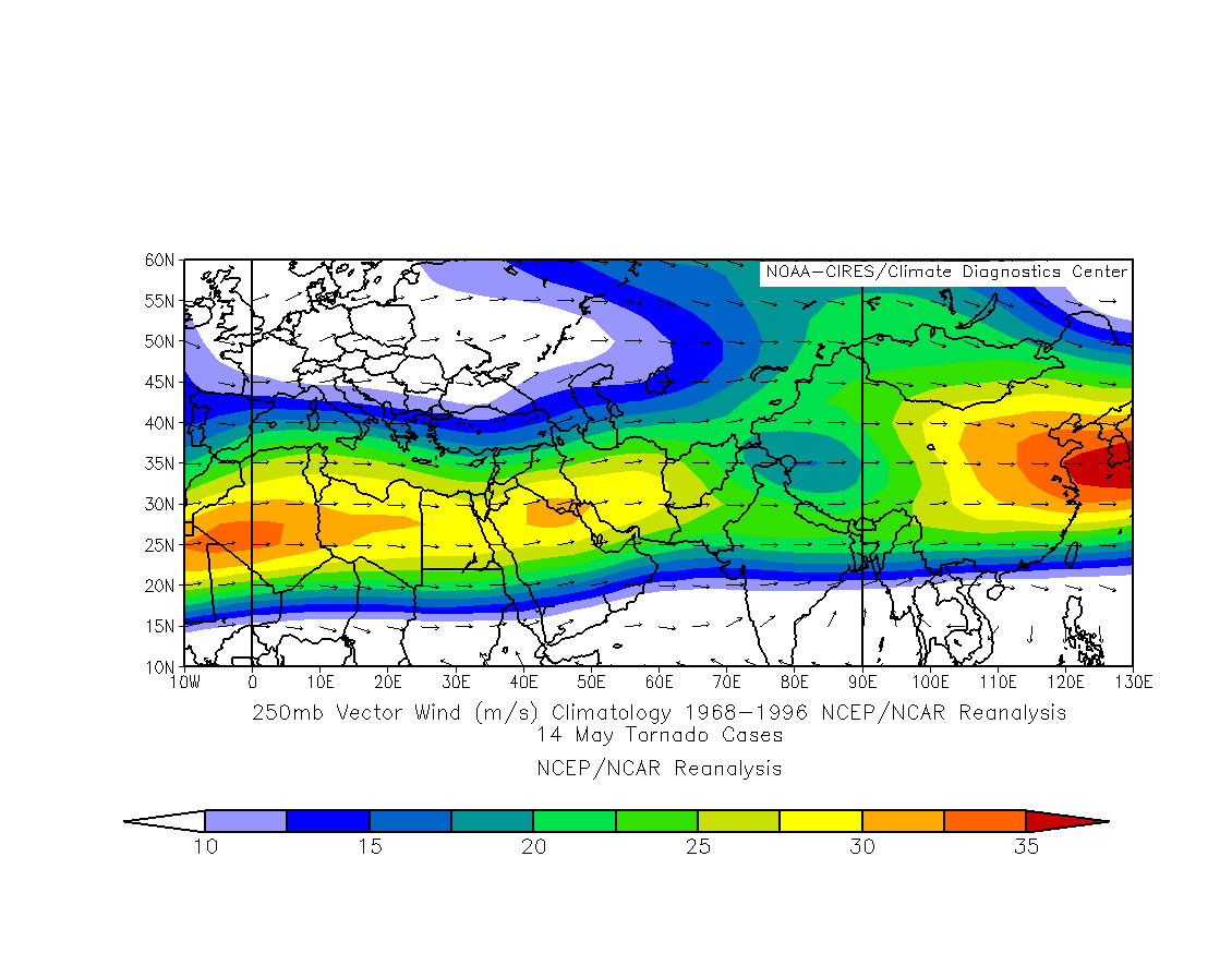
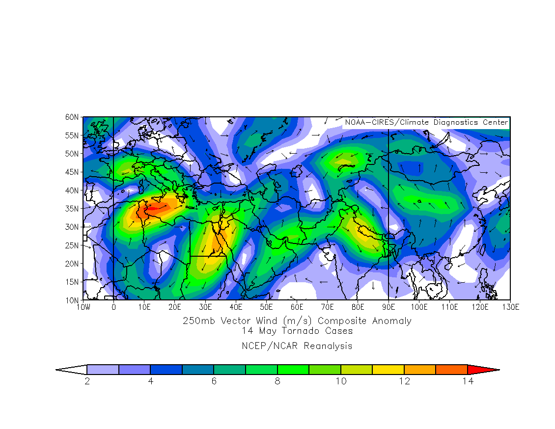
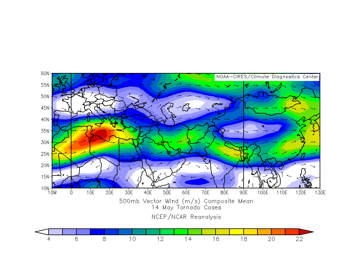
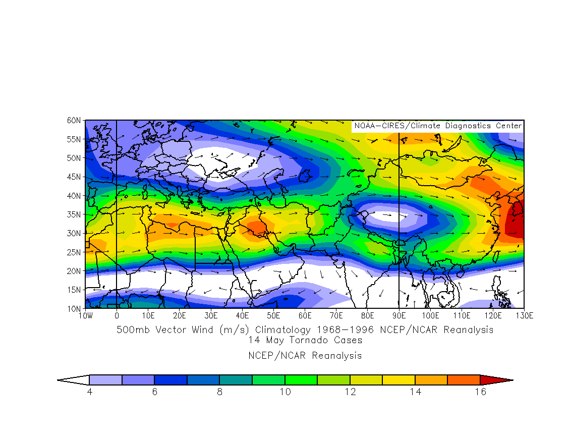
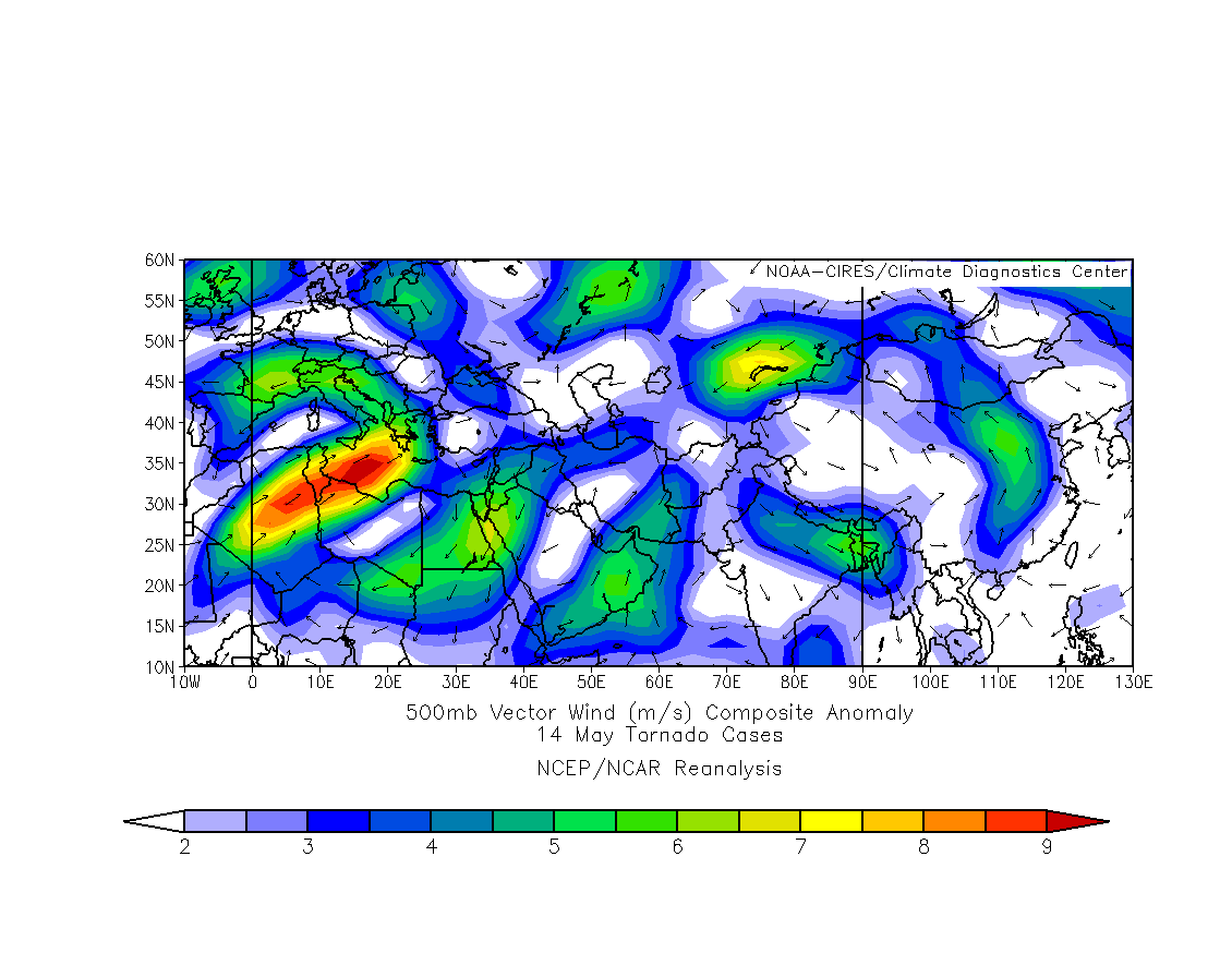
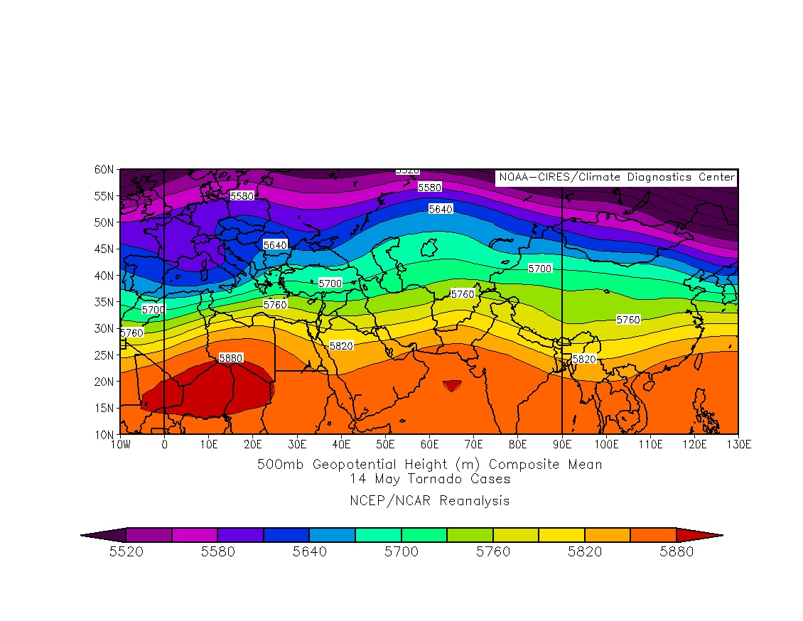
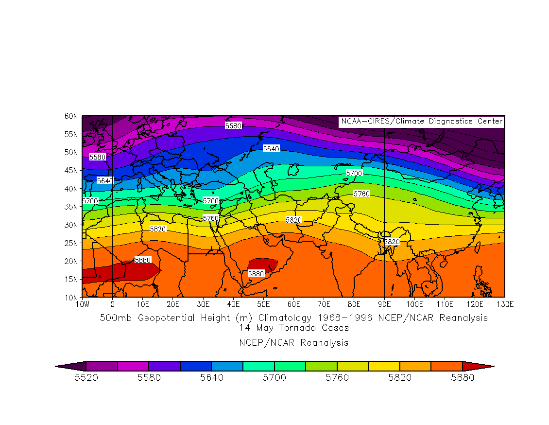
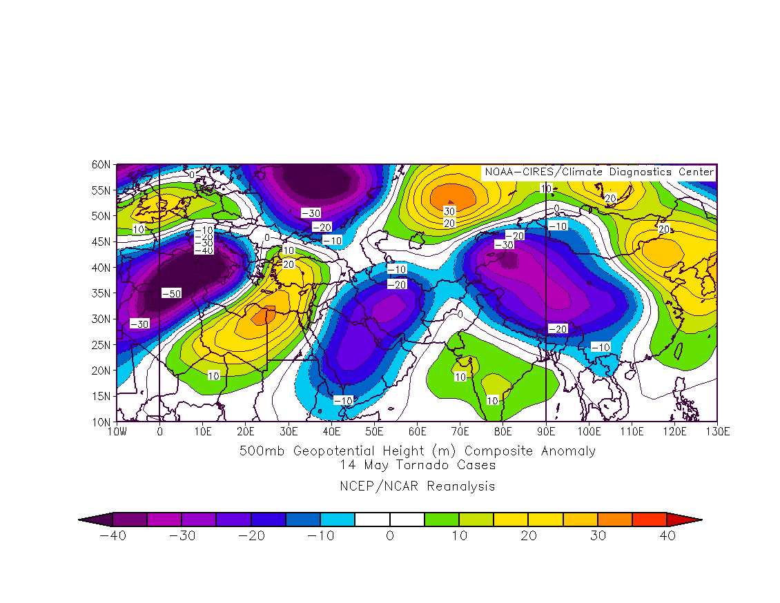
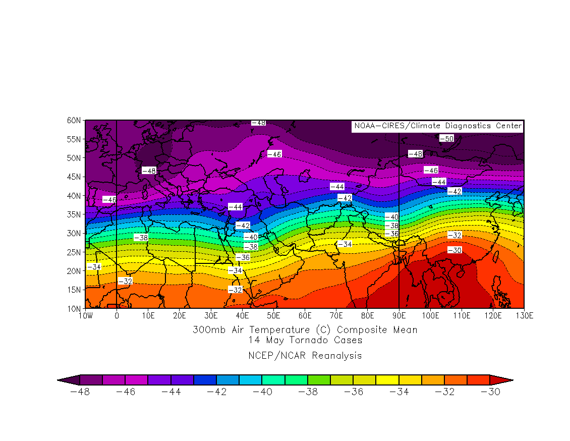
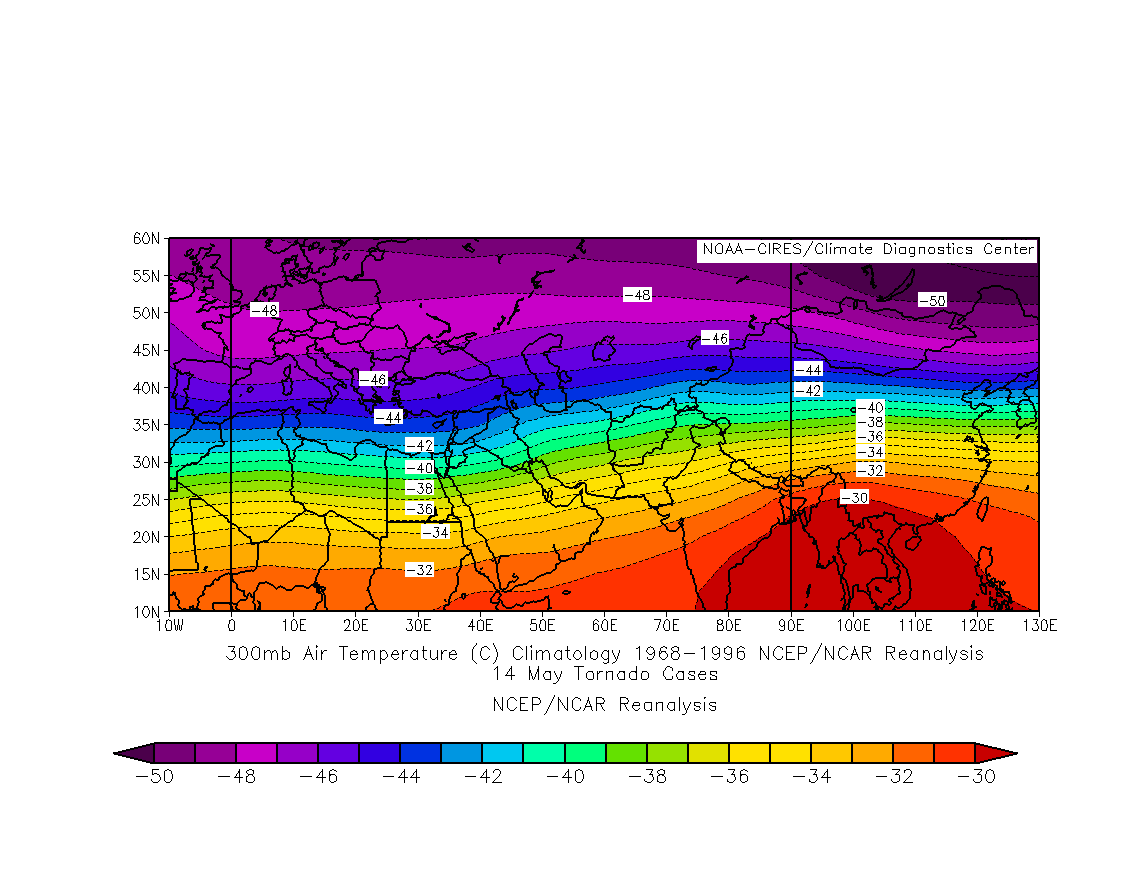
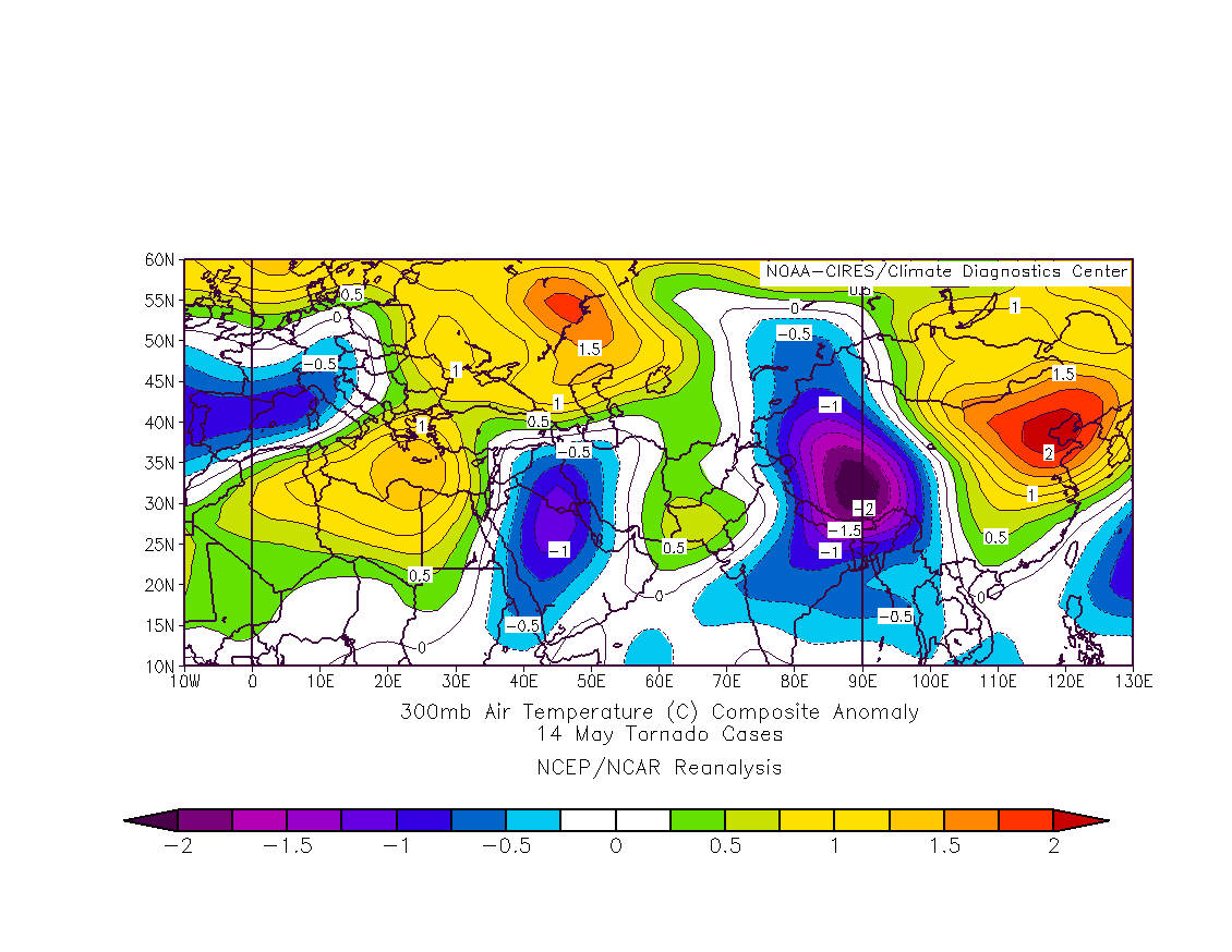
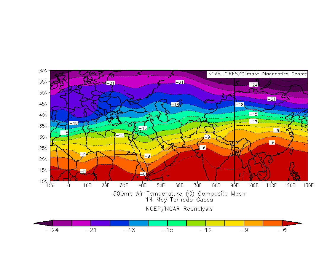
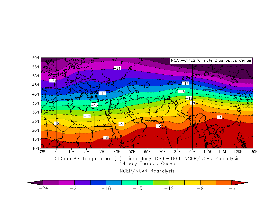
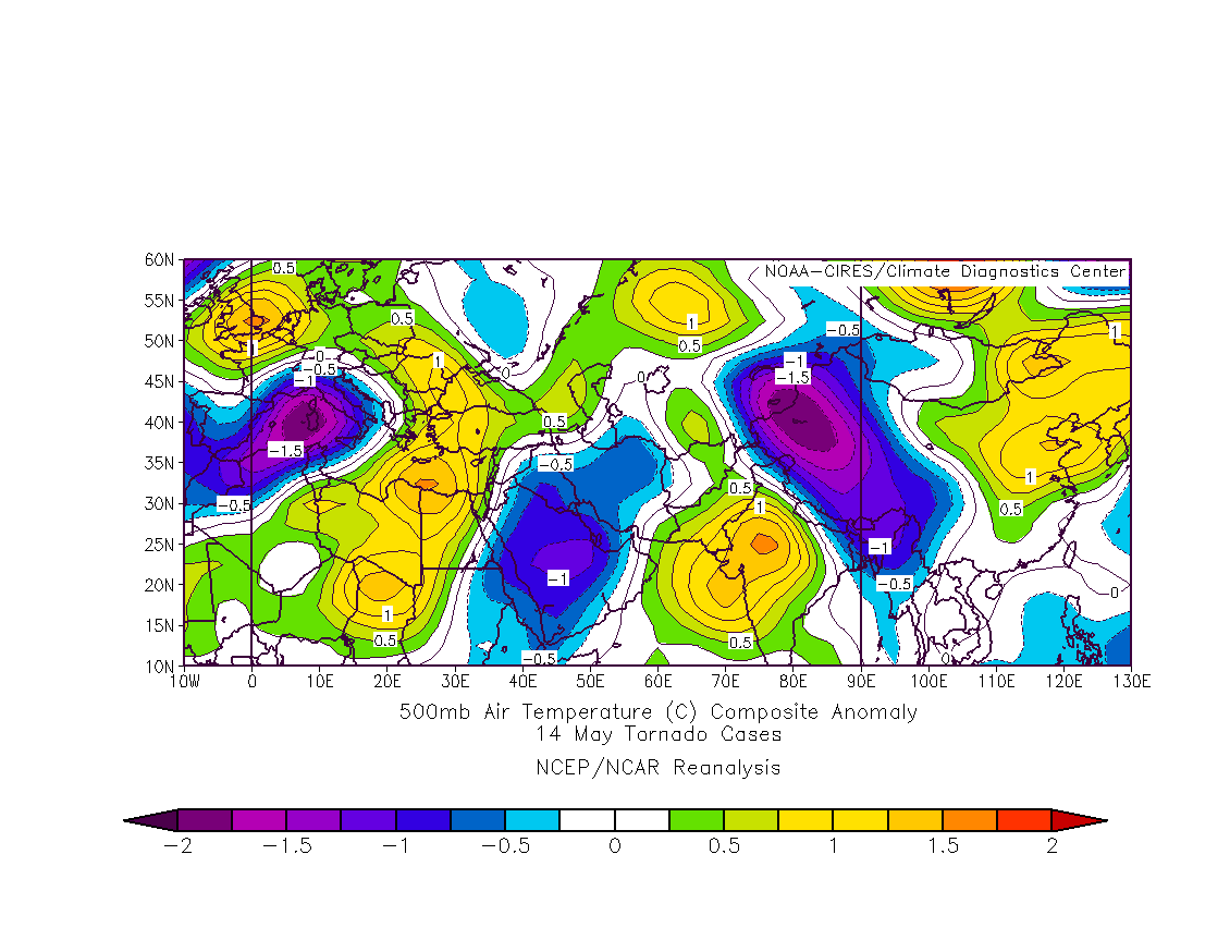
Reanalysis Composites for May tornado cases
14 cases
200mb wind m/s
climatology
anomaly
250mb wind m/s
climatology
anomaly
500mb wind m/s
climatology
anomaly
500mb height
climatology
anomaly
300mb temp
climatology
anomaly
500mb temp
climatology
anomaly
Tornado Forecasting -- things to keep in mind
Look for nose of high level jet over Bangladesh.
Watch out for outflow boundaries and trough/frontal positions.
The dryline/front(trough) intersection
wind speeds at different levels favorable for tornadoes in Bangladesh:
adequate low level flow from Bay of Bengal
700mb 270 to 290 at 35 to 50kts
500mb 270 to 300 at 40 to 55 kts
200mb 270 to 300 at 60 to 80 kts
Surface dewpoints usually range from 73F to 81F when tornadoes occur.