*****************************************************************
Preliminary reports indicate
that between 22 and 31 people were killed in eastern Bangladesh by a tornado
Sunday evening(May 4). Village Noabadi near the Indian border was
hardest hit. Many of the injured lost hands or feet
from flying debris. This area
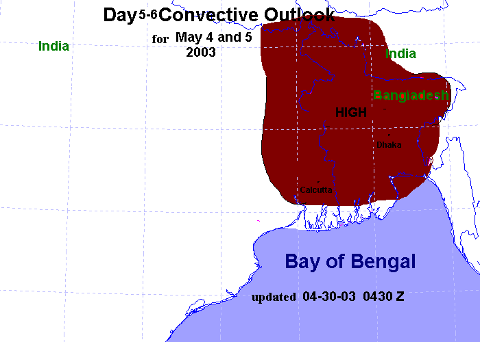
was outlooked with a HIGH
risk of severe
storms in the day 5 convective
outlook. A day 5 outlook was given since
I was headed out of town on
the April 30. Unfortunately I downgraded to
a MODERATE risk in the day 1
outlook on May 3 since storm initiation
was in question. More information
will be posted as details are available.
The forecast discussion from
April 30 is as follows:
Day 3-6 discussion updated 4-30-03 0445 UTC
An upper level ridge over the northern part of the Tibetan plateau
will gradually shift east over the next 72 hours. A
deep upper level trough will progress eastward from the middle east over
the next 72 hours. By May 2, this trough will be centered over far northwest
India and Pakistan. Strong westerly flow at the base of this trough
will tend to be suppresed just south of the Tibetan Plateau, leading to
an increase in the mid-upper level wind fields immediately south of the
Himalayas. The 500mb winds may increase to 45-60kts as early as May 3.
If everything pans out, tornadic storms will be likely from May 2 to May
5. Thus I will go ahead and issue a moderate
risk for much of central and northern Bangladesh and adjacent Assam and
West Bengal, India for May 2-4, and a high risk of severe storms for May
4 and May 5 for much of the Bengal region. I may not be able to update
these forecasts for a few days since I will be away from computing resources.
Days 3-4 outlook May 2
and May 3 moderate risk
of severe storms
Days 5-6 outlook May 4 and May
5 high
risk of severe storms
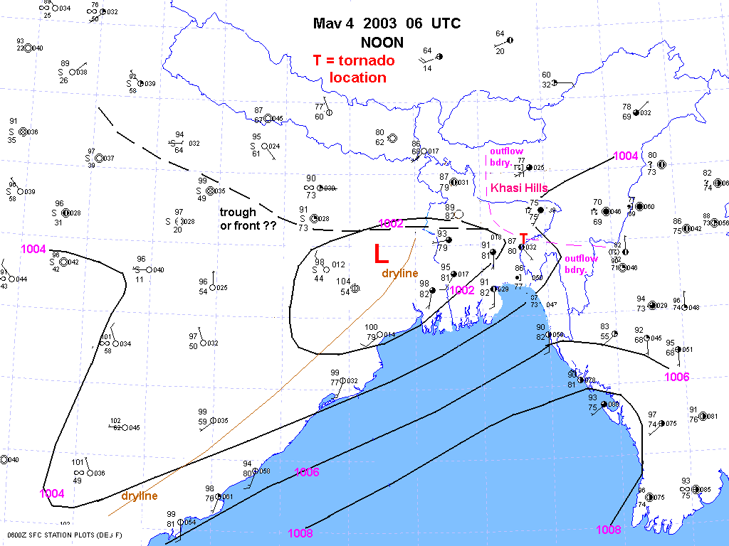
Click here
for a surface chart for 06 UTC May 4, here
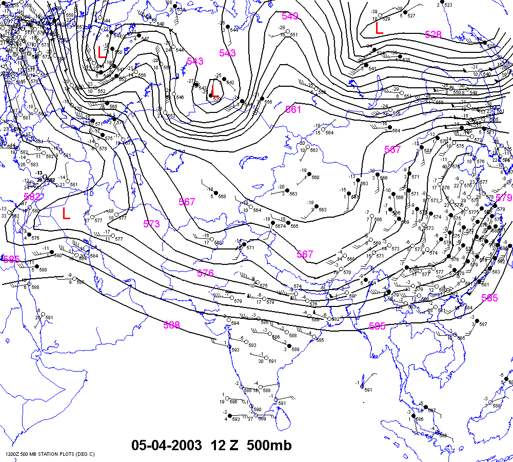
for the 12 UTC 500mb chart and here
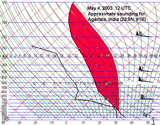
for an approximate sounding
for Agartala, India. Neither Agartala nor
Dhaka made balloon launches at 00 and 12 UTC which is disappointing.
*****************************************************************
Storms erupted between 09 and 12Z on April 12 along an outflow boundary from the previous nights storm complex. We will have to wait for discussion in newspaper reports out of Dhaka. Update--A large ferry boat capsized in northern Bangladesh Saturday evening. About half of the 200 people were able to swim to shore but the others are missing. Fourteen bodies have been recovered so far.
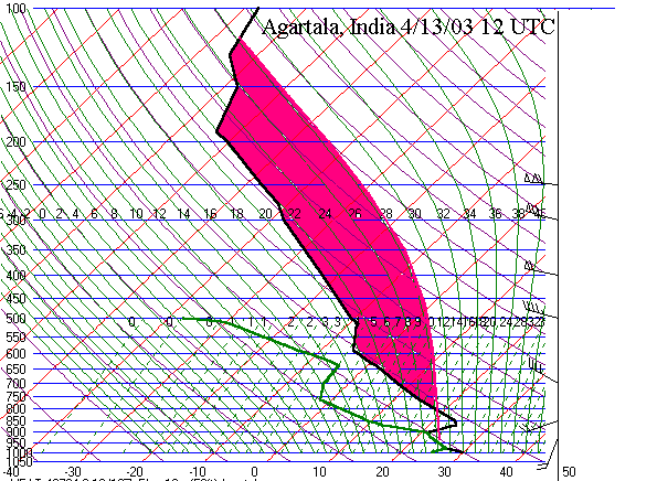
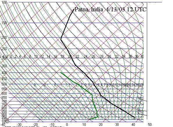
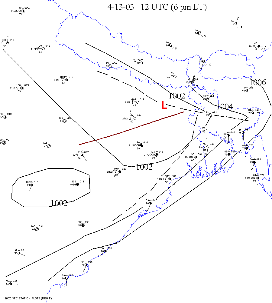
Storms erupted around 12Z April 13 along an outflow boundary in northern BD(25N) from another storm complex the night before. The 12Z soundings from (22.7N), Agartala(24N)(in the moist air) and Patna(25.6N)(behind the dryline) are impressive. The 12Z surface map shows the outflow boundary across northern BD.
Storms fired once again on April 14 along the
outflow boundary as mentioned in the moderate risk discussion from April
13.
Certainly April 16 newspaper reports will
have some information on these storms.
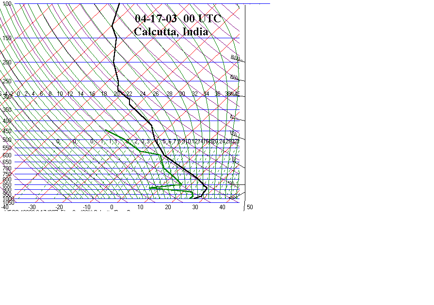
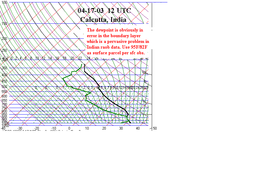
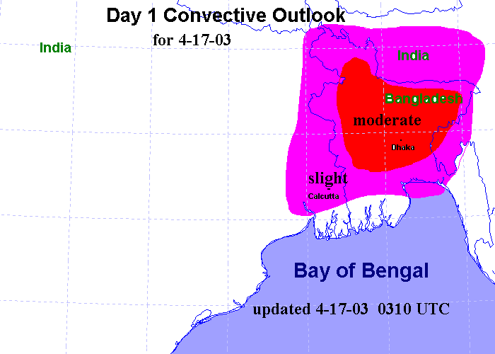
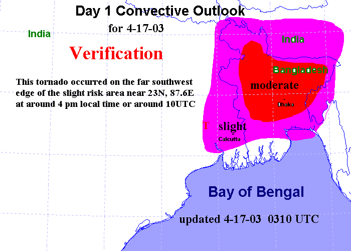
A severe storm developed on April 17 in eastern India to the west of Calcutta. The Telegraph gives details, details of the event in the 19th and 20th editions. The Statesman also gives a few details of this event. This was probably a tornado that killed 2 people near Joypur, a town west of Calcutta. The morning sounding from Calcutta is hereand the afternoon sounding here. Surface based capes were probably 9-10,000 g/kg based on that fact that lower 80 dewpoints were present at Calcutta, IN which is just east of where the storm hit. The soundings from Calcutta will be posted as soon as possible. The affected area was covered in a slight risk of severe storms in the day 1 outlook and day 1 discussion. For forecast verification see Day 1 verification map. Mish Michaels(Weather Channel meteorologist), whose family is from Calcutta, India, was actually visiting there on April 17 and experienced high winds from
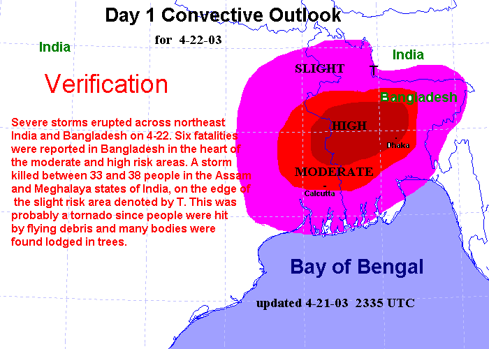
Severe storms erupted on April 22 in the moderate and high risk areas. These storms were severe with several deaths reported in the Bangladesh Newspapers.
A tornado on April 22 killed between 33 and
50 people near Mankachar, India(25.4N, 90E) or about 100 miles north(350
deg) of Dhaka, BD. This tornado occurred in the slight risk area. For forecast
verification see Day 1
Verification map. Many people and cows were "blown away" and found
wedged in trees. This tornado occurred near the point where the Assam and
Meghalaya states of India meet Bangladesh on the eastern bank of the Brahmaputra
river.
A thunderstorms developed along an outflow boundary in southwest Bangladesh on May 2 with cloud top temps around -77C.
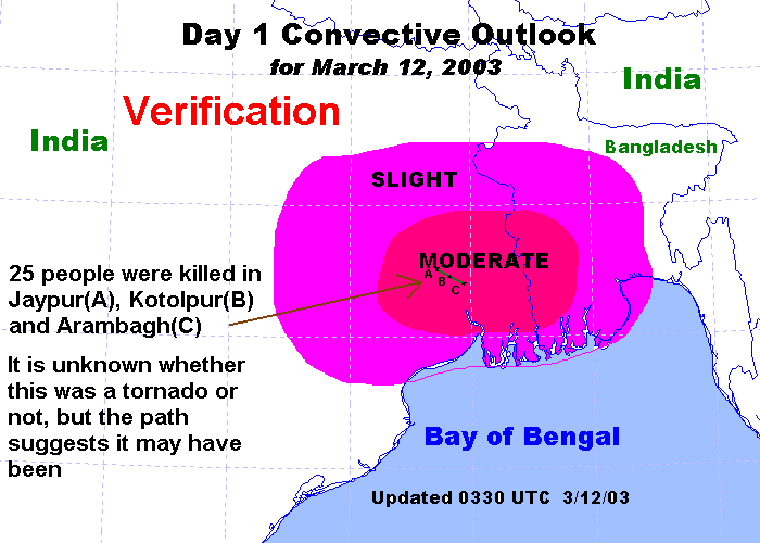
For verification of March 12 risk
outlooks see Day
1 verification map Day
2 verification map
A thunderstorm moved east-southeast from Joypur
to Kotolpur to Arambagh, killing 25 people. This could have been a tornado,
but finding proof will be difficult due to the lack of details surrounding
the storm.
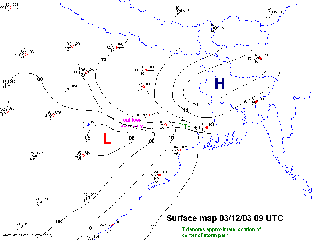
Surface
map for March 12 severe storm event (plotted
using digital atmosphere)
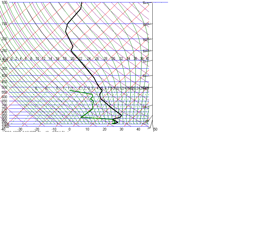
00Z sounding (~6 am local)
at Bhubaneswar, India(20N, 85.8E) Check
out the elevated mixed layer!
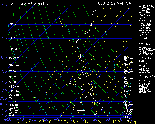
Compare with United States elevated mixed
layer soundings
Little
Rock (November 27, 1994)
North Platte (July 11, 1977)
Hatteras
(March 28, 1984)
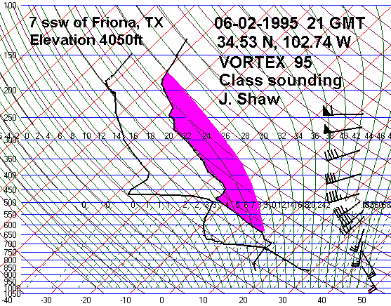
Friona, TX (June 2, 1995)
Flint
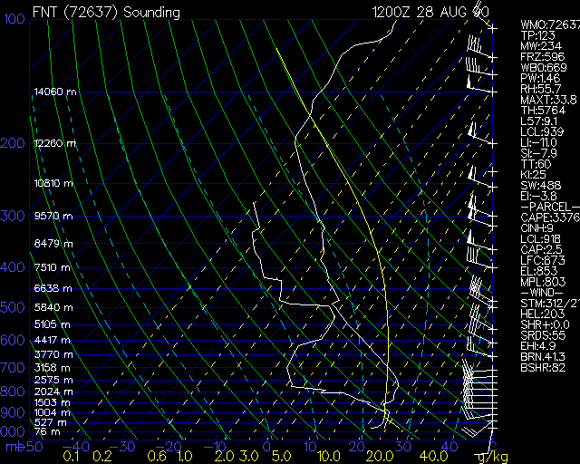
(August 28, 1990)
Amarillo, TX (March 19, 1982)
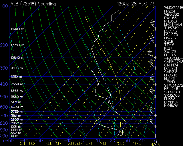
Albany(
August 28, 1973)
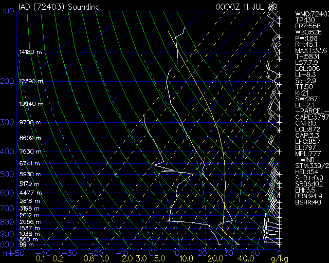
Washington
Dulles(July 11, 1989)
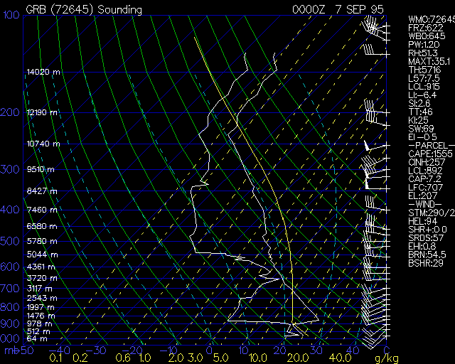
Green Bay
(September 6, 1995)
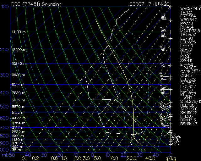
Dodge City
(June 6, 1990)